
0 S State Road 35 Hwy Unit 202522213 Muncie, IN 47302
Estimated payment $3,484/month
Total Views
2,530
57
Acres
$10,988
Price per Acre
2,477,693
Sq Ft Lot
Highlights
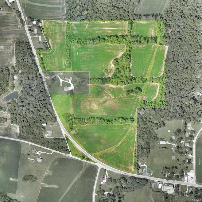
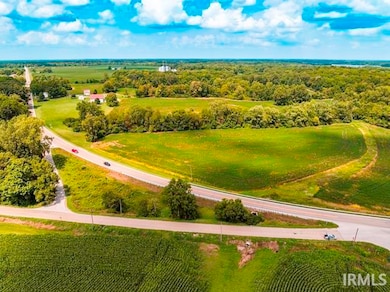
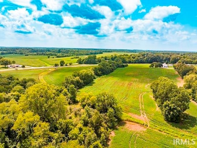
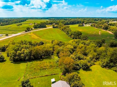
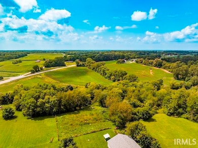
- 56.88 Acre Lot
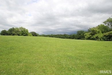
- 3 Acres of Pasture
- Partially Fenced Property
About This Lot
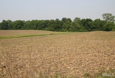
56.88 acres zoned farming. Approximately 50 acres tillable. Crops belong to current tenant. Total of 4 parcels - will not be divided. Fourth parcel number is 18-16-19-227-001.000-020. For directional purposes: this acreage is North & South of 1100 S. US 35 which is a 4 acre parcel with house & barn, etc. owned by neighbor & not included in the sale. Also, not included in the 56.88 acres is 1.35 acres south of highway 35 which will be separated at closing). Seller will consider a contract sale for qualified buyer.
Listing Agent
Coldwell Banker Real Estate Group Brokerage Phone: 765-289-2228 Listed on: 06/11/2025
Property Details
Property Type
- Land
Est. Annual Taxes
- $2,003
Lot Details
- 56.88 Acre Lot
- Property fronts a state road
- Rural Setting
- Partially Fenced Property
- Finished Lot(s)
- Land Lease
Parking
- Driveway
Schools
- Selma Elementary And Middle School
- Wapahani High School
Farming
- Livestock Fence
- 3 Acres of Pasture
- Agricultural
Utilities
- Well Required
Listing and Financial Details
- Assessor Parcel Number 18-16-17-300-007.000-020
Map
Create a Home Valuation Report for This Property
The Home Valuation Report is an in-depth analysis detailing your home's value as well as a comparison with similar homes in the area
Home Values in the Area
Average Home Value in this Area
Property History
| Date | Event | Price | Change | Sq Ft Price |
|---|---|---|---|---|
| 06/11/2025 06/11/25 | For Sale | $625,000 | -- | -- |
Source: Indiana Regional MLS
Similar Property in Muncie, IN
Source: Indiana Regional MLS
MLS Number: 202522213
Disclaimer: Certain information contained herein is derived from information provided by parties other than Homes.com. All information provided is deemed reliable, but is not guaranteed to be accurate and should be independently verified.
![]() IDX information is provided exclusively for personal, non-commercial use, and may not be used for any purpose other than to identify prospective properties consumers may be interested in purchasing. Information is deemed reliable but not guaranteed.
IDX information is provided exclusively for personal, non-commercial use, and may not be used for any purpose other than to identify prospective properties consumers may be interested in purchasing. Information is deemed reliable but not guaranteed.
Nearby Homes
- 6900 S Primrose Pkwy
- 520 E County Road 500 S
- 2205 S Walnut St Unit 2
- 3812 S Ebright St
- 0 E 29th St Unit LotWP001 23555179
- 0 E 29th St
- 3404 S Penn St
- 3529 S Walnut St
- 1530 E 26th St
- 1101 E 25th St
- 3505 S Eaton Ave
- 3324 S Walnut St
- 3200 Blk 7.9 ac S Meeker Ave
- 3213 S Cherokee Rd
- 3210 S Madison St
- 1401 E 24th St
- 7801 S Sun Mor Dr
- 1618 E 24th St
- 1614 E 24th St
- 4610 S Burlington Dr
- 3110 S Pershing Dr
- 216 E 13th St
- 1000 E 8th St
- 1001 W 1st St Unit 2
- 309 W Charles St
- 607 S Pierce St
- 2800 W Memorial Dr
- 326 W Charles St
- 1320 E Main St
- 112 S Proud St
- 400 W Washington St
- 2800 W Memorial Dr Unit 108
- 2800 W Memorial Dr Unit 128
- 2800 W Memorial Dr Unit 84
- 2800 W Memorial Dr Unit 133
- 2590 W White River Blvd
- 1406 W Main St
- 312 S Nichols Ave
- 631 N Mulberry St
- 408 S Brittain Ave