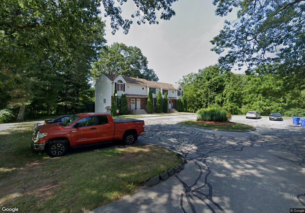
1 Cranberry Hollow Enfield, CT 06082
Estimated Value: $205,000 - $226,000
2
Beds
2
Baths
1,040
Sq Ft
$207/Sq Ft
Est. Value
About This Home
This home is located at 1 Cranberry Hollow, Enfield, CT 06082 and is currently estimated at $215,238, approximately $206 per square foot. 1 Cranberry Hollow is a home located in Hartford County with nearby schools including Prudence Crandall Elementary School, Nathan Hale Elementary School, and John F. Kennedy Middle School.
Ownership History
Date
Name
Owned For
Owner Type
Purchase Details
Closed on
Aug 10, 2020
Sold by
Richards Laurie and Perrone Kevin M
Bought by
Perrone Kevin M
Current Estimated Value
Home Financials for this Owner
Home Financials are based on the most recent Mortgage that was taken out on this home.
Original Mortgage
$132,900
Outstanding Balance
$118,684
Interest Rate
3%
Mortgage Type
VA
Estimated Equity
$88,837
Purchase Details
Closed on
Dec 9, 2008
Sold by
Zaremba Anthony and Perrone Shannon
Bought by
Richards Laurie
Home Financials for this Owner
Home Financials are based on the most recent Mortgage that was taken out on this home.
Original Mortgage
$138,077
Interest Rate
6.11%
Create a Home Valuation Report for This Property
The Home Valuation Report is an in-depth analysis detailing your home's value as well as a comparison with similar homes in the area
Home Values in the Area
Average Home Value in this Area
Purchase History
| Date | Buyer | Sale Price | Title Company |
|---|---|---|---|
| Perrone Kevin M | $132,900 | None Available | |
| Richards Laurie | $139,900 | -- |
Source: Public Records
Mortgage History
| Date | Status | Borrower | Loan Amount |
|---|---|---|---|
| Open | Perrone Kevin M | $132,900 | |
| Previous Owner | Richards Laurie | $130,132 | |
| Previous Owner | Richards Laurie | $138,077 |
Source: Public Records
Tax History Compared to Growth
Tax History
| Year | Tax Paid | Tax Assessment Tax Assessment Total Assessment is a certain percentage of the fair market value that is determined by local assessors to be the total taxable value of land and additions on the property. | Land | Improvement |
|---|---|---|---|---|
| 2025 | $3,348 | $94,300 | $0 | $94,300 |
| 2024 | $3,259 | $94,300 | $0 | $94,300 |
| 2023 | $3,240 | $94,300 | $0 | $94,300 |
| 2022 | $2,984 | $94,300 | $0 | $94,300 |
| 2021 | $2,820 | $73,000 | $0 | $73,000 |
| 2020 | $2,791 | $73,000 | $0 | $73,000 |
| 2019 | $2,718 | $73,000 | $0 | $73,000 |
| 2018 | $2,657 | $73,000 | $0 | $73,000 |
| 2017 | $2,513 | $73,000 | $0 | $73,000 |
| 2016 | $2,506 | $75,580 | $0 | $75,580 |
| 2015 | $2,433 | $75,580 | $0 | $75,580 |
| 2014 | $2,375 | $75,580 | $0 | $75,580 |
Source: Public Records
Map
Nearby Homes
- 3 Henry Rd
- 176 Cottage Rd
- 50 Cottage Rd
- 304 Brainard Rd Unit 1
- 22 King Philip Dr
- 36 Bacon Rd
- 109 Yarmouth St
- 118 Yarmouth St
- 12 the Laurels Unit 12
- 39 Liberty Ln
- 7 Twin Hills Dr
- 41 Liberty Ln
- 381 The Meadows
- 517 George Washington Rd
- 223 Wolf Swamp Rd
- 151 Wolf Swamp Rd
- 18 Sherwin Dr
- 13 Birchwood Rd
- 207 Hazardville Rd
- 12 Shady Oak Dr
- 1 Cranberry Hollow Unit 1
- 24 Cranberry Hollow
- 23 Cranberry Hollow
- 22 Cranberry Hollow
- 21 Cranberry Hollow
- 20 Cranberry Hollow
- 19 Cranberry Hollow
- 18 Cranberry Hollow
- 17 Cranberry Hollow
- 16 Cranberry Hollow
- 15 Cranberry Hollow
- 14 Cranberry Hollow
- 13 Cranberry Hollow
- 23 Cranberry Hollow Unit 23
- 17 Cranberry Hollow Unit 17
- 16 Cranberry Hollow Unit 16
- 18 Cranberry Hollow Unit 18
- 21 Cranberry Hollow Unit 21
- 15 Cranberry Hollow Unit 15
- 19 Cranberry Hollow Unit 19