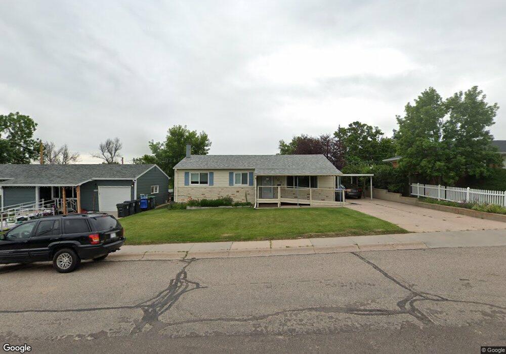
1001 Ridge Rd Cheyenne, WY 82001
Sun Valley NeighborhoodEstimated Value: $234,000 - $330,000
--
Bed
--
Bath
1,120
Sq Ft
$269/Sq Ft
Est. Value
About This Home
This home is located at 1001 Ridge Rd, Cheyenne, WY 82001 and is currently estimated at $301,036, approximately $268 per square foot. 1001 Ridge Rd is a home located in Laramie County with nearby schools including Lebhart Elementary School, Fairview Elementary School, and Johnson Junior High School.
Ownership History
Date
Name
Owned For
Owner Type
Purchase Details
Closed on
Feb 26, 2004
Sold by
Tibbetts Sally J
Bought by
Tibbetts Sally Jo
Current Estimated Value
Home Financials for this Owner
Home Financials are based on the most recent Mortgage that was taken out on this home.
Original Mortgage
$43,500
Interest Rate
5.67%
Mortgage Type
Purchase Money Mortgage
Purchase Details
Closed on
Feb 25, 2004
Sold by
Tibbetts Sally Jo
Bought by
Tibbetts Sally J
Home Financials for this Owner
Home Financials are based on the most recent Mortgage that was taken out on this home.
Original Mortgage
$43,500
Interest Rate
5.67%
Mortgage Type
Purchase Money Mortgage
Purchase Details
Closed on
Jan 13, 2000
Sold by
Tibbetts Sally J
Bought by
Tibbetts Sally J and Sally J Tibbetts Living Trust
Create a Home Valuation Report for This Property
The Home Valuation Report is an in-depth analysis detailing your home's value as well as a comparison with similar homes in the area
Home Values in the Area
Average Home Value in this Area
Purchase History
| Date | Buyer | Sale Price | Title Company |
|---|---|---|---|
| Tibbetts Sally Jo | -- | Summit Title Services | |
| Tibbetts Sally J | -- | -- | |
| Tibbetts Sally J | -- | -- |
Source: Public Records
Mortgage History
| Date | Status | Borrower | Loan Amount |
|---|---|---|---|
| Closed | Tibbetts Sally Jo | $43,500 |
Source: Public Records
Tax History Compared to Growth
Tax History
| Year | Tax Paid | Tax Assessment Tax Assessment Total Assessment is a certain percentage of the fair market value that is determined by local assessors to be the total taxable value of land and additions on the property. | Land | Improvement |
|---|---|---|---|---|
| 2025 | $1,929 | $14,381 | $2,419 | $11,962 |
| 2024 | $1,929 | $27,284 | $4,837 | $22,447 |
| 2023 | $1,907 | $26,963 | $4,837 | $22,126 |
| 2022 | $1,818 | $25,193 | $4,837 | $20,356 |
| 2021 | $1,611 | $22,272 | $4,837 | $17,435 |
| 2020 | $1,491 | $20,668 | $4,837 | $15,831 |
| 2019 | $1,385 | $19,183 | $4,837 | $14,346 |
| 2018 | $1,228 | $17,168 | $3,715 | $13,453 |
| 2017 | $1,176 | $16,294 | $3,012 | $13,282 |
| 2016 | $1,007 | $13,941 | $2,961 | $10,980 |
| 2015 | $934 | $12,928 | $2,961 | $9,967 |
| 2014 | $920 | $12,655 | $2,961 | $9,694 |
Source: Public Records
Map
Nearby Homes
- 3429 E 12th St
- 827 Cahill Dr
- 840 Stevens Dr
- 1012 Baldwin Dr
- 3106 Grier Blvd
- 3314 Barbell Ct
- Lot 2 E 13th St
- 3922 E 6th St
- 3946 E 6th St
- 3224 Randy Rd
- 4021 E 7th St
- 1108 Monroe Ave
- 1218 Monroe Ave
- 3228 Boxelder Dr
- 3241 Acacia Dr
- 1230 Rosebud Rd
- 857 Cleveland Ave
- 3109 Forest Dr
- 2974 Kelley Dr
- TBD Atkin St