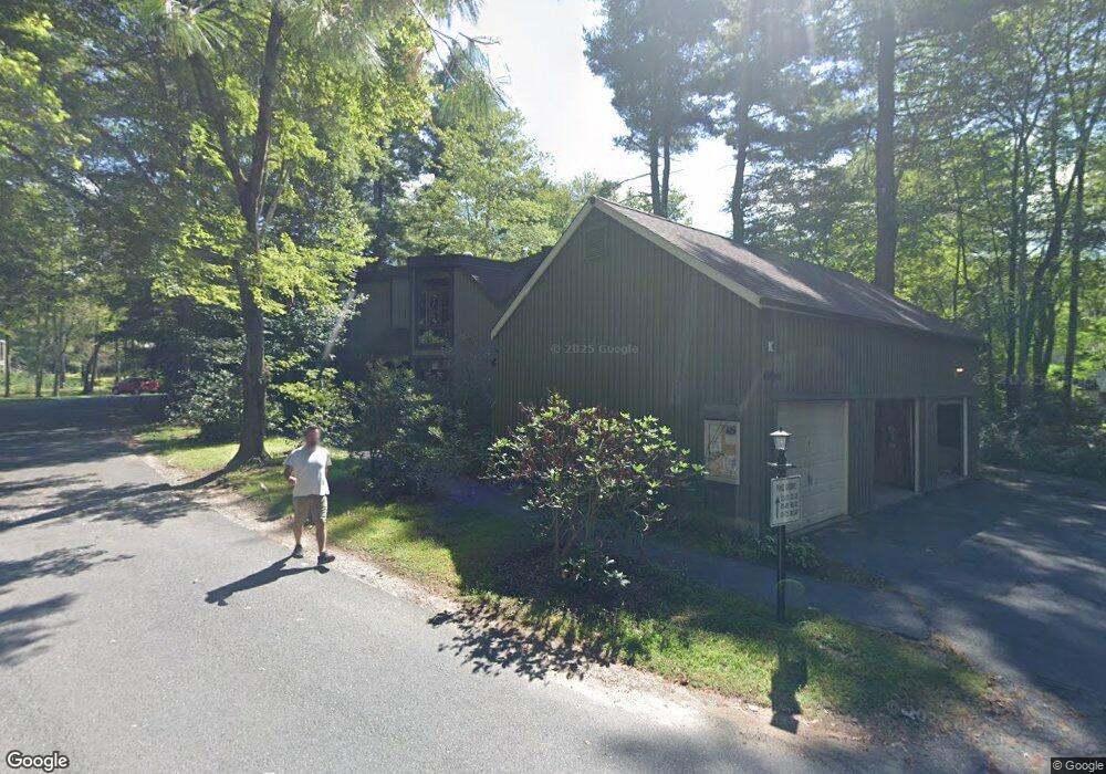
11 Pine Grove Amherst, MA 01002
Amherst NeighborhoodEstimated Value: $354,000 - $400,971
2
Beds
3
Baths
1,416
Sq Ft
$271/Sq Ft
Est. Value
About This Home
This home is located at 11 Pine Grove, Amherst, MA 01002 and is currently estimated at $383,493, approximately $270 per square foot. 11 Pine Grove is a home located in Hampshire County with nearby schools including Fort River Elementary School, Amherst Regional Middle School, and Amherst Regional High School.
Ownership History
Date
Name
Owned For
Owner Type
Purchase Details
Closed on
Aug 29, 1995
Sold by
Hinds John Iii Est
Bought by
Mcdonald Mark A and Mcdonald Sharon S
Current Estimated Value
Home Financials for this Owner
Home Financials are based on the most recent Mortgage that was taken out on this home.
Original Mortgage
$80,000
Outstanding Balance
$4,278
Interest Rate
7.32%
Mortgage Type
Purchase Money Mortgage
Estimated Equity
$381,960
Purchase Details
Closed on
Nov 4, 1993
Sold by
Gagnon Lester R
Bought by
Hinds John
Home Financials for this Owner
Home Financials are based on the most recent Mortgage that was taken out on this home.
Original Mortgage
$84,000
Interest Rate
6.83%
Mortgage Type
Purchase Money Mortgage
Create a Home Valuation Report for This Property
The Home Valuation Report is an in-depth analysis detailing your home's value as well as a comparison with similar homes in the area
Home Values in the Area
Average Home Value in this Area
Purchase History
| Date | Buyer | Sale Price | Title Company |
|---|---|---|---|
| Mcdonald Mark A | $100,500 | -- | |
| Mcdonald Mark A | $100,500 | -- | |
| Hinds John | $105,000 | -- | |
| Hinds John | $105,000 | -- |
Source: Public Records
Mortgage History
| Date | Status | Borrower | Loan Amount |
|---|---|---|---|
| Open | Hinds John | $80,000 | |
| Closed | Hinds John | $80,000 | |
| Previous Owner | Hinds John | $84,000 |
Source: Public Records
Tax History Compared to Growth
Tax History
| Year | Tax Paid | Tax Assessment Tax Assessment Total Assessment is a certain percentage of the fair market value that is determined by local assessors to be the total taxable value of land and additions on the property. | Land | Improvement |
|---|---|---|---|---|
| 2025 | $57 | $320,000 | $0 | $320,000 |
| 2024 | $5,507 | $297,500 | $0 | $297,500 |
| 2023 | $4,744 | $236,000 | $0 | $236,000 |
| 2022 | $4,769 | $224,200 | $0 | $224,200 |
| 2021 | $4,556 | $208,800 | $0 | $208,800 |
| 2020 | $4,916 | $230,600 | $0 | $230,600 |
| 2019 | $4,700 | $215,600 | $0 | $215,600 |
| 2018 | $4,558 | $215,600 | $0 | $215,600 |
| 2017 | $4,484 | $205,400 | $0 | $205,400 |
| 2016 | $4,359 | $205,400 | $0 | $205,400 |
| 2015 | $4,219 | $205,400 | $0 | $205,400 |
Source: Public Records
Map
Nearby Homes
- 57 Tanglewood Rd
- 6 Webster Ct
- 63 Larkspur Dr
- 95 Larkspur Dr
- 12 Chadwick Ct
- 11 Dayton Ln
- 7 Moss Ln
- 130 Linden Ridge Rd
- 20 Station Rd
- 6 Evening Star Dr
- 53 Iduna Ln
- 19 Hawthorn Rd
- 324 Pomeroy Ln
- 61 S Valley Rd
- 631 Warren Wright Rd
- 252 West St Unit 18
- 124 Pomeroy Ln
- 20 Salem Place
- 1301 S East St
- 36 Railroad St