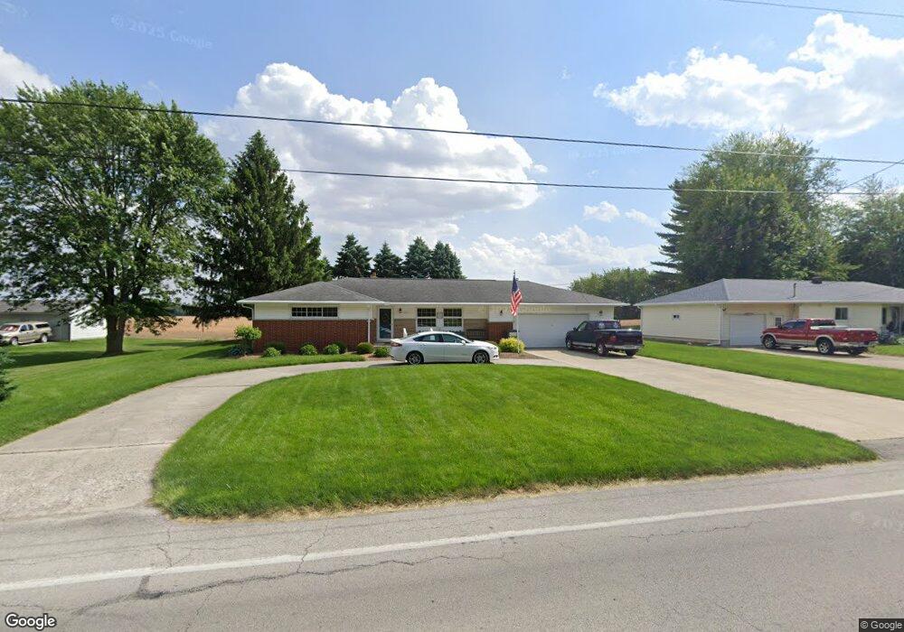
1141 E Cole Rd Fremont, OH 43420
Estimated Value: $219,000 - $262,000
3
Beds
2
Baths
1,804
Sq Ft
$132/Sq Ft
Est. Value
About This Home
This home is located at 1141 E Cole Rd, Fremont, OH 43420 and is currently estimated at $238,260, approximately $132 per square foot. 1141 E Cole Rd is a home located in Sandusky County with nearby schools including Fremont Ross High School, Sacred Heart School, and Temple Christian Academy.
Ownership History
Date
Name
Owned For
Owner Type
Purchase Details
Closed on
Jun 29, 2023
Sold by
Sabiers Karen E
Bought by
Karen E Sabiers Irrevocable Trust and Sabiers
Current Estimated Value
Purchase Details
Closed on
Jul 28, 2020
Sold by
Sabiers Karen E
Bought by
Smith Kelly E and Metzger Kathy J
Purchase Details
Closed on
Nov 20, 1996
Sold by
Link Milton F
Bought by
Sabiers Asa and Sabiers Karen
Home Financials for this Owner
Home Financials are based on the most recent Mortgage that was taken out on this home.
Original Mortgage
$87,500
Interest Rate
7.94%
Mortgage Type
New Conventional
Purchase Details
Closed on
Mar 1, 1987
Sold by
Sabiers Asa and Karen Tru
Bought by
Sabiers Asa & Karen Trustees
Purchase Details
Closed on
Mar 1, 1985
Bought by
Sabiers Asa & Karen Trustees
Create a Home Valuation Report for This Property
The Home Valuation Report is an in-depth analysis detailing your home's value as well as a comparison with similar homes in the area
Home Values in the Area
Average Home Value in this Area
Purchase History
| Date | Buyer | Sale Price | Title Company |
|---|---|---|---|
| Karen E Sabiers Irrevocable Trust | -- | None Listed On Document | |
| Sabiers Karen E | -- | None Available | |
| Sabiers Asa | $120,000 | -- | |
| Sabiers Asa & Karen Trustees | $59,900 | -- | |
| Sabiers Asa & Karen Trustees | $49,000 | -- |
Source: Public Records
Mortgage History
| Date | Status | Borrower | Loan Amount |
|---|---|---|---|
| Previous Owner | Sabiers Asa | $87,500 |
Source: Public Records
Tax History Compared to Growth
Tax History
| Year | Tax Paid | Tax Assessment Tax Assessment Total Assessment is a certain percentage of the fair market value that is determined by local assessors to be the total taxable value of land and additions on the property. | Land | Improvement |
|---|---|---|---|---|
| 2024 | $2,761 | $69,240 | $12,150 | $57,090 |
| 2023 | $2,761 | $57,690 | $10,120 | $47,570 |
| 2022 | $2,457 | $57,690 | $10,120 | $47,570 |
| 2021 | $2,530 | $57,690 | $10,120 | $47,570 |
| 2020 | $1,625 | $45,860 | $10,120 | $35,740 |
| 2019 | $1,624 | $45,860 | $10,120 | $35,740 |
| 2018 | $1,425 | $45,860 | $10,120 | $35,740 |
| 2017 | $1,271 | $38,400 | $10,120 | $28,280 |
| 2016 | $1,113 | $38,400 | $10,120 | $28,280 |
| 2015 | $1,095 | $38,400 | $10,120 | $28,280 |
| 2014 | $1,173 | $39,170 | $9,910 | $29,260 |
| 2013 | $1,147 | $39,170 | $9,910 | $29,260 |
Source: Public Records
Map
Nearby Homes
- 1641 Morrison Rd
- 40 Linda Dr
- 210 Briarwood Dr
- 400 Guernsey Dr
- 1307 Fleetwood Dr
- 600 S Buchanan St
- 0 S Buchanan St
- 748 S Front St
- 907 Tiffin St Unit 45
- 457 Morrison St
- 428 Saint Joseph St
- 1538 Sunrise Blvd
- 1013 Whittlesey St
- 1926 Tiffin Rd
- 1501 Tiffin Rd
- 234 S Pennsylvania Ave
- 700 June St
- 216 S Buchanan St
- 1636 Arrowhead Dr
- 414 Hayes Ave