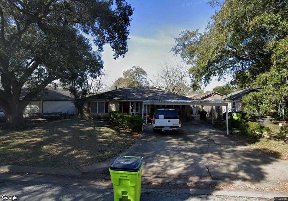
1210 George St Rosenberg, TX 77471
Estimated Value: $175,000 - $194,000
2
Beds
1
Bath
1,170
Sq Ft
$159/Sq Ft
Est. Value
About This Home
This home is located at 1210 George St, Rosenberg, TX 77471 and is currently estimated at $185,493, approximately $158 per square foot. 1210 George St is a home located in Fort Bend County with nearby schools including Bowie Elementary School, Navarro Middle School, and George Junior High School.
Ownership History
Date
Name
Owned For
Owner Type
Purchase Details
Closed on
May 4, 2015
Sold by
Boyd Michael L
Bought by
Garrett Diane
Current Estimated Value
Home Financials for this Owner
Home Financials are based on the most recent Mortgage that was taken out on this home.
Original Mortgage
$54,750
Outstanding Balance
$42,871
Interest Rate
3.74%
Mortgage Type
New Conventional
Estimated Equity
$137,827
Purchase Details
Closed on
Oct 24, 2011
Sold by
Gerstenberger William Charles
Bought by
Boyd Michael L
Home Financials for this Owner
Home Financials are based on the most recent Mortgage that was taken out on this home.
Original Mortgage
$60,410
Interest Rate
4.13%
Mortgage Type
Assumption
Purchase Details
Closed on
Aug 28, 2007
Sold by
Gerstenberger Allene Lena
Bought by
Garrett Diane
Create a Home Valuation Report for This Property
The Home Valuation Report is an in-depth analysis detailing your home's value as well as a comparison with similar homes in the area
Home Values in the Area
Average Home Value in this Area
Purchase History
| Date | Buyer | Sale Price | Title Company |
|---|---|---|---|
| Garrett Diane | -- | Mission Title Lp | |
| Boyd Michael L | -- | Startex Title | |
| Garrett Diane | -- | -- | |
| Garrett Diane | -- | -- |
Source: Public Records
Mortgage History
| Date | Status | Borrower | Loan Amount |
|---|---|---|---|
| Open | Garrett Diane | $54,750 | |
| Previous Owner | Garrett Diane | $60,410 |
Source: Public Records
Tax History Compared to Growth
Tax History
| Year | Tax Paid | Tax Assessment Tax Assessment Total Assessment is a certain percentage of the fair market value that is determined by local assessors to be the total taxable value of land and additions on the property. | Land | Improvement |
|---|---|---|---|---|
| 2023 | $3,144 | $162,873 | $38,704 | $124,169 |
| 2022 | $3,135 | $153,040 | $38,700 | $114,340 |
| 2021 | $3,119 | $150,340 | $43,100 | $107,240 |
| 2020 | $3,093 | $145,730 | $49,350 | $96,380 |
| 2019 | $3,085 | $135,080 | $23,830 | $111,250 |
| 2018 | $2,521 | $108,610 | $23,830 | $84,780 |
| 2017 | $2,310 | $98,980 | $23,830 | $75,150 |
| 2016 | $2,158 | $92,450 | $23,830 | $68,620 |
| 2015 | $1,654 | $70,490 | $23,830 | $46,660 |
| 2014 | $1,904 | $80,180 | $23,830 | $56,350 |
Source: Public Records
Map
Nearby Homes
- 3326 Tilley Dr
- 1220 Mulcahy St
- 1400 Carlisle St
- 1615 Brazos St
- 1504 Carlisle St
- 1808 George St
- 1019 Avenue E
- 2634 Wastelbread Ln
- 5503 Bowquiver Ln
- 2639 Clapbread Ln
- 503 Willow St
- 1603 Walnut Ave
- 915 Avenue E
- 1605 Walnut Ave
- 428 West St
- 1004 Houston St
- 110 Hollys Eddy Ln
- 1108 Easy St
- 413 Mulcahy St
- 1314 Avenue G