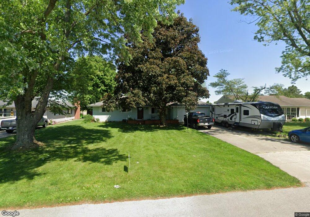
1715 Oak Dr Fremont, OH 43420
Estimated Value: $181,000 - $223,000
3
Beds
1
Bath
1,332
Sq Ft
$151/Sq Ft
Est. Value
About This Home
This home is located at 1715 Oak Dr, Fremont, OH 43420 and is currently estimated at $200,495, approximately $150 per square foot. 1715 Oak Dr is a home located in Sandusky County with nearby schools including Fremont Ross High School, Sacred Heart School, and St. Joseph School.
Ownership History
Date
Name
Owned For
Owner Type
Purchase Details
Closed on
Nov 9, 2007
Sold by
Long Norma Jean and Kramer Donna Jean
Bought by
Clapp Phillip R and Clapp Rachel C
Current Estimated Value
Home Financials for this Owner
Home Financials are based on the most recent Mortgage that was taken out on this home.
Original Mortgage
$104,400
Interest Rate
6.44%
Mortgage Type
VA
Purchase Details
Closed on
Mar 30, 2006
Sold by
Estate Of Merrit E Sheidler and Dull Cathy D
Bought by
Long Norma Jean
Home Financials for this Owner
Home Financials are based on the most recent Mortgage that was taken out on this home.
Original Mortgage
$88,000
Interest Rate
6.38%
Mortgage Type
Fannie Mae Freddie Mac
Purchase Details
Closed on
Aug 1, 1993
Bought by
Clapp Phillip R and Clapp Rachel C
Create a Home Valuation Report for This Property
The Home Valuation Report is an in-depth analysis detailing your home's value as well as a comparison with similar homes in the area
Home Values in the Area
Average Home Value in this Area
Purchase History
| Date | Buyer | Sale Price | Title Company |
|---|---|---|---|
| Clapp Phillip R | $76,500 | Firelands | |
| Long Norma Jean | $82,500 | None Available | |
| Clapp Phillip R | -- | -- |
Source: Public Records
Mortgage History
| Date | Status | Borrower | Loan Amount |
|---|---|---|---|
| Open | Clapp Philip R | $87,500 | |
| Closed | Clapp Phillip R | $100,000 | |
| Closed | Clapp Phillip R | $104,400 | |
| Closed | Long Norma Jean | $88,000 |
Source: Public Records
Tax History Compared to Growth
Tax History
| Year | Tax Paid | Tax Assessment Tax Assessment Total Assessment is a certain percentage of the fair market value that is determined by local assessors to be the total taxable value of land and additions on the property. | Land | Improvement |
|---|---|---|---|---|
| 2024 | $1,990 | $49,880 | $10,430 | $39,450 |
| 2023 | $1,990 | $41,550 | $8,680 | $32,870 |
| 2022 | $1,771 | $41,550 | $8,680 | $32,870 |
| 2021 | $1,824 | $41,550 | $8,680 | $32,870 |
| 2020 | $1,565 | $34,930 | $8,680 | $26,250 |
| 2019 | $1,508 | $33,670 | $8,680 | $24,990 |
| 2018 | $1,358 | $33,670 | $8,680 | $24,990 |
| 2017 | $1,249 | $28,460 | $8,680 | $19,780 |
| 2016 | $1,098 | $28,460 | $8,680 | $19,780 |
| 2015 | $1,080 | $28,460 | $8,680 | $19,780 |
| 2014 | $2,193 | $29,440 | $8,510 | $20,930 |
| 2013 | $2,120 | $29,440 | $8,510 | $20,930 |
Source: Public Records
Map
Nearby Homes
- 1641 Morrison Rd
- 40 Linda Dr
- 210 Briarwood Dr
- 1307 Fleetwood Dr
- 400 Guernsey Dr
- 600 S Buchanan St
- 0 S Buchanan St
- 748 S Front St
- 457 Morrison St
- 428 Saint Joseph St
- 907 Tiffin St Unit 45
- 1538 Sunrise Blvd
- 1013 Whittlesey St
- 234 S Pennsylvania Ave
- 216 S Buchanan St
- 700 June St
- 1501 Tiffin Rd
- 1926 Tiffin Rd
- 414 Hayes Ave
- 116 N Pennsylvania Ave