1970 Imboden Rd Watkins, CO 80137
Estimated payment $2,526/month
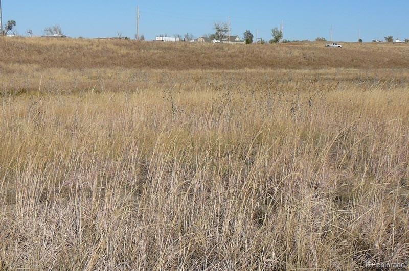
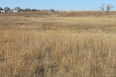
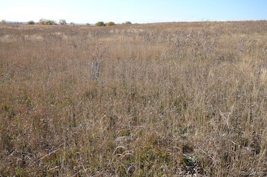
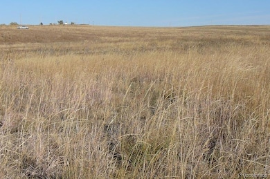
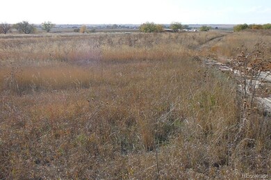
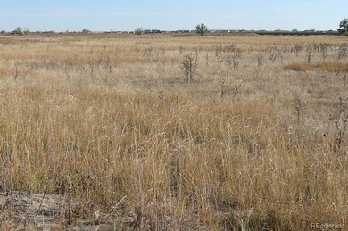
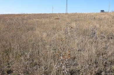
Highlights
- Water Views
- 7 Acres of Pasture
- Development of the land is complete
- No HOA
About This Lot
LEGAL: Watkins Storage Subdivision Block 1 Lot 1, City of Watkins, Adams County Colorado
ACREAGE: 7.25 Acres per professional survey of the Property.
PRICE: $450,000.00 cash at closing.
ZONING: The Property is presently zoned A1 Agricultural (minimal dividable lot size of 2.5 acres). In prime area to rezone for future commercial or industrial development.
IMPROVEMENTS: Professional Land Survey Plat, Grading Plan for flood plain mitigation, Use By Special Review for recreational volley ball courts
WATER RIGHTS: Decree of Water Case No. 22CW3023 granting 2.54 acre feet in the Arapahoe Aquifer.
WELLS: None.
OUTBUILDINGS: None.
MINERALS: Property includes all of Sellers mineral rights that they own, if any.
TAXES: 2022 property taxes $885.28 paid in full.
FLOOD PLAIN: Approxiimately 2.1 acres of the Property lies in the flood plain restricting the use of this area however this area can be mitigated by a one to one transfer of fill from the higher grade into the flood plain
NOTE: The information contained herein has been obtained from reliable sources but, is not guaranteed by Seller or
Broker. This offer is subject to error, change, prior sale or withdrawal. Broker is a Transaction (neutral) broker and not a Seller's agent.
Listing Agent
Colorado Land Realty Brokerage Email: 7487028@gmail.com,303-748-7028 License #277291 Listed on: 11/21/2023
Property Details
Property Type
- Land
Est. Annual Taxes
- $885
Lot Details
- 7.25 Acre Lot
- Development of the land is complete
- Property is zoned A1
Property Views
- Water
- City
- Pasture
- Mountain
- Meadow
- Valley
Additional Features
- 7 Acres of Pasture
- Septic Tank
Community Details
- No Home Owners Association
- Watkins Storage Subdivsion Subdivision
Listing and Financial Details
- Property held in a trust
- Assessor Parcel Number 0181732301001
Map
Home Values in the Area
Average Home Value in this Area
Tax History
| Year | Tax Paid | Tax Assessment Tax Assessment Total Assessment is a certain percentage of the fair market value that is determined by local assessors to be the total taxable value of land and additions on the property. | Land | Improvement |
|---|---|---|---|---|
| 2024 | $6,138 | $79,280 | $79,280 | -- |
| 2023 | $6,182 | $81,920 | $81,920 | -- |
| 2022 | $885 | $11,770 | $11,770 | $0 |
| 2021 | $877 | $11,770 | $11,770 | $0 |
| 2020 | $863 | $11,770 | $11,770 | $0 |
| 2019 | $889 | $11,770 | $11,770 | $0 |
| 2018 | $530 | $6,310 | $6,310 | $0 |
| 2017 | $534 | $6,310 | $6,310 | $0 |
| 2016 | $513 | $6,310 | $6,310 | $0 |
| 2015 | $510 | $6,310 | $6,310 | $0 |
| 2014 | $518 | $6,310 | $6,310 | $0 |
Property History
| Date | Event | Price | Change | Sq Ft Price |
|---|---|---|---|---|
| 11/21/2023 11/21/23 | For Sale | $450,000 | -- | -- |
Purchase History
| Date | Type | Sale Price | Title Company |
|---|---|---|---|
| Warranty Deed | -- | Good & Good Pc | |
| Quit Claim Deed | -- | None Available | |
| Special Warranty Deed | $275,000 | None Available |
Source: REcolorado®
MLS Number: 7930972
APN: 1817-32-3-01-001
Disclaimer: Certain information contained herein is derived from information provided by parties other than Homes.com. All information provided is deemed reliable, but is not guaranteed to be accurate and should be independently verified.
![]() The content relating to real estate for sale in this Web site comes in part from the Internet Data eXchange (“IDX”) program of METROLIST, INC., DBA RECOLORADO®. Real estate listings held by brokers other than Ten-X are marked with the IDX Logo. This information is being provided for the consumers’ personal, non-commercial use and may not be used for any other purpose. All information subject to change and should be independently verified.
The content relating to real estate for sale in this Web site comes in part from the Internet Data eXchange (“IDX”) program of METROLIST, INC., DBA RECOLORADO®. Real estate listings held by brokers other than Ten-X are marked with the IDX Logo. This information is being provided for the consumers’ personal, non-commercial use and may not be used for any other purpose. All information subject to change and should be independently verified.
This publication is designed to provide information with regard to the subject matter covered. It is displayed with the understanding that the publisher and authors are not engaged in rendering real estate, legal, accounting, tax, or other professional services and that the publisher and authors are not offering such advice in this publication. If real estate, legal, or other expert assistance is required, the services of a competent, professional person should be sought.
The information contained in this publication is subject to change without notice. METROLIST, INC., DBA RECOLORADO MAKES NO WARRANTY OF ANY KIND WITH REGARD TO THIS MATERIAL, INCLUDING, BUT NOT LIMITED TO, THE IMPLIED WARRANTIES OF MERCHANTABILITY AND FITNESS FOR A PARTICULAR PURPOSE. METROLIST, INC., DBA RECOLORADO SHALL NOT BE LIABLE FOR ERRORS CONTAINED HEREIN OR FOR ANY DAMAGES IN CONNECTION WITH THE FURNISHING, PERFORMANCE, OR USE OF THIS MATERIAL.
PUBLISHER’S NOTICE: All real estate advertised herein is subject to the Federal Fair Housing Act and the Colorado Fair Housing Act, which Acts make it illegal to make or publish any advertisement that indicates any preference, limitation, or discrimination based on race, color, religion, sex, handicap, familial status, or national origin.
METROLIST, INC., DBA RECOLORADO will not knowingly accept any advertising for real estate that is in violation of the law. All persons are hereby informed that all dwellings advertised are available on an equal opportunity basis.
© 2025 METROLIST, INC., DBA RECOLORADO® – All Rights Reserved. 6455 S. Yosemite St., Suite 500 Greenwood Village, CO 80111 USA
ALL RIGHTS RESERVED WORLDWIDE. No part of this publication may be reproduced, adapted, translated, stored in a retrieval system or transmitted in any form or by any means, electronic, mechanical, photocopying, recording, or otherwise, without the prior written permission of the publisher. The information contained herein including but not limited to all text, photographs, digital images, virtual tours, may be seeded and monitored for protection and tracking.
- 724 Imboden Rd
- 34827 E 7th Ave
- 836 Imboden Rd
- 970 Inyokern Ct
- 881 Kirby Ct
- 1415 Eclipse St Unit 1
- 0 Tbd East 12 Place
- 369 S Bonnie Ln
- 35055 E Mississippi Ave
- 1980 Gilmore St
- 1335 S Kio St
- 1860 S Kio St
- 1614 N Manila Rd
- 28820 6th Place
- 760 N Deer Park St
- 770 N Deer Park St
- 780 N Deer Park St
- 832 N Deer Park St
- 842 N Deer Park St
- 852 N Deer Park St
- 27664 E 1st Place
- 32 N Trussville St
- 249 S Uriah St
- 298 S Trussville St
- 27062 E Ellsworth Ave
- 26987 E Maple Ave
- 434 N Old Hammer St
- 26099 E 1st Ave
- 27932 E 7th Place
- 195 S Oak Hill St
- 25023 E 5th Ave
- 25062 E Cedar Place
- 124 N Flat Rock St
- 23494 E 2nd Place
- 23501 E 2nd Place
- 23566 E 2nd Place
- 23524 E 2nd Place
- 24762 E Wyoming Cir
- 1182 S Fultondale Cir
- 24603 E Louisiana Cir
