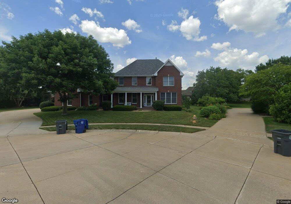
2070 Greenview Ct Bettendorf, IA 52722
Estimated Value: $598,000 - $686,636
4
Beds
5
Baths
3,524
Sq Ft
$184/Sq Ft
Est. Value
About This Home
This home is located at 2070 Greenview Ct, Bettendorf, IA 52722 and is currently estimated at $647,909, approximately $183 per square foot. 2070 Greenview Ct is a home located in Scott County with nearby schools including Riverdale Heights Elementary School, Pleasant Valley Junior High School, and Pleasant Valley High School.
Ownership History
Date
Name
Owned For
Owner Type
Purchase Details
Closed on
Jan 27, 2006
Sold by
Bashor Steven B and Bashor Kathleen C
Bought by
Olt Theodore F and Olt Rosemary W
Current Estimated Value
Home Financials for this Owner
Home Financials are based on the most recent Mortgage that was taken out on this home.
Original Mortgage
$250,000
Interest Rate
6.34%
Mortgage Type
New Conventional
Create a Home Valuation Report for This Property
The Home Valuation Report is an in-depth analysis detailing your home's value as well as a comparison with similar homes in the area
Home Values in the Area
Average Home Value in this Area
Purchase History
| Date | Buyer | Sale Price | Title Company |
|---|---|---|---|
| Olt Theodore F | $477,500 | None Available |
Source: Public Records
Mortgage History
| Date | Status | Borrower | Loan Amount |
|---|---|---|---|
| Open | Olt Theodore F | $197,800 | |
| Closed | Olt Theodore F | $205,000 | |
| Closed | Olt Theodore F | $215,000 | |
| Closed | Olt Theodore F | $250,000 |
Source: Public Records
Tax History Compared to Growth
Tax History
| Year | Tax Paid | Tax Assessment Tax Assessment Total Assessment is a certain percentage of the fair market value that is determined by local assessors to be the total taxable value of land and additions on the property. | Land | Improvement |
|---|---|---|---|---|
| 2024 | $8,906 | $588,700 | $92,200 | $496,500 |
| 2023 | $9,252 | $588,700 | $92,200 | $496,500 |
| 2022 | $9,158 | $520,840 | $92,160 | $428,680 |
| 2021 | $9,158 | $520,840 | $92,160 | $428,680 |
| 2020 | $9,076 | $498,900 | $92,160 | $406,740 |
| 2019 | $8,896 | $483,260 | $92,160 | $391,100 |
| 2018 | $8,720 | $483,260 | $92,160 | $391,100 |
| 2017 | $2,669 | $483,260 | $92,160 | $391,100 |
| 2016 | $8,794 | $479,260 | $0 | $0 |
| 2015 | $8,794 | $459,330 | $0 | $0 |
| 2014 | $8,528 | $459,330 | $0 | $0 |
| 2013 | $8,376 | $0 | $0 | $0 |
| 2012 | -- | $463,600 | $80,720 | $382,880 |
Source: Public Records
Map
Nearby Homes
- 2592 Middle Rd Unit 318
- 2592 Middle Rd Unit 319
- 316 Linda Ln
- 2910 Maplecrest Rd
- 1551 Forest Hills Rd
- 2086 Ashford Rd
- 3040 Oak Street Ct
- 1612 20th St
- 2865 S Hampton Dr
- 1231 Devils Glen Rd
- 1992 Plum Tree Rd
- 17 Wildwood Trail
- 27 Sutton Ct
- 2505 Cody St
- 3394 Clearwater Dr
- 3071 S Hampton Dr
- 3439 Maple Glen Dr
- 2524 Bellevue Ave
- 3295 Johnathan Ave
- 2003 Edgewood Dr
- 2205 Lundy Ln
- 2075 Greenview Ct
- 2177 Lundy Ln
- 2233 Lundy Ln
- 2060 Greenview Ct
- 2931 Lundy Ln
- 3075 Lundy Ln
- 2065 Greenview Ct
- 2153 Lundy Ln
- 198S Saint David Dr
- 3085 Lundy Ln
- 2050 Greenview Ct
- 2194 Lundy Ln
- 2055 Greenview Ct
- 2138 Saint David Dr
- 2226 Lundy Ln
- 2128 Saint David Dr
- 2148 Saint David Dr
- 2148 St David Dr
- 2244 Lundy Ln