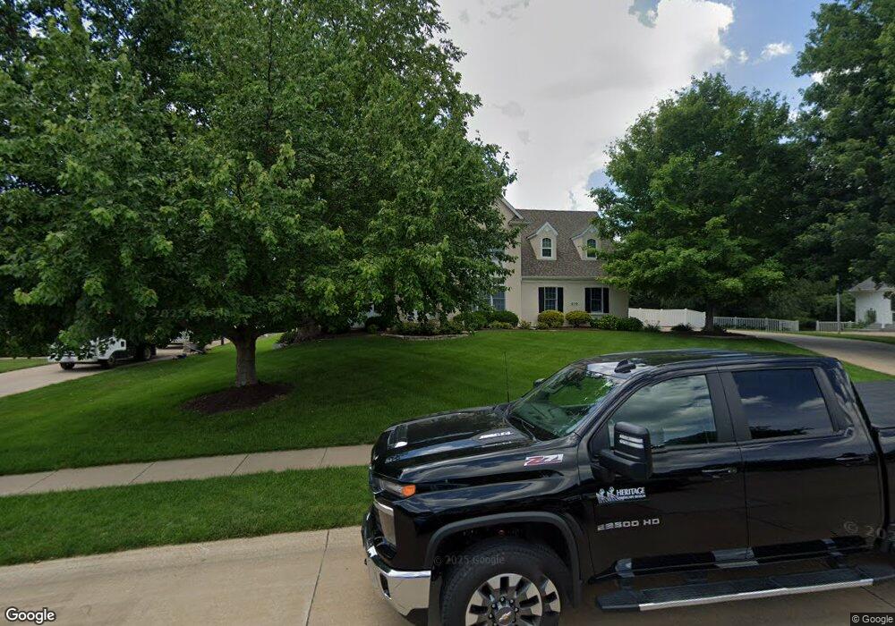
2110 Lundy Ln Bettendorf, IA 52722
Estimated Value: $643,000 - $861,528
5
Beds
5
Baths
3,742
Sq Ft
$190/Sq Ft
Est. Value
About This Home
This home is located at 2110 Lundy Ln, Bettendorf, IA 52722 and is currently estimated at $712,382, approximately $190 per square foot. 2110 Lundy Ln is a home located in Scott County with nearby schools including Riverdale Heights Elementary School, Pleasant Valley Junior High School, and Pleasant Valley High School.
Ownership History
Date
Name
Owned For
Owner Type
Purchase Details
Closed on
Jul 31, 2016
Sold by
Shammas Nicolas W and Shammas Gail A
Bought by
Shammas Nicolas W and Shammas Gail A
Current Estimated Value
Home Financials for this Owner
Home Financials are based on the most recent Mortgage that was taken out on this home.
Original Mortgage
$500,000
Interest Rate
3.61%
Mortgage Type
Credit Line Revolving
Create a Home Valuation Report for This Property
The Home Valuation Report is an in-depth analysis detailing your home's value as well as a comparison with similar homes in the area
Home Values in the Area
Average Home Value in this Area
Purchase History
| Date | Buyer | Sale Price | Title Company |
|---|---|---|---|
| Shammas Nicolas W | -- | None Available |
Source: Public Records
Mortgage History
| Date | Status | Borrower | Loan Amount |
|---|---|---|---|
| Closed | Shammas Nicolas W | $500,000 |
Source: Public Records
Tax History Compared to Growth
Tax History
| Year | Tax Paid | Tax Assessment Tax Assessment Total Assessment is a certain percentage of the fair market value that is determined by local assessors to be the total taxable value of land and additions on the property. | Land | Improvement |
|---|---|---|---|---|
| 2024 | $11,818 | $766,300 | $102,600 | $663,700 |
| 2023 | $11,908 | $766,300 | $102,600 | $663,700 |
| 2022 | $11,786 | $663,390 | $102,650 | $560,740 |
| 2021 | $11,786 | $663,390 | $102,650 | $560,740 |
| 2020 | $11,098 | $603,980 | $102,650 | $501,330 |
| 2019 | $10,872 | $584,690 | $102,650 | $482,040 |
| 2018 | $10,658 | $584,690 | $102,650 | $482,040 |
| 2017 | $3,252 | $584,690 | $102,650 | $482,040 |
| 2016 | $10,222 | $551,880 | $0 | $0 |
| 2015 | $10,222 | $528,490 | $0 | $0 |
| 2014 | $9,910 | $528,490 | $0 | $0 |
| 2013 | $9,736 | $0 | $0 | $0 |
| 2012 | -- | $529,330 | $84,260 | $445,070 |
Source: Public Records
Map
Nearby Homes
- 2592 Middle Rd Unit 318
- 2592 Middle Rd Unit 319
- 316 Linda Ln
- 1551 Forest Hills Rd
- 1612 20th St
- 17 Wildwood Trail
- 3040 Oak Street Ct
- 2865 S Hampton Dr
- 2910 Maplecrest Rd
- 27 Sutton Ct
- 2505 Cody St
- 1231 Devils Glen Rd
- 2086 Ashford Rd
- 2003 Edgewood Dr
- 2524 Bellevue Ave
- 3071 S Hampton Dr
- 2503 Bellevue Ave
- 1525 Elmwood Ave
- 1992 Plum Tree Rd
- 1815 Lincoln Rd
- 2090 Lundy Ln
- 2118 Lundy Ln
- 2103 Lundy Ln
- 2144 Lundy Ln
- 2153 Lundy Ln
- 3026 Greenview Dr
- 2050 Greenview Ct
- 198S Saint David Dr
- 2170 Lundy Ln
- 2177 Lundy Ln
- 2060 Greenview Ct
- 3012 Greenview Dr
- 2194 Lundy Ln
- 1938 St David
- 1938 Saint David Dr
- 2205 Lundy Ln
- 1935 Saint David Dr
- 2045 Greenview Ct
- 2998 Greenview Dr
- 2070 Greenview Ct