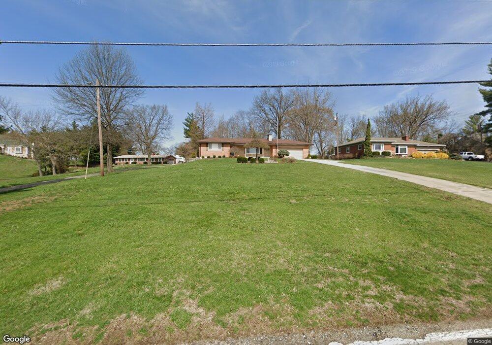
2157 Cliff Rd North Bend, OH 45052
Estimated Value: $243,000 - $341,000
2
Beds
2
Baths
1,386
Sq Ft
$218/Sq Ft
Est. Value
About This Home
This home is located at 2157 Cliff Rd, North Bend, OH 45052 and is currently estimated at $301,877, approximately $217 per square foot. 2157 Cliff Rd is a home located in Hamilton County with nearby schools including Charles T. Young Elementary School, Taylor Middle School, and Taylor High School.
Ownership History
Date
Name
Owned For
Owner Type
Purchase Details
Closed on
Nov 20, 2014
Sold by
Barnhorst Richard A and Joyce Barnhorst M
Bought by
Barnhorst Family Preservation Trust
Current Estimated Value
Purchase Details
Closed on
Sep 4, 1998
Sold by
Jones Samuel W
Bought by
Barnhorst Richard A and Barnhorst Joyce
Create a Home Valuation Report for This Property
The Home Valuation Report is an in-depth analysis detailing your home's value as well as a comparison with similar homes in the area
Home Values in the Area
Average Home Value in this Area
Purchase History
| Date | Buyer | Sale Price | Title Company |
|---|---|---|---|
| Barnhorst Family Preservation Trust | -- | Attorney | |
| Barnhorst Richard A | $190,000 | Vintage Title Agency Inc |
Source: Public Records
Mortgage History
| Date | Status | Borrower | Loan Amount |
|---|---|---|---|
| Open | Barnhorst Richard A | $150,000 | |
| Closed | Barnhorst Richard A | $64,000 |
Source: Public Records
Tax History Compared to Growth
Tax History
| Year | Tax Paid | Tax Assessment Tax Assessment Total Assessment is a certain percentage of the fair market value that is determined by local assessors to be the total taxable value of land and additions on the property. | Land | Improvement |
|---|---|---|---|---|
| 2024 | $2,849 | $70,725 | $23,804 | $46,921 |
| 2023 | $2,889 | $70,725 | $23,804 | $46,921 |
| 2022 | $2,622 | $52,417 | $21,641 | $30,776 |
| 2021 | $2,545 | $52,417 | $21,641 | $30,776 |
| 2020 | $2,576 | $52,417 | $21,641 | $30,776 |
| 2019 | $2,779 | $52,417 | $21,641 | $30,776 |
| 2018 | $2,672 | $52,417 | $21,641 | $30,776 |
| 2017 | $2,504 | $52,417 | $21,641 | $30,776 |
| 2016 | $2,488 | $53,463 | $25,764 | $27,699 |
| 2015 | $2,518 | $53,463 | $25,764 | $27,699 |
| 2014 | $2,545 | $53,463 | $25,764 | $27,699 |
| 2013 | $2,492 | $53,463 | $25,764 | $27,699 |
Source: Public Records
Map
Nearby Homes
- 2700 Rittenhouse Rd
- 22 Timberline Ct
- 14 Timberline Ct
- 9807 Miamiview Rd
- 16 Washington Ave
- 20 Washington Ave
- 21 Wamsley Ave
- 10651 Brower Rd
- 1739 Barons Cove
- 104 E Main St
- 9 E State Rd
- 1353 Dominion Trail
- 220 Cleves Ave
- 22 Skidmore Ave
- 1196 Breckenridge Ln
- 1843 Emory Ct
- 0 Saint Annes Unit 1826785
- 1846 Emory Ct
- 1155 Breckenridge Ln
- 240 E Morgan St