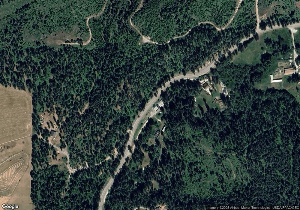
2685 Burnt Valley Rd Chewelah, WA 99109
Estimated Value: $542,000 - $773,365
4
Beds
4
Baths
3,000
Sq Ft
$219/Sq Ft
Est. Value
About This Home
This home is located at 2685 Burnt Valley Rd, Chewelah, WA 99109 and is currently estimated at $657,455, approximately $219 per square foot. 2685 Burnt Valley Rd is a home located in Stevens County with nearby schools including Gess Elementary School and Jenkins Junior/Senior High School.
Ownership History
Date
Name
Owned For
Owner Type
Purchase Details
Closed on
Apr 14, 2016
Sold by
Wasco Michelle R and Wasco Curtis G
Bought by
Wasco Michelle R and Wasco Curtis G
Current Estimated Value
Home Financials for this Owner
Home Financials are based on the most recent Mortgage that was taken out on this home.
Original Mortgage
$276,000
Interest Rate
3.64%
Mortgage Type
New Conventional
Create a Home Valuation Report for This Property
The Home Valuation Report is an in-depth analysis detailing your home's value as well as a comparison with similar homes in the area
Home Values in the Area
Average Home Value in this Area
Purchase History
| Date | Buyer | Sale Price | Title Company |
|---|---|---|---|
| Wasco Michelle R | -- | Stevens County Title Company |
Source: Public Records
Mortgage History
| Date | Status | Borrower | Loan Amount |
|---|---|---|---|
| Closed | Wasco Michelle R | $50,000 | |
| Closed | Wasco Michelle R | $243,000 | |
| Closed | Wasco Michelle R | $260,000 | |
| Closed | Wasco Michelle R | $100,000 | |
| Closed | Wasco Michelle R | $276,000 | |
| Closed | Wasco Michelle R | $324,100 | |
| Closed | Wasoc Michelle R | $62,000 | |
| Closed | Wasco Michelle | $347,378 | |
| Closed | Wasco Michaelle R | $319,600 |
Source: Public Records
Tax History Compared to Growth
Tax History
| Year | Tax Paid | Tax Assessment Tax Assessment Total Assessment is a certain percentage of the fair market value that is determined by local assessors to be the total taxable value of land and additions on the property. | Land | Improvement |
|---|---|---|---|---|
| 2024 | $3,859 | $517,701 | $8,382 | $509,319 |
| 2023 | $3,965 | $599,451 | $92,000 | $507,451 |
| 2022 | $3,958 | $561,207 | $92,000 | $469,207 |
| 2021 | $4,095 | $451,229 | $6,255 | $444,974 |
| 2020 | $4,154 | $451,229 | $6,255 | $444,974 |
| 2019 | $3,567 | $430,901 | $6,173 | $424,728 |
| 2018 | $4,304 | $375,104 | $6,505 | $368,599 |
| 2017 | $4,077 | $415,403 | $6,993 | $408,410 |
| 2016 | $3,866 | $425,698 | $17,288 | $408,410 |
| 2015 | $3,953 | $425,632 | $17,222 | $408,410 |
| 2013 | -- | $425,599 | $17,189 | $408,410 |
Source: Public Records
Map
Nearby Homes
- 2694 Sand Canyon Rd
- 2443 Eagle Lambert Rd
- 23XX Burnt Valley Rd Unit Parcel 2566428
- 2593 Burnt Valley Rd
- XXX Burnt Valley Rd
- 26XX Sand Canyon Lot 2 Rd
- 26XX Sand Canyon Lot 3 Rd
- 3033 Major Rd
- 2360 Burnt Valley Rd
- 2367 Morse Way
- 2243 Tyra Dr
- 203 Eagle Dr
- 205 Eagle Dr
- 207 Eagle Dr
- 102 Trappers Loop W
- 183 E Trappers Loop
- 182 E Trappers Loop
- 102 Birdie Trail Unit 80
- 251 Eagle Dr
- 256 Eagle Dr
- 2685 Burnt Valley Rd
- 2693 Burnt Valley Rd
- 2660 Burnt Valley Rd
- 2660XX Burnt Valley Rd
- 2690 Burnt Valley Rd
- 2611 Burnt Valley Rd
- 2686 Burnt Valley Rd
- 2686 Burnt Valley Rd Unit B
- 2706 Burnt Valley Rd
- 2716 Moser Rd
- 26XX Burnt Valley Rd
- 2728 Burnt Valley Rd
- 2692 Highline Rd
- 2642 Highline Rd
- 2700 Blk Burnt Valley
- 2726 Highline Rd
- 26XX Highline Rd
- 2710 Highline Rd
- 2584 Burnt Valley Rd
- 2604 Burnt Valley Rd
