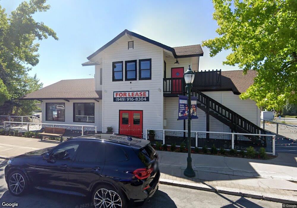
415 N Mount Shasta Blvd Mount Shasta, CA 96067
Estimated Value: $558,240
--
Bed
--
Bath
--
Sq Ft
7,841
Sq Ft Lot
About This Home
This home is located at 415 N Mount Shasta Blvd, Mount Shasta, CA 96067 and is currently estimated at $558,240. 415 N Mount Shasta Blvd is a home located in Siskiyou County with nearby schools including Mt. Shasta Elementary School, Mt. Shasta High School, and Golden Eagle Charter School.
Ownership History
Date
Name
Owned For
Owner Type
Purchase Details
Closed on
Jan 27, 2022
Sold by
Tadina 2003 Trust
Bought by
Parker Family Trust
Current Estimated Value
Home Financials for this Owner
Home Financials are based on the most recent Mortgage that was taken out on this home.
Original Mortgage
$470,000
Outstanding Balance
$438,088
Interest Rate
3.55%
Mortgage Type
Purchase Money Mortgage
Estimated Equity
$116,336
Purchase Details
Closed on
Nov 6, 2003
Sold by
Tadina Robert and Tadina Freida M
Bought by
Tadina Robert and Tadina Freida M
Create a Home Valuation Report for This Property
The Home Valuation Report is an in-depth analysis detailing your home's value as well as a comparison with similar homes in the area
Home Values in the Area
Average Home Value in this Area
Purchase History
| Date | Buyer | Sale Price | Title Company |
|---|---|---|---|
| Parker Family Trust | $520,000 | Mt Shasta Title And Escrow Co | |
| Tadina Robert | -- | -- |
Source: Public Records
Mortgage History
| Date | Status | Borrower | Loan Amount |
|---|---|---|---|
| Open | Parker Family Trust | $470,000 |
Source: Public Records
Tax History Compared to Growth
Tax History
| Year | Tax Paid | Tax Assessment Tax Assessment Total Assessment is a certain percentage of the fair market value that is determined by local assessors to be the total taxable value of land and additions on the property. | Land | Improvement |
|---|---|---|---|---|
| 2025 | $5,947 | $551,827 | $122,038 | $429,789 |
| 2023 | $5,947 | $530,400 | $117,300 | $413,100 |
| 2022 | $4,563 | $410,053 | $117,909 | $292,144 |
| 2021 | $4,488 | $402,014 | $115,598 | $286,416 |
| 2020 | $4,489 | $397,893 | $114,413 | $283,480 |
| 2019 | $4,409 | $390,092 | $112,170 | $277,922 |
| 2018 | $4,327 | $382,444 | $109,971 | $272,473 |
| 2017 | $4,286 | $374,946 | $107,815 | $267,131 |
| 2016 | $4,206 | $367,595 | $105,701 | $261,894 |
| 2015 | -- | $362,075 | $104,114 | $257,961 |
| 2014 | -- | $354,983 | $102,075 | $252,908 |
Source: Public Records
Map
Nearby Homes
- lot 7 Ream Ave
- parcel 3 Deetz Rd
- 300 E Jessie St
- 531 Cedar St
- 619 Spring St
- 801 Pine St
- 114 Smith St
- 622 Kenneth Way
- 0 Berry St
- 206 E Hinckley St
- 396 Washington Place
- 211 Smith St
- 506 Eiler Rd
- 00 Kenneth Marjorie
- 509 Mccloud Ave
- 809 Caroline Ave
- 201 Terry Lynn Ave
- Parcel 2 / 36 Court St
- 311 Old McCloud Rd
- 1422 Kingston Rd
- 426 N Mount Shasta Blvd
- 101 E Alma St
- 418 N Mount Shasta Blvd
- 416 N Mount Shasta Blvd
- 414 N Mount Shasta Blvd
- 412 N Mount Shasta Blvd
- 406 N Mount Shasta Blvd
- 404 N Mount Shasta Blvd
- 110 W Castle St
- 0 (Undisclosed Address) Unit 20220095
- 0 Chestnut Unit 112213
- 000 Chestnut St
- 0 Chestnut Unit 6-6813
- 414-418 Chestnut St Unit 416
- 416 Chestnut St Unit 416
- Lot 6 Unit 2 Shasta Lake Blvd Unit 2
- Parcel 1,2,3 Pine Field St
- n/a Lake Washington
- 420A Chestnut St
- 420A Chestnut St