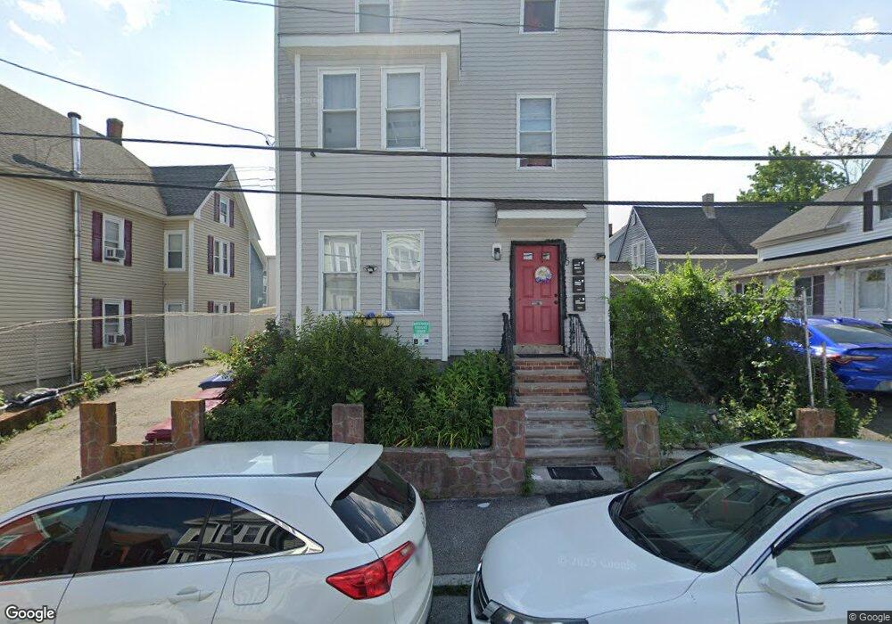
5 Ware St Lowell, MA 01851
Lower Highlands NeighborhoodEstimated Value: $356,000 - $893,000
9
Beds
3
Baths
4,788
Sq Ft
$145/Sq Ft
Est. Value
About This Home
This home is located at 5 Ware St, Lowell, MA 01851 and is currently estimated at $696,333, approximately $145 per square foot. 5 Ware St is a home located in Middlesex County with nearby schools including Abraham Lincoln Elementary School, Charles W. Morey Elementary School, and Charlotte M Murkland Elementary School.
Ownership History
Date
Name
Owned For
Owner Type
Purchase Details
Closed on
Jun 30, 1993
Sold by
Mainstream Mtg Co
Bought by
Nieves-Reynoso Olga
Current Estimated Value
Home Financials for this Owner
Home Financials are based on the most recent Mortgage that was taken out on this home.
Original Mortgage
$46,800
Interest Rate
7.46%
Mortgage Type
Purchase Money Mortgage
Create a Home Valuation Report for This Property
The Home Valuation Report is an in-depth analysis detailing your home's value as well as a comparison with similar homes in the area
Home Values in the Area
Average Home Value in this Area
Purchase History
| Date | Buyer | Sale Price | Title Company |
|---|---|---|---|
| Nieves-Reynoso Olga | $52,000 | -- | |
| Nieves-Reynoso Olga | $52,000 | -- |
Source: Public Records
Mortgage History
| Date | Status | Borrower | Loan Amount |
|---|---|---|---|
| Open | Nieves-Reynoso Olga C | $170,000 | |
| Closed | Nieves-Reynoso Olga C | $150,000 | |
| Closed | Amlaw William D | $9,897 | |
| Closed | Amlaw William D | $46,800 |
Source: Public Records
Tax History Compared to Growth
Tax History
| Year | Tax Paid | Tax Assessment Tax Assessment Total Assessment is a certain percentage of the fair market value that is determined by local assessors to be the total taxable value of land and additions on the property. | Land | Improvement |
|---|---|---|---|---|
| 2025 | $9,111 | $793,600 | $112,400 | $681,200 |
| 2024 | $8,676 | $728,500 | $105,100 | $623,400 |
| 2023 | $8,538 | $687,400 | $91,400 | $596,000 |
| 2022 | $7,784 | $613,400 | $72,200 | $541,200 |
| 2021 | $6,696 | $497,500 | $62,800 | $434,700 |
| 2020 | $6,118 | $457,900 | $62,800 | $395,100 |
| 2019 | $5,959 | $424,400 | $59,700 | $364,700 |
| 2018 | $5,411 | $376,000 | $56,900 | $319,100 |
| 2017 | $5,176 | $346,900 | $55,200 | $291,700 |
| 2016 | $4,713 | $310,900 | $51,200 | $259,700 |
| 2015 | $4,443 | $287,000 | $51,200 | $235,800 |
| 2013 | $3,793 | $252,700 | $61,400 | $191,300 |
Source: Public Records
Map
Nearby Homes
- 27 Bellevue St
- 45 Marshall St
- 6 Mcintyre St
- 173 Westford St
- 113 Bellevue St
- 65 Smith St
- 201 Thorndike St Unit 5-02
- 201 Thorndike St Unit 501
- 15 Barclay St
- 613 School St
- 491 Dutton St Unit 409
- 491 Dutton St Unit 403
- 491 Dutton St Unit 415
- 491 Dutton St Unit 210B
- 491 Dutton St Unit 209
- 17 Burns St Unit D
- 17 Burns St Unit 2
- 17 Burns St Unit 1
- 987 Middlesex St
- 31 Waite St