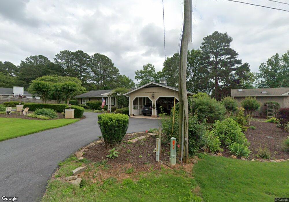
545 Tahoe Dr Hartwell, GA 30643
Estimated Value: $762,000 - $790,000
3
Beds
3
Baths
3,074
Sq Ft
$253/Sq Ft
Est. Value
About This Home
This home is located at 545 Tahoe Dr, Hartwell, GA 30643 and is currently estimated at $776,556, approximately $252 per square foot. 545 Tahoe Dr is a home located in Hart County with nearby schools including Hart County High School.
Ownership History
Date
Name
Owned For
Owner Type
Purchase Details
Closed on
Nov 9, 2020
Sold by
Westbury Philip J
Bought by
Westbury Sherrill M
Current Estimated Value
Purchase Details
Closed on
Jul 12, 2007
Sold by
Bailey A Judson
Bought by
Westbury Philip J
Home Financials for this Owner
Home Financials are based on the most recent Mortgage that was taken out on this home.
Original Mortgage
$600,000
Interest Rate
6.71%
Mortgage Type
New Conventional
Purchase Details
Closed on
Apr 1, 1976
Create a Home Valuation Report for This Property
The Home Valuation Report is an in-depth analysis detailing your home's value as well as a comparison with similar homes in the area
Home Values in the Area
Average Home Value in this Area
Purchase History
| Date | Buyer | Sale Price | Title Company |
|---|---|---|---|
| Westbury Sherrill M | -- | -- | |
| Westbury Philip J | $620,000 | -- | |
| -- | -- | -- |
Source: Public Records
Mortgage History
| Date | Status | Borrower | Loan Amount |
|---|---|---|---|
| Previous Owner | Westbury Philip J | $510,000 | |
| Previous Owner | Westbury Philip J | $576,330 | |
| Previous Owner | Westbury Philip J | $600,000 |
Source: Public Records
Tax History Compared to Growth
Tax History
| Year | Tax Paid | Tax Assessment Tax Assessment Total Assessment is a certain percentage of the fair market value that is determined by local assessors to be the total taxable value of land and additions on the property. | Land | Improvement |
|---|---|---|---|---|
| 2024 | $3,663 | $237,212 | $116,000 | $121,212 |
| 2023 | $3,686 | $221,354 | $116,000 | $105,354 |
| 2022 | $3,516 | $211,171 | $116,000 | $95,171 |
| 2021 | $3,222 | $173,719 | $86,000 | $87,719 |
| 2020 | $3,070 | $168,548 | $86,000 | $82,548 |
| 2019 | $2,906 | $158,665 | $79,200 | $79,465 |
| 2018 | $2,961 | $159,782 | $79,200 | $80,582 |
| 2017 | $2,963 | $159,043 | $79,200 | $79,843 |
| 2016 | $3,053 | $158,812 | $79,200 | $79,612 |
| 2015 | $2,866 | $157,566 | $79,200 | $78,366 |
| 2014 | $2,850 | $154,212 | $72,000 | $82,212 |
| 2013 | -- | $155,340 | $72,000 | $83,340 |
Source: Public Records
Map
Nearby Homes
- 210 Rosewood Cir
- 676 Old Mount Hebron Rd
- 676 Old Mt Hebron
- 2375 Reed Creek Hwy
- 2567 Reed Creek Hwy
- 01 Mount Olivet Rd
- 0 Pointe Sidney Dr Unit Lot 9 20285933
- LOT 16 Pointe Sidney Dr
- 9 Pointe Sidney Dr
- 330 Ivy Trail
- 680 Fred King Rd
- 3596 Reed Creek Hwy
- 290 Bowers Estates Dr
- 177 Sawyer Ln
- 0 Grandview Ct Unit 10533280
- 123 Carlota Way
- 68 Capri Dr
- 0 N Forest Ave Unit 10550060
- 121 Woodlake Landing
- LOT E2 Nylah Ln
- 517 Tahoe Dr
- 569 Tahoe Dr
- 544 Tahoe Dr Unit 20
- 544 Tahoe Dr
- 570 Tahoe Dr
- 485 Tahoe Dr
- 0 Tahoe Ct Unit 7236318
- 0 Tahoe Ct Unit 7097447
- 0 Tahoe Ct Unit 3224439
- 0 Tahoe Ct Unit 2691068
- 0 Tahoe Ct
- 528 Tahoe Dr
- 590 Tahoe Dr
- 510 Tahoe Dr
- 461 Tahoe Dr
- 19 Tahoe Ct
- 27 Tahoe Ct
- 409 Tahoe Dr
- 53 Tahoe Ct
- 375 Tahoe Dr