$363,250Average Value$325Average Price per Sq Ft1Home For Sale
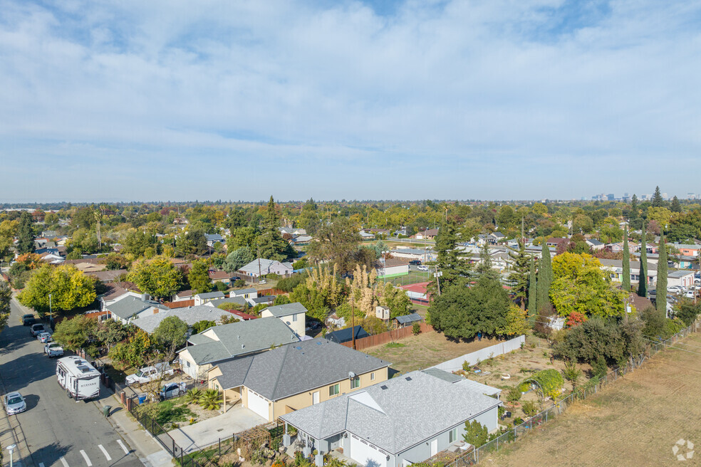
South Sacramento suburb close to growing employment center
About 6 miles south of downtown Sacramento, the midcentury suburb of South City Farms was once home to many employees of the former Cambell Soup Company manufacturing plant, set just south of the neighborhood. Today, this plant has been restyled as the Capital Commerce Center, housing operations for Macy’s, Silgan Containers and other large businesses, with plans to expand by late 2025. Many residents work either for these operations or at longstanding local businesses along the eastside Franklin Boulevard, including Mexican restaurants and automotive service centers. South City Farms commuters can easily access the Sacramento Light Rail system to the west and the Sacramento Freeway to the east. Local families enjoy access to the Maple Neighborhood Center, a nonprofit recreation facility for local kids, and Saint Patrick Academy, a nearby private Catholic school.
Many South City Farms residents work at longstanding local businesses along Franklin Blvd.
South City Farms is About 6 miles south of downtown Sacramento,
1/2
Midcentury homes and multifamily investment opportunities
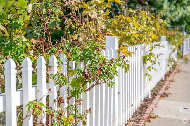
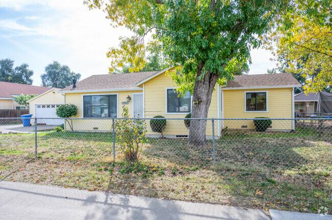
South City Farms' residential streets are lined with sidewalks, and uniform front yards are guarded with wire or wrought-iron fences. Cottages and ranch-style homes from the 1940s and ‘50s are common; these two- to four-bedroom homes often have minimalist exteriors, small, covered front porches, and yards semi-shaded by mature pine or cypress trees. Many of these older properties are in need of repairs, and depending on a home's condition, prices range from $250,000 to $450,000. There are also a few recently built new traditional homes dotted between older properties with stucco or vinyl exteriors and, in some cases, attached one-car garages. These two- to three-bedroom properties are few and far between since there aren't many empty parcels available for development, typically ranging from $300,000 to $500,000.
Sometimes, several single-family homes are bundled together and sold to investors to be used as rental properties. Multifamily properties, including bundled single-family homes and apartment buildings, range from $800,000 to $1.1 million, depending on how many rentable units there are.
Park in your driveway in South City Farms.
Newer homes can also be found in South City Farms.
1/2
Commuting on the Sacramento Freeway or Sacramento light rail
The Sacramento Freeway is just east, and leads 6 miles north to downtown Sacramento. The Sacramento light rail system’s Blue Line borders the neighborhood to the west, and passing light rail cars and industrial trains can be heard throughout the day. The Blue Line travels north to downtown Sacramento, and the closest station is just north on Fruitridge Road. UC Davis Medical Center is about 4 miles away. The Sacramento Executive Airport is about 2 miles west, mainly used for small private flights, while Sacramento International Airport is about 19 miles away.
Sacramento school programs with an international focus
Rosa Parks K-8 School serves elementary and middle school students and scores an overall C rating from Niche. School staff works hard to support its diverse population, organizing Cultural Heritage Fairs that local families can also get involved in. Saint Patrick Academy, adjacent to the neighborhood, is a local private school option attached to Saint Rose Catholic Church, serving grades K-8. The B-plus-rated C. K. McClatchy High School hosts specialized magnet programs, including a Humanities and International Studies Program that allows students to explore global cultures through the lens of various disciplines like art, religion and history.
C. K. McClatchy High serves grades 9-12 and is located in Sacramento.
Ethel Phillips Elementary School is located in the North City Farms neighborhood.
1/2
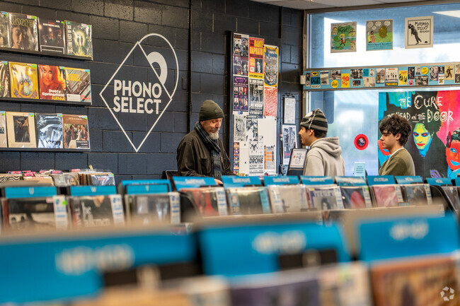
Longstanding local businesses along Franklin Boulevard
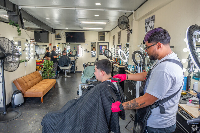
On the neighborhood's east side, Franklin Boulevard is lined with longstanding independent businesses. In addition to a florist, there are several beauty salons and automotive service centers. The many Mexican restaurants here include Caballo Blanco, which opened in 1961 and serves popular dishes like Chile Colorado; the owners of this family-owned restaurant frequently participate in community engagements like food literacy programs, which teach essential nutrition and cooking skills. Down the street is Roma’s Pizzeria, which has served pasta and other Italian staples since 1973. “They’ve been around for as long as I can remember,” says Mike Bokan, the Executive Director of the Franklin Boulevard Business District. “Everybody from this area goes there.” Nearby grocery stores include Safeway and Foods Co., each about 2 miles away.
Cabello Blanco is a long standing Mexican Food Joint in South City Farms.
You can get some ice cream at Plaza Zacatecas in South City Farms.
1/2
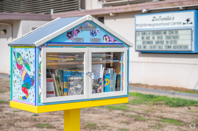
Local family-oriented nonprofits like the Maple Neighborhood Center
Though there aren’t many nearby green spaces, the southside Maple Neighborhood Center offers a gathering space for local kids and families. Youth programming includes leadership classes and pop-up events, and the Sacramento Adventure Playground is a crafty, DIY play area open to local kids after school. Outside the center are two futsal courts, where locals can play a hardcourt version of soccer, and across the street is a larger, grassy soccer field. Next to the neighborhood center, 916 Ink is a local nonprofit that organizes creative writing camps and classes for local kids. During the hot Sacramento summers, locals can cool off at Mangan Park's community pool, set about a mile west, on the other side of the train tracks.
You can come to play at the Maple Park Courts in South City Farms.
Maple Neighborhood Center features a playground in the neighborhood of
South City Farms
1/2
Connecting with diverse local communities at the South Sac Festival
Each August, the annual South Sac Festival gives locals the opportunity to connect with surrounding communities. Held about 5 miles away at Valley Hi Park, the event includes booths from local businesses and nonprofits and live performances from cultural organizations like the Kohai Halau O Kaponookalani Ohana Dance Group.
Plans to expand job opportunities at the Capital Commerce Center
Many South City Farms residents live within walking distance of the Capital Commerce Center, just south. Major employers with operations here include Macy’s, Bloomingdale’s and Silgan Containers. Plans to expand the center were announced in 2021 and are expected to be completed in 2025, bringing more than 1.4 million square feet of new space and a big boost to the local job market. “It has consignment warehouses and will build out to include offices and other businesses in the near future,” Bokan says. The train tracks that border the community to the west are often used for shipments coming out of the Capital Commerce Center.
Many South City Farms residents live within walking distance of the Capital Commerce Center.
The expansion of Capitol Commerce center is expected to be completed in 2025.
GreatSchools:
The GreatSchools Rating helps parents compare schools within a state based on a variety of school quality indicators and provides a helpful picture of how effectively each school serves all of its students. Ratings are on a scale of 1 (below average) to 10 (above average) and can include test scores, college readiness, academic progress, advanced courses, equity, discipline and attendance data. We also advise parents to visit schools, consider other information on school performance and programs, and consider family needs as part of the school selection process.
View GreatSchools Rating Methodology
Interested in learning more about homes in this area?
Reach out to
Ruth Carter,
an experienced agent in this neighborhood.
Parks in this Area
Jack Davis Park
Basketball
Picnic Area
Playground
Lawrence Park
Basketball
Picnic Area
Playground
Rainbow Mini Park
Nicholas Park
Maple Neighborhood Center
Playground
Events
Parking Lot
Woodbine Park
Picnic Area
Playground
Multi-Purpose Field
Mangan Park
Airport Park
Transit
Airport
Sacramento International
26 min drive
Bus
Fruitridge Rd & 28th St (Wb)
Bus
Fruitridge Rd & 28th St (Eb)
Crime and Safety
1 - Low Crime, 10 - High Crime
South City Farms
US
Homicide
4
4
Sexual Assault
5
4
Assault with Weapon
6
4
Robbery
5
4
Burglary
6
4
Motor Vehicle Theft
8
4
Larceny
4
4
Crime Score
5
4
Source: WhatIsMyCrimeRisk.com
Demographics and Home Trends
On average, homes in South City Farms, Sacramento sell after 25 days on the market compared to the national average of 47 days. The average sale price for homes in South City Farms, Sacramento over the last 12 months is $357,454, up 7% from the average home sale price over the previous 12 months.
Newly updated duplex in the fromd and a recently updated unit in the back. Front is a 2/2 with new flooring countertope and bathroom. Rear is a recently updated 2/1. Both units have small yards and parking. Great house hack opportunity to live in one and rent the other.
Welcome to 3262 38th Ave! A beautifully renovated home bursting with modern charm & comfort! Step inside to discover fresh paint, new flooring, new appliances, stylish kitchen cabinets & quartz countertops, upgraded lighting, a sleek bathroom remodel, & a brand-new roof. The front landscaping creates inviting curb appeal, while the new water heater & central HVAC ensure year-round comfort.
Interested in learning more about homes in this area?
Reach out to
Ruth Carter,
an experienced agent in this neighborhood.
Average Home Value
Source: Public Records
Property Mix - Square Feet
This Neighborhood Has More Renters
Demographics
Total Population
1,841
Median Age
34
Population Density
13 ppl/acre
Population under 18
28.6%
On par with the national average
23.8%
Population over 65
11.7%
Below the national average
19.1%
Finances
Median Household Income
$59,999
Below the national average
$71,702
Average Household Income
$65,767
Education and Workforce
High School Graduates
65.5%
Below the national average
89.1%
College Graduates
9.7%
Below the national average
34.1%
Advanced Degrees
0.2%
% Population in Labor Force
57.7%
Weather
Annual Precipitation
18''
Average Winter Low Temperature
39°F
Average Summer High Temperature
92°F
Annual Snowfall
0''
Area Factors
Bikeable
Bike Score®
59/ 100
Somewhat Walkable
Walk Score®
60/ 100
Some Transit
Transit Score®
43/ 100
Source: Walk Score
Source: Walk Score
Sound Score® measures the noise level of any address. Transit Score® measures access to public transit. Bike Score® measures the bikeability of any address.
Disclaimer: Certain information contained herein is derived from information provided by parties other than Homes.com. Our sources include: Accuweather, Public Records and Neustar. All information provided is deemed reliable, but is not guaranteed to be accurate and should be independently verified.