$280,333Average Value$146Average Price per Sq Ft9Homes For Sale
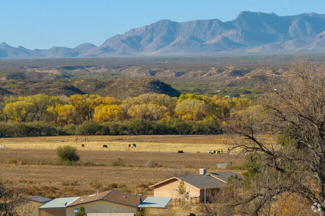
Artesian wells and farming near Benson, Arizona
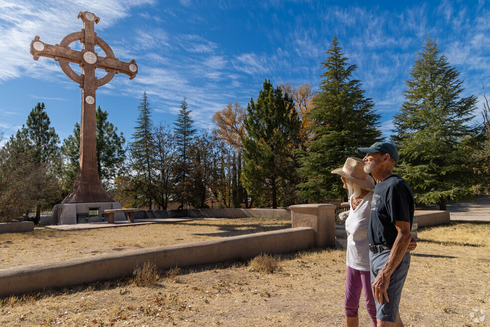
Unlike most communities in the Sonoran and Chihuahuan deserts, Saint David gets its water from artesian wells. These wells rely on hydraulic pressure rather than a pump. Once a well is drilled, water from an underground aquifer shoots up to the surface. This constant flow nearly eliminates maintenance and electricity costs, and also adds a distinct color to the neighborhood — literally. “Because of all the water, you have a lot of greenery and mature trees. It looks so different from Whetstone and other parts of the desert,” says Michelle Hagele, who lives in neighboring Sierra Vista and has sold property with Long Realty since 2016. Saint David’s soil is fertile as a result, and it’s a popular area for agriculture. Multiacre parcels make up most of the neighborhood, and state Route 80 is the main route in and out. The nearest town is Benson, about 7 miles up the road.
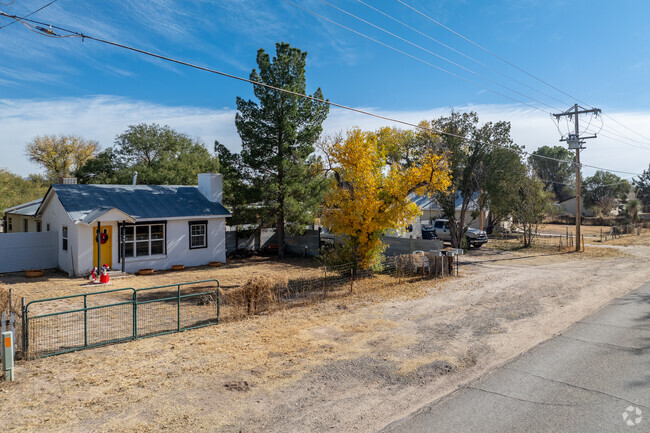
Farmland near the San Pedro River, manufactured and ranch-style homes
People often move to Saint David for the land. “It’s a big farming and ranching community, so you can have anything from one acre to thousands of acres,” says Rick Frank, a designated broker with United Country Real Estate. He’s brokered properties in this area since 2012. “We sell some 40-acre or 100-acre lots, but whatever the size, you probably get more land than you would on the East Coast.” Most people hold onto higher acreage properties, though; a majority of land sold in 2023 and 2024 was around an acre, ranging from $15,000 to $110,000. Manufactured and site-built homes are often closer to state Route 80, and they’re usually built between the 1950s and 1970s. However, some homes were built in the 2000s and 2010s, and they have more updates. Fixer-upper manufactured homes range from $30,000 to $175,000. Move-in-ready, ranch-style homes start at $220,000 but can reach $510,000 with double the square footage. The neighborhood’s CAP Index Crime Score is 1 out of 10, much lower than the national average of 4.
San Pedro River, Dragoon and Whetstone mountains
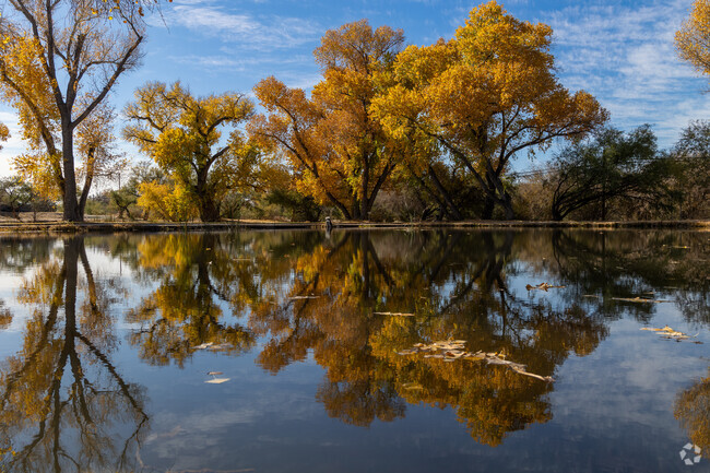
The San Pedro River flows along the neighborhood’s west side. While it’s usually too shallow for kayaking or other sports, this waterway is home to many plant species, and mesquite trees line its banks. These trees shed their leaves in December and remain barren until April; the rest of the year, they light up the area with green. The San Pedro Riparian National Conservation Area is just south of the neighborhood too, and it protects around 40 miles of this habitat. Its San Pedro Trail follows the water for roughly the same distance.
The surrounding mountains have more open space, and they’re a short drive from Saint David. The Dragoon Range is about 20 miles east, and the Whetstone Range is about the same distance west. Hiking and mountain biking trails spread across these peaks, and some of them scale thousands of feet in elevation. At the base of the Whetstone Range, however, Kartchner Caverns State Park is less strenuous. Its trail network is on flatter ground, and park guides offer tours of its limestone cavern. The highlight of the tour is often the Throne Room, a vaulted hall with huge formations. The Kubla Khan column stands at 58 feet and is the tallest of its kind in Arizona, and one of the hall’s stalactites measures over 21 feet, making it one of the longest in the world.
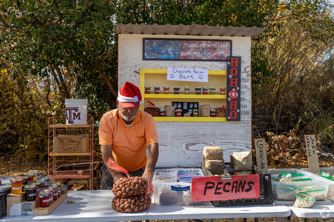
Walkable restaurants and shops in Benson
Saint David doesn’t have any commercial spaces, but Benson is about 7 miles north. Centered around a railroad line from the 1880s, this historic town has walkable restaurants and shops, and its businesses often feature murals of the Old West. The Horseshoe is one of these businesses, its side painted with horses and cowboys. This café has specialized in American fare since 1936, and its neon sign is an unofficial landmark for the town. The property went under new ownership in 2023; ingredients continue to be locally sourced, but now portions are bigger for breakfast, lunch and dinner. Mi Casa Restaurant is just west for a casual meal. As the name suggests, this small blue house has been converted into a kitchen, serving modern takes on Mexican classics. Potted plants surround its outdoor seating area and add to the relaxed atmosphere. Zearing’s Mercantile is nearby with curios and gifts, and Country Girls Antiques is next door with home décor. Safeway, Ace Hardware and Walmart Supercenter are in this area for groceries and other household needs.
Schools next door: St. David Unified School District
St. David Elementary is on the neighborhood’s northern side and gets a B from Niche. With nearly 300 students, it serves kindergarten through eighth grade. St. David High is in the building next door and serves about 120 students. Niche gives it a B-plus. Between the two schools, computer labs have over 400 devices for student use; special education programs cater to individual student needs, collaborating with parents to develop programming.
Tradition at the San Pedro Valley Fair
The San Pedro Valley Fair has been held at St. David High School since 1934. Started by the Future Farmers of America, the fair used to include greased pig catching, cow milking and other agricultural competitions. Now it centers on homemade food and exhibits, and vendors sell everything from quilts to corn. While the fair continues to be popular with Saint David residents, people from Benson and other neighboring communities attend too.
State Route 80 and neighboring towns
Saint David is a rural community miles from the nearest town, and major roads are paved. As a result, most people have a car here, and state Route 80 is the main thoroughfare through the neighborhood. Starting the drive from Saint David’s elementary and high schools, Benson is roughly 7 miles north, and Tombstone is about 17 miles south. Bisbee is about 25 miles farther south. Regional airports cater to military and private travel, so the closest commercial flights are at Tucson International Airport, about 50 miles northwest.
GreatSchools:
The GreatSchools Rating helps parents compare schools within a state based on a variety of school quality indicators and provides a helpful picture of how effectively each school serves all of its students. Ratings are on a scale of 1 (below average) to 10 (above average) and can include test scores, college readiness, academic progress, advanced courses, equity, discipline and attendance data. We also advise parents to visit schools, consider other information on school performance and programs, and consider family needs as part of the school selection process.
View GreatSchools Rating Methodology
Interested in learning more about homes in this area?
Reach out to
Stephanie Leidenheimer,
an experienced agent in this neighborhood.
Crime and Safety
1 - Low Crime, 10 - High Crime
Saint David
US
Homicide
3
4
Sexual Assault
1
4
Assault with Weapon
2
4
Robbery
2
4
Burglary
1
4
Motor Vehicle Theft
1
4
Larceny
1
4
Crime Score
1
4
Source: WhatIsMyCrimeRisk.com
Demographics and Home Trends
On average, homes in Saint David, AZ sell after 80 days on the market compared to the national average of 47 days. The average sale price for homes in Saint David, AZ over the last 12 months is $228,925, up 14% from the average home sale price over the previous 12 months.
This stunning 3bed, 3bath home offers 1969sqft of thoughtfully updated living space on over half an acre. Completely remodeled in 2020, the home features new flooring, updated kitchen and bathrooms, all new plumbing and electrical, a new HVAC system, and a new metal roof - providing peace of mind and modern comfort throughout. Enjoy the spacious open floor plan with granite countertops and
Wonderful home located in the heart of St David sitting on almost a full acre lot. This 4 bedroom, and 2.5 half bath home has lots of inside storage with a large laundry room and pantry storage. Kitchen has staggered upper cabinets and an island with a granite countertop. Vaulted ceilings, ceramic tile in throughout all traffic areas, Fenced rear yard that's great for outdoor living with a
Nice 3-bedroom, 2 Bathroom home. Fenced yard, front and back porches with shop and carport. Owner is licensed to sell real estate in the state of Arizona. Owner/Agent
Interested in learning more about homes in this area?
Reach out to
Stephanie Leidenheimer,
an experienced agent in this neighborhood.
Average Home Value
Source: Public Records
Property Mix - Square Feet
This Neighborhood Has More Owners
Demographics
Total Population
1,403
Median Age
48
Population under 18
22.8%
On par with the national average
23.8%
Population over 65
29.9%
Above the national average
19.1%
Finances
Median Household Income
$45,989
Significantly below the national average
$71,702
Average Household Income
$59,335
Education and Workforce
High School Graduates
96.2%
College Graduates
22.4%
Below the national average
34.1%
Advanced Degrees
9.9%
% Population in Labor Force
48.2%
Below the national average
65.1%
Weather
Annual Precipitation
13''
Average Winter Low Temperature
37°F
Average Summer High Temperature
95°F
Annual Snowfall
3''
Area Factors
Somewhat Bikeable
Bike Score®
27/ 100
Car-Dependent
Walk Score®
4/ 100
Source: Walk Score
Source: Walk Score
Sound Score® measures the noise level of any address. Transit Score® measures access to public transit. Bike Score® measures the bikeability of any address.
Disclaimer: Certain information contained herein is derived from information provided by parties other than Homes.com. Our sources include: Accuweather, Public Records and Neustar. All information provided is deemed reliable, but is not guaranteed to be accurate and should be independently verified.