$1,404,795Average Value$1,075Average Price per Sq Ft1Home For Sale
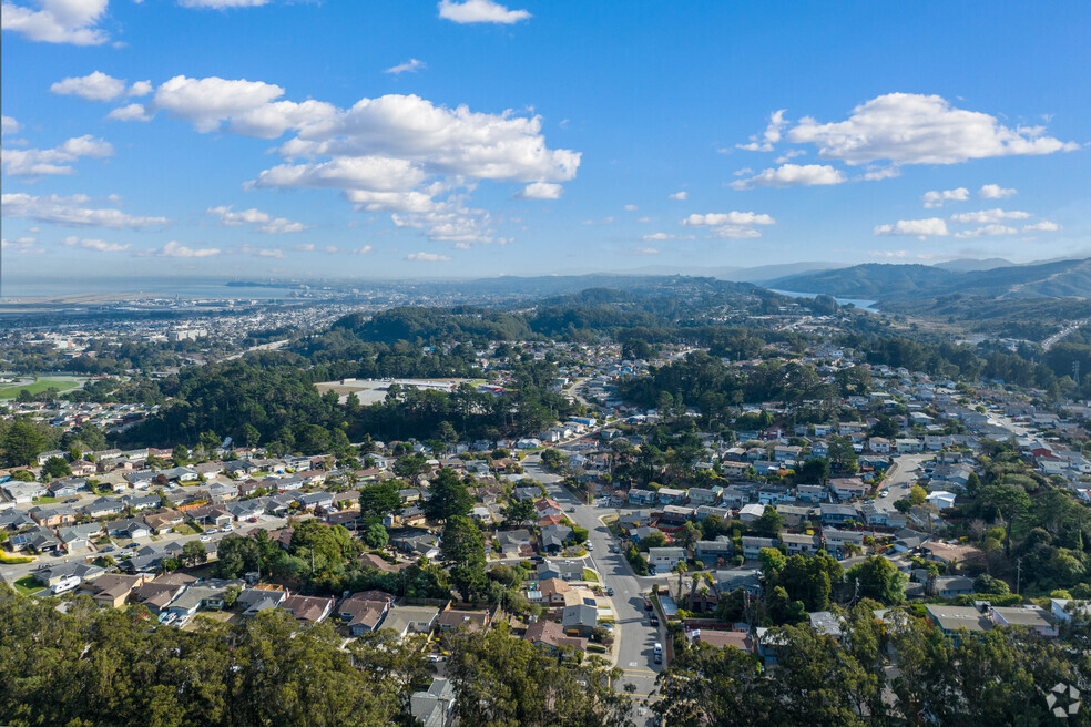
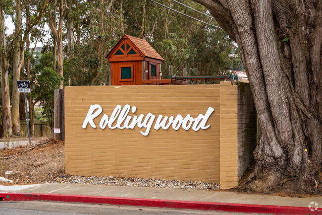
An evolving community overlooking downtown San Bruno
At the base of the Santa Cruz Mountain foothills, Rollingwood is a sought-after residential community with views of San Bruno Mountain and easy freeway access. The tranquil, sometimes foggy, neighborhood has had several names through the decades. Initially called Golden Gate Estates and then Rosswood, Rollingwood continues expanding its identity today. “The area is growing because Google and YouTube are in the Bayhill Business Park, and more corporations are coming to us. There are new developments along El Camino Real, and home prices have already started to rise,” says Jim Cary, a Broker with Reliance Realty Group with over 30 years of experience. “San Bruno might be the next Silicon Valley, and technology employees are gravitating here.” Slightly more affordable than nearby cities like Burlingame, the neighborhood is also close to beaches and the Pacific Ocean.
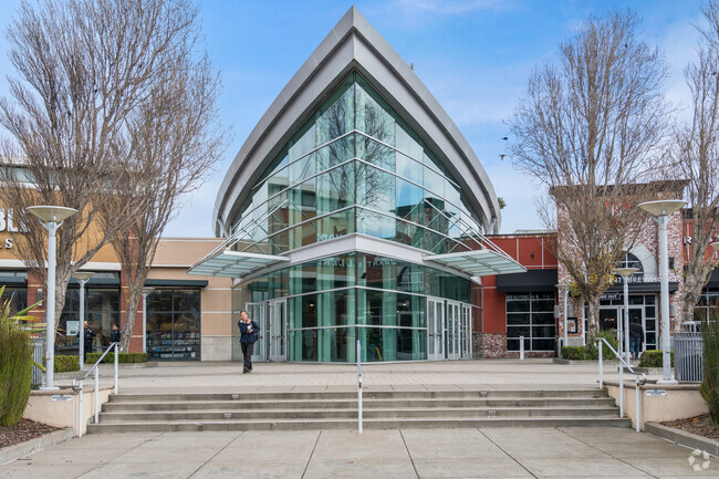
Shopping centers and casual eateries
The neighborhood is 2 miles from San Bruno Towne Center and the Shops at Tanforan. The Towne Center has large chain restaurants like Red Robin and Red Lobster and retailers like Marshalls. The Shops at Tanforan has a Target, Target Grocery and JCPenny alongside a dozen eateries. Sarku Japan cooks its famous Teriyaki meals to order. Pate a Choux makes a variety of cream puffs and fresh fruit teas. In the neighborhood is Shari’s Cafe and Pies, which specializes in comfort classics like breakfast skillets and patty melts.
Westborough Square is a poplar shopping center in Rollingwood, CA.
Local Kitchen near Rollingwood serves up a side of lively atmosphere with its dishes.
1/2
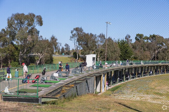
Small parks and driving ranges
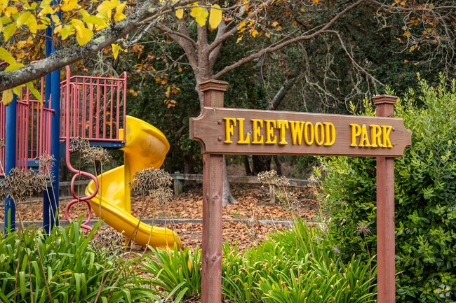
Fleetwood Park sits along Skyline Boulevard in the southwest corner of Rollingwood. The half-acre space has a playground with slides and swings and a basketball court. Just north of the neighborhood, Monte Verde Park occupies 5 acres with a soccer field and an ample grassy space for picnics and dog walking. Earl-Glenview Park is south of Rollingwood and features a basketball court and a playground with a jungle gym. San Bruno Golf Center allows customers to work on their long game in a practice stall or their short game on the 2-acre chipping and putting green.
Earl-Glenview Park occupies a corner spot not far from Rollingwood.
Practice your swing at the San Bruno Golf Center driving range near Rollingwood.
1/2
Midcentury housing and rolling hills
Rollingwood’s houses were primarily built in the 1950s and ‘60s, although the newest homes were constructed in the early 2000s. Most have three bedrooms and have between 1,040 to 2,550 square feet of living space. The community is mainly raised ranch-style houses with a scattering of other midcentury designs. These well-maintained single-family homes rest on lots of less than one-half-acre alongside steep and curving tree-lined streets. The hilly terrain provides views of San Bruno’s ‘flat land’ neighborhoods and downtown. People tend to stay for generations, and nearly 75% of homes here are owner-occupied. Homes sell for a median price of $1.5 million after around 14 days. Prices range from $1 million to $1.7 million.
Rollingwood is known for hillside homes.
Rollingwood homes exhibit lots of character.
1/2
Hands-on learning, international courses and associate degrees
Students can attend Portola Elementary School, which earned a B-plus from Niche and Parkside Intermediate School with a B-minus ranking. A-minus Capuchino High School has a number of pathways for careers and college preparation. Career Technical Education courses focus on areas like network engineering and video communication. The International Baccalaureate Programme offers students challenging courses that can lead to an internationally recognized diploma. Skyline College awards professional certificates and associate degrees across dozens of specialized subjects.
Portola Elementary School is where Rollingwood locals prefer to send their kids.
Capuchino High School is a highly rated public school for Rollingwood students.
1/2
Major roadways, train stations and the San Francisco International Airport
Sidewalks connect the subdivisions, although streets are typically steep, and a handful of SamTrans bus stops dot Rollingwood Drive. The San Bruno BART station is two miles east, making traveling 15 miles to San Francisco or 44 miles to San Jose more straightforward. Interstate 280 borders the community’s eastern side, while Sneath Lane and Skyline Boulevard form the southern and western boundaries. Rollingwood is 3.5 miles from Kaiser Permanente South San Francisco Medical Center and 5 miles from the San Francisco International Airport. Those living along the freeway or in the airport’s flyway will hear noise during heavy travel times.
Varying air quality
Rollingwood experiences unhealthy air for around 15 days each year. During these times, people are advised to wear masks outdoors and use air purifiers inside their homes.
GreatSchools:
The GreatSchools Rating helps parents compare schools within a state based on a variety of school quality indicators and provides a helpful picture of how effectively each school serves all of its students. Ratings are on a scale of 1 (below average) to 10 (above average) and can include test scores, college readiness, academic progress, advanced courses, equity, discipline and attendance data. We also advise parents to visit schools, consider other information on school performance and programs, and consider family needs as part of the school selection process.
View GreatSchools Rating Methodology
Interested in learning more about homes in this area?
Reach out to
Ali Gilmartin Davis,
an experienced agent in this neighborhood.
Parks in this Area
Fleetwood Park
Brentwood Park
Baseball/Softball
Basketball
Tennis
Monte Verde Park
Pacific Heights Park
Baseball/Softball
Trails
Playground
Avalon Park
Baseball/Softball
Picnic Area
Trails
Earl Glenview Park
Transit
Airport
San Francisco International
11 min drive
Bus
Rollingwood Dr & Sequoia Ave
Bus
Rollingwood Dr & Sneath Ln
Bus
Sneath Ln & Claremont Dr
Bus
2233 Rollingwood Dr
Bus
Rollingwood Dr & Cottonwood Dr
Bus
2260 Rollingwood Dr
Bus
Sequoia Ave & Fleetwood Dr
Crime and Safety
1 - Low Crime, 10 - High Crime
Rollingwood
US
Homicide
1
4
Sexual Assault
2
4
Assault with Weapon
2
4
Robbery
3
4
Burglary
3
4
Motor Vehicle Theft
4
4
Larceny
2
4
Crime Score
3
4
Source: WhatIsMyCrimeRisk.com
Demographics and Home Trends
On average, homes in Rollingwood, San Bruno sell after 14 days on the market compared to the national average of 47 days. The average sale price for homes in Rollingwood, San Bruno over the last 12 months is $1,455,351, up 7% from the average home sale price over the previous 12 months.
Nestled in a highly sought-after neighborhood of San Bruno, this inviting single-family home offers a perfect blend of comfort, style & convenience. The main level features 3 bedrooms & 2 bathrooms, creating an ideal living space for families of all sizes. The bright & airy living room welcomes you with natural light, while the kitchen & dining area provide a great space for entertaining. The
Interested in learning more about homes in this area?
Reach out to
Ali Gilmartin Davis,
an experienced agent in this neighborhood.
Average Home Value
Source: Public Records
Property Mix - Square Feet
This Neighborhood Has More Owners
Demographics
Total Population
3,547
Median Age
46
Population Density
12 ppl/acre
Population under 18
19.4%
On par with the national average
23.8%
Population over 65
23.5%
On par with the national average
19.1%
Finances
Median Household Income
$104,521
Significantly above the national average
$71,702
Average Household Income
$134,433
Education and Workforce
High School Graduates
95%
Above the national average
89.1%
College Graduates
42.9%
Above the national average
34.1%
Advanced Degrees
14.1%
% Population in Labor Force
65.1%
Weather
Annual Precipitation
20''
Average Winter Low Temperature
44°F
Average Summer High Temperature
73°F
Annual Snowfall
0''
Area Factors
Somewhat Bikeable
Bike Score®
22/ 100
Car-Dependent
Walk Score®
13/ 100
Source: Walk Score
Source: Walk Score
Sound Score® measures the noise level of any address. Transit Score® measures access to public transit. Bike Score® measures the bikeability of any address.
Disclaimer: Certain information contained herein is derived from information provided by parties other than Homes.com. Our sources include: Accuweather, Public Records and Neustar. All information provided is deemed reliable, but is not guaranteed to be accurate and should be independently verified.