$381,072Average Value$199Average Price per Sq Ft1Home For Sale
Industrial history in the heart of the Lehigh Valley
Stockertown began as “Stockersville” when it was founded as a fertile farm community in 1845. Over the next few decades, the area grew as surrounding Northampton County transformed into the “Slate Belt” and became the largest producer of slate in the country. Today, Stockertown remains small, with less than 1,000 residents. The local economy is still held up by industry, including the production of cement, polymer and industrial gas. The residents who have continued to make their home in this small town have plenty to enjoy, from a variety of home styles and top-notch schools to local parks and trails and easy access to nearby shopping. “It’s easy for Stockertown to get lost because much larger towns surround it, but it really is such a great place with a lot to offer,” says Margaret Kelce, a volunteer at the Memorial Library of Nazareth who has lived in the Lehigh Valley for over a decade.
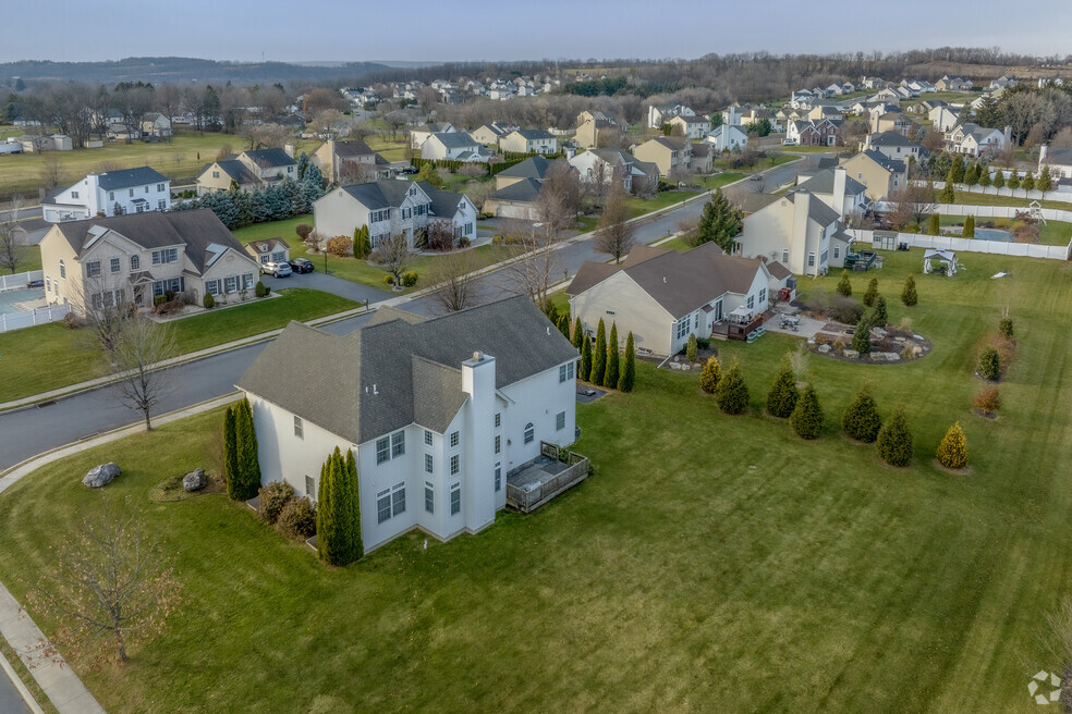
Farm homes, Colonials and bungalows side by side
Stockertown neighborhoods can be eclectic, with multiple architectural styles in one area. Local streets might feature Cape Cod-style homes, Colonial Revival properties and bungalows built alongside each other. Rural areas of the borough often have big, open yards with large maple and oak trees serving as natural barriers between houses. In more populated neighborhoods, there are smaller yards and neat sidewalks. Street parking is also common since many homes do not have driveways. Stockertown properties typically cost between $200,000 to $300,000 regardless of location and style.
Farm homes dot Stockertown's back roads
It is not uncommon to see a variety of homes side by side in Stockertown
Even new, grand construction in Stockertown has classic design elements
1/3
Stockertown enjoys its outdoor activities, from hiking to hunting
Hiking paths along the historic “Slate Belt”
The borough has two small parks that are across the street from each other. Sherman Metzgar Park on Lincoln Avenue has fields for baseball, soccer and volleyball, as well as a playground and a basketball court. Newhart Par on Main Street is popular for community gatherings since it has a shelter pavilion, picnic tables and charcoal grills. Visitors can also use the playground or volleyball and badminton courts. Just north of Stockertown is one end of the Plainfield Township Trail, which stretches for nearly 7 miles up to the foot of Blue Mountain in the borough of Pen Argyl. This trail takes hikers along Little Bushkill Creek and through the remains of the region’s “Slate Belt.” “You can actually see piles of slate along the trail from over 100 years ago. It’s such a unique thing,” Kelce says.
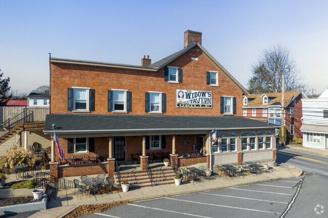
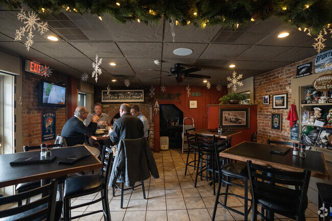
Gatherings at Goat Pub or Widow's Tavern
Stockertown may be small, but it is not lacking in dining options. The Goat Pub & Pie on Main Street is best known for its “Detroit-Style Pizza” – a regional dish that is recognizable for its square shape. Widow’s Tavern and Grill has a rotating seasonal menu and offers weekly special meals, like a weekday three-course dinner and slow-roasted prime rib every Friday and Saturday.
For weekly groceries and everyday needs, Park Plaza at 1800 Sullivan Trail in neighboring Forks Township has a Giant, as well as home improvement stores, a bank and a gym. For another grocery option, there is a Weis Market on Sullivan Trail in Easton, just a mile from the center of Stockertown.
Friendly and familiar service awaits at Stockertown's local restaurants,.
Stockertown residents can travel to nearby shopping plazas, like Northhampton Crossing
Stockertown residents hold morning meetings at the neighborhood's many businesses.
1/3
The Nazareth Area School District was named the Best School District in the county by Niche
Nazareth Area Schools in the top spot
Local kids can attend Nazareth Area School District, which Niche names the Best School District in Northampton County. Students may start at schools like Shafer Elementary School, Lower Nazareth Elementary School, Nazareth Area Intermediate School and Nazareth Area Middle School, which all earn an A-minus on Niche. Nazareth Area High School scores an A on Niche. Students passionate about writing can join the Blue and White Standard, a student newspaper that prints school news, opinion columns and photo galleries. Lafayette College is 5 miles away from Stockertown in neighboring Easton for a nearby higher education option.
Despite its small size, the borough of Stockertown is well-connected thanks to many main roads
Route 33 offers easy connection
Pennsylvania Route 33 runs directly through Stockertown, directly connecting to the rest of the Lehigh Valley. Despite its small size, the borough is well-connected. It is only 7 miles from the college town of Easton, 20 miles from Allentown and about 8 miles from the New Jersey border. Stockertown is also served by Lehigh and Northampton Transportation Authority (LANta), which has multiple bus stops along Main Street. The bus system has daily routes to surrounding cities like Easton, Bethlehem and Allentown.
GreatSchools:
The GreatSchools Rating helps parents compare schools within a state based on a variety of school quality indicators and provides a helpful picture of how effectively each school serves all of its students. Ratings are on a scale of 1 (below average) to 10 (above average) and can include test scores, college readiness, academic progress, advanced courses, equity, discipline and attendance data. We also advise parents to visit schools, consider other information on school performance and programs, and consider family needs as part of the school selection process.
View GreatSchools Rating Methodology
Interested in learning more about homes in this area?
Reach out to
Donald Hannig,
an experienced agent in this neighborhood.
Parks in this Area
Nazareth Borough Park
Baseball/Softball
Picnic Area
Pool
Mark A. Metz Memorial Park
High Street Park
Nazareth Dog Park
Dog Park
Mill Race Park
Soccer
Pickleball
Playground
Penn's Grant Path
Trails
Transit
Airport
Lehigh Valley International
22 min drive
Bus
Main & Bushkill
Bus
Sullivan Trail & Forks Church Nb
Bus
Main & Industrial Sb
Bus
Rt 191 & Ariel Sb
Crime and Safety
1 - Low Crime, 10 - High Crime
Stockertown
US
Homicide
1
4
Sexual Assault
1
4
Assault with Weapon
1
4
Robbery
1
4
Burglary
1
4
Motor Vehicle Theft
2
4
Larceny
1
4
Crime Score
1
4
Source: WhatIsMyCrimeRisk.com
Demographics and Home Trends
On average, homes in Stockertown, PA sell after 53 days on the market compared to the national average of 47 days. The average sale price for homes in Stockertown, PA over the last 12 months is $306,800, down 12% from the average home sale price over the previous 12 months.
Take advantage of this exceptional opportunity to own a used car lot in Stockertown. This prime location can hold up to 20 vehicles, providing ample space to display a diverse inventory. The lot benefits from being adjacent to a busy gas station, ensuring high visibility to attract potential buyers. The property features a detached finished office, perfect for conducting business in a
Interested in learning more about homes in this area?
Reach out to
Donald Hannig,
an experienced agent in this neighborhood.
Average Home Value
Source: Public Records
Property Mix - Square Feet
This Neighborhood Has More Owners
Demographics
Total Population
954
Median Age
44
Population Density
2 ppl/acre
Population under 18
19.8%
On par with the national average
23.8%
Population over 65
20.4%
On par with the national average
19.1%
Finances
Median Household Income
$102,035
Significantly above the national average
$71,702
Average Household Income
$102,301
Education and Workforce
High School Graduates
95.8%
College Graduates
24.4%
Below the national average
34.1%
Advanced Degrees
9.5%
% Population in Labor Force
72.5%
Above the national average
65.1%
Weather
Annual Precipitation
51''
Average Winter Low Temperature
17°F
Average Summer High Temperature
84°F
Annual Snowfall
21''
Area Factors
Somewhat Bikeable
Bike Score®
41/ 100
Car-Dependent
Walk Score®
33/ 100
Source: Walk Score
Source: Walk Score
Sound Score® measures the noise level of any address. Transit Score® measures access to public transit. Bike Score® measures the bikeability of any address.
Disclaimer: Certain information contained herein is derived from information provided by parties other than Homes.com. Our sources include: Accuweather, Public Records and Neustar. All information provided is deemed reliable, but is not guaranteed to be accurate and should be independently verified.