$653,592Average Value$380Average Price per Sq Ft2Homes For Sale
"Not much goes on in Arrowsic.”
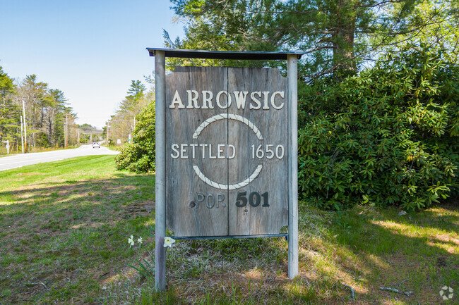
Thickly forested and sparsely populated, the inlet of Arrowsic is a quiet rural town in Maine’s Midcoast region. Sandwiched between the shipbuilding town of Bath and the tourist community of Georgetown, Arrowsic is a town of small lighthouses where people move when they want a country way of life near the water. “It’s a gateway to Georgetown,” says Julie A. Cromwell, owner of Cromwell Coastal Properties in nearby Woolwich. “It’s just a rural town – not much goes on in Arrowsic.”
The bench on the trail to Squirrel Point Lighthouse in Arrowsic, Maine offers trail goers a welcome resting spot with nice views.
Photo of the Arrowsic Town Office along route 127 in Arrowsic, Maine.
1/2
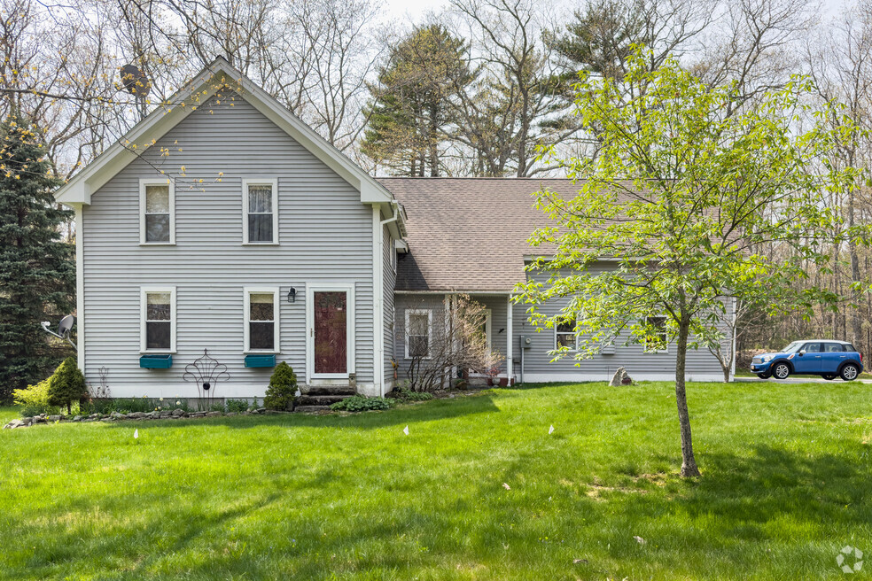
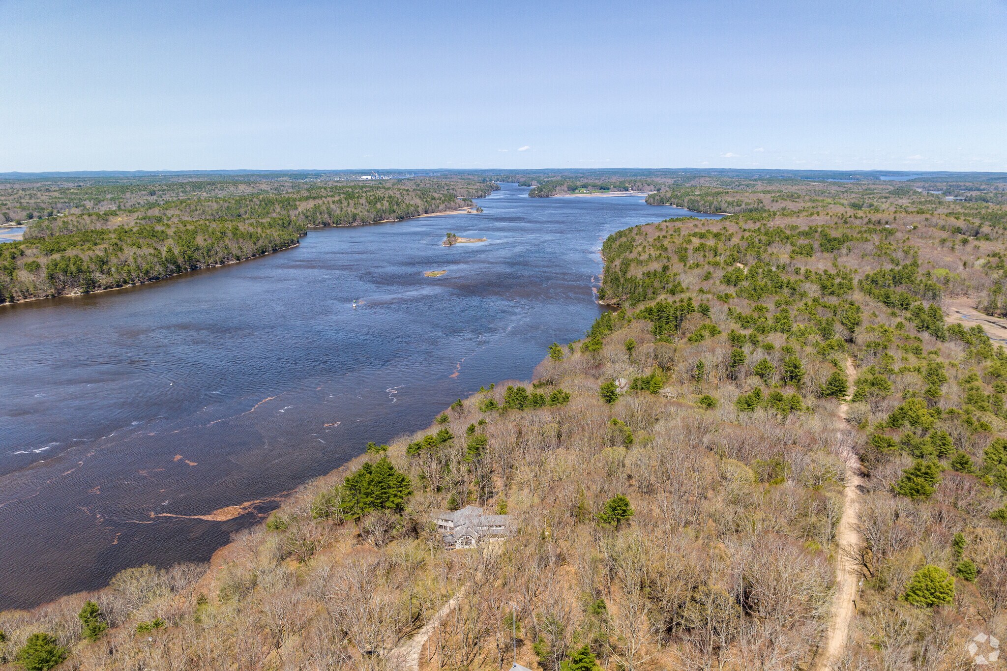
Aerial view of a home along the Kennebec River in Arrowsic, Maine.
Tons of acreage
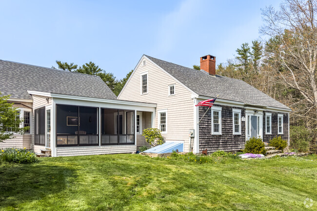
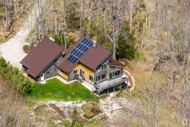
Arrowsic’s roughly 500 residents live in homes spread out from each other on multiple acres of land. Houses like Cape Cods and post and beam structures came online in the 20th century. Some homes have river frontage and deepwater docks and sit in the woods engulfed by trees. Cape Cods from the late 1980s can cost $630,000, early 20th century homes with cathedral ceilings can go for $500,000, log cabins can cost $800,000, Cape-style houses with deepwater frontage can go for $500,000 and open concept post and beam wood houses on 19 acres can cost $830,000. “It’s close to everything, but away from the hubbub, so it’s great if people want something more rural,” says Cromwell.
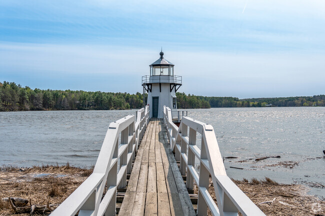
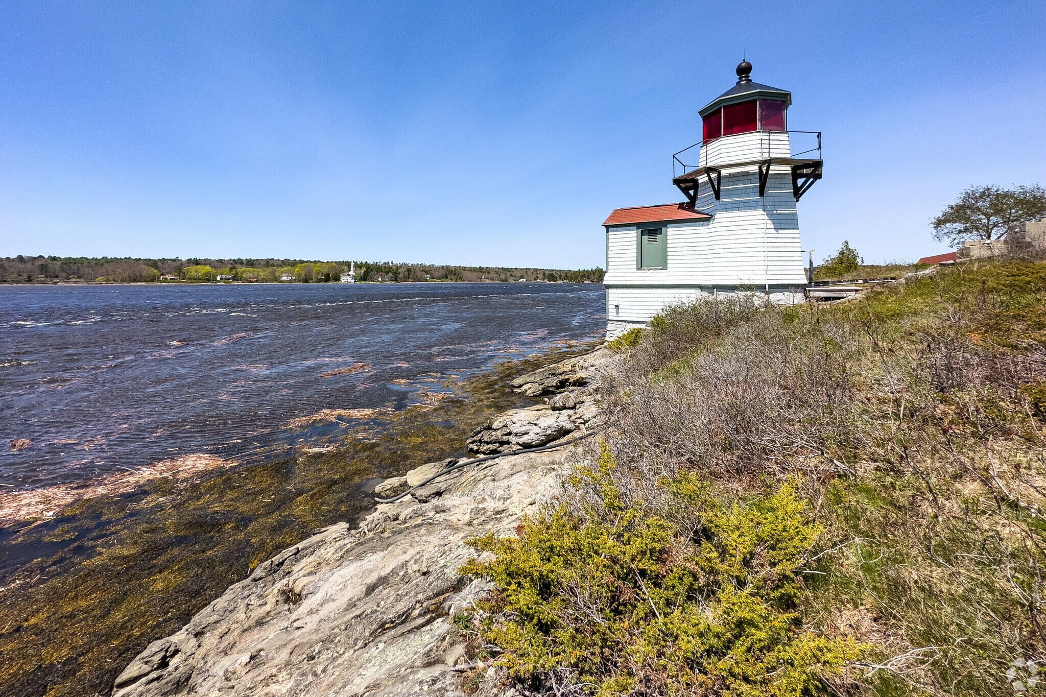
Squirrel Point Lighthouse in Arrowsic, Maine offers beautiful views of the Kennebec River.
19th-century lighthouses
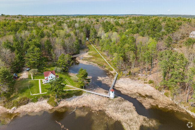
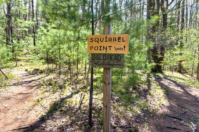
In the 1890s, several lighthouses came online on the south end of Arrowsic because of a need for signals along the Kennebec River. Lighthouses, including the Squirrel Point Lighthouse, can be accessed by walking trails. The 23-ft. Doubling Point Light sits at the end of a boarded catwalk, and the twin Kennebec River Range Lights signal mariners around a turn. Squirrel Point connects to Bald Head Preserve, a bald eagle nesting ground and hiking area where the Kennebec and Back Rivers merge.
Let's go to the beach
Arrowsic is forested and rustic, but people can still get their beach fix. Reid State Park in Georgetown has a sandy beach with some of Maine’s best surfing. Neighbors can see some of the nearby coastal islands from the rocky shoreline and a viewing area called Griffith Head.
Leaving the island
Arrowsic is rural and residential, so the island has no stores or restaurants. Shaw’s supermarket and big-box chains like Family Dollar sit on the other side of the bridge in Bath. Downtown Bath is full of mom-and-pop merchants like jewelry stores, natural markets, Irish pubs and candy stores. Neighbors drive into Bath for sandwiches at Burano’s Wood-Fired Pizza, coffee at Mae’s Café & Bakery and sesame chicken at Yum Mee Chinese Restaurant.
Morse High School serves Bath, Maine.
Regional schools
Children in Arrowsic attend schools through Regional School Unit 1, a public school district serving Arrowsic, Bath, Phippsburg and Woolwich. The school district has a B-minus rating from Niche. Some kids attend Dike-Newell School in Bath (rated B), followed by Bath Middle School (rated B-minus) and Morse High School (rated B-minus), which recently got a new School-Based Health Center to provide expanded health care services.
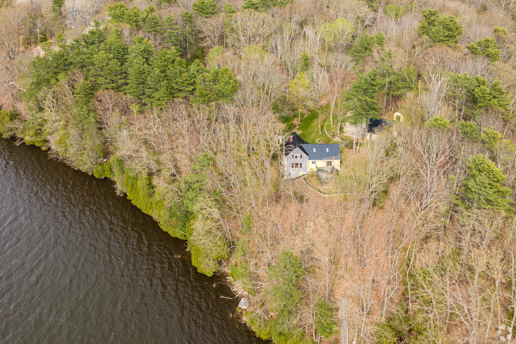
Aerial view of a home on a large lot of land that sits along the Kennebec River in Arrowsic, Maine.
Coastal Maine and beyond
The main road in Arrowsic is Route 127, which takes travelers north to Woolwich and southeast to Georgetown. Route 127 connects with Route 1, which runs west to Bath and south to Portland and beyond. Neighbors can take the Amtrak Downeaster line from Brunswick, a 20-minute drive. The train runs south along the Maine and New Hampshire coastlines, eventually stopping in Boston at North Station.
GreatSchools:
The GreatSchools Rating helps parents compare schools within a state based on a variety of school quality indicators and provides a helpful picture of how effectively each school serves all of its students. Ratings are on a scale of 1 (below average) to 10 (above average) and can include test scores, college readiness, academic progress, advanced courses, equity, discipline and attendance data. We also advise parents to visit schools, consider other information on school performance and programs, and consider family needs as part of the school selection process.
View GreatSchools Rating Methodology
Interested in learning more about homes in this area?
Reach out to
Julie Cromwell,
an experienced agent in this neighborhood.
Parks in this Area
Library Park
Trails
Bates-Morse Mountain Conservation Area
Linwood E. Temple Waterfront Park
Boating
South End Dog Park
Dog Park
Popham Beach State Park
Boating
Fishing
Grills
Josephine Newman Sanctuary
Bike Trails
Lake
Trails
Transit
Airport
Portland International Jetport
61 min drive
Reviews
Niche Reviews
4.52 Reviews
5.0Niche User
5/19/2016Niche Review
The crime and saftey rating are impecciable, the area I live in is mostly elderly, and don't cause much trouble. I have never had issues with vandalism or graffiti. No abandoned bulidinbgs or houses. Yards are upkept and neat, roads are great, kept in good shape.
Are you familiar with the Arrowsic neighborhood?
to let others know what life in this neighborhood is like.
Crime and Safety
1 - Low Crime, 10 - High Crime
Arrowsic
US
Homicide
1
4
Sexual Assault
1
4
Assault with Weapon
1
4
Robbery
1
4
Burglary
1
4
Motor Vehicle Theft
1
4
Larceny
1
4
Crime Score
1
4
Source: WhatIsMyCrimeRisk.com
Demographics and Home Trends
On average, homes in Arrowsic, West Bath sell after 18 days on the market compared to the national average of 47 days. The average sale price for homes in Arrowsic, West Bath over the last 12 months is $789,500, up 2% from the average home sale price over the previous 12 months.
Sophisticated, serene and sensational. This inspired renovation spared no expense to celebrate the exceptional setting along the river's edge. Stunning waterfront kitchen with a wall of windows seamlessly flows into the living area. Designed with the gourmet in mind, the kitchen offers high end appliances, gleaming white granite countertops and acres of workspace. Open design living area wraps
This large, lovely parcel of land is in an excellent location and has so much to offer! A beautiful template to build your home, this parcel has a natural bounty of trees, high bush blueberries, and plenty of wildlife. Located near Sewall Pond and the Holt Research Forest, and between downtown Bath and the beaches of Reid State Park, it is both private and accessible--an ideal Maine habitat to
Nicely sized (9.87 acres) lot of open and wooded improved land. Driveway is in, power is in and a 61' x 71' foundation is in and set back from the road. Lots of possibilities!
Interested in learning more about homes in this area?
Reach out to
Julie Cromwell,
an experienced agent in this neighborhood.
Average Home Value
Source: Public Records
Property Mix - Square Feet
This Neighborhood Has More Owners
Demographics
Total Population
518
Median Age
59
Population Density
1 person/acre
Population under 18
16.8%
Below the national average
23.8%
Population over 65
37.8%
Above the national average
19.1%
Finances
Median Household Income
$92,187
Above the national average
$71,702
Average Household Income
$113,734
Education and Workforce
High School Graduates
96.9%
College Graduates
52.5%
Above the national average
34.1%
Advanced Degrees
29.9%
Above the national average
13.3%
% Population in Labor Force
58.9%
Weather
Annual Precipitation
50''
Average Winter Low Temperature
12°F
Average Summer High Temperature
79°F
Annual Snowfall
47''
Area Factors
Somewhat Bikeable
Bike Score®
25/ 100
Car-Dependent
Walk Score®
0/ 100
Source: Walk Score
Source: Walk Score
Sound Score® measures the noise level of any address. Transit Score® measures access to public transit. Bike Score® measures the bikeability of any address.
Disclaimer: Certain information contained herein is derived from information provided by parties other than Homes.com. Our sources include: Accuweather, Public Records and Neustar. All information provided is deemed reliable, but is not guaranteed to be accurate and should be independently verified.