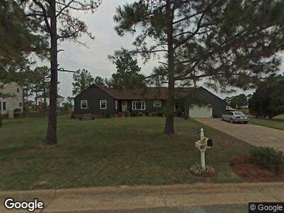
10 Rivercrest Dr Poquoson, VA 23662
Poquoson Shores NeighborhoodEstimated Value: $623,000 - $747,000
3
Beds
2
Baths
2,343
Sq Ft
$290/Sq Ft
Est. Value
About This Home
This home is located at 10 Rivercrest Dr, Poquoson, VA 23662 and is currently estimated at $678,410, approximately $289 per square foot. 10 Rivercrest Dr is a home located in Poquoson City.
Ownership History
Date
Name
Owned For
Owner Type
Purchase Details
Closed on
Aug 1, 2022
Sold by
Davidson Gregory S
Bought by
Grimmett Hall and Grimmett Krista
Current Estimated Value
Home Financials for this Owner
Home Financials are based on the most recent Mortgage that was taken out on this home.
Original Mortgage
$510,000
Outstanding Balance
$494,854
Interest Rate
5.81%
Mortgage Type
New Conventional
Estimated Equity
$215,976
Purchase Details
Closed on
Dec 17, 2013
Sold by
Catlett Charles T
Bought by
Davidson Gregory S
Home Financials for this Owner
Home Financials are based on the most recent Mortgage that was taken out on this home.
Original Mortgage
$494,200
Interest Rate
4.24%
Mortgage Type
VA
Create a Home Valuation Report for This Property
The Home Valuation Report is an in-depth analysis detailing your home's value as well as a comparison with similar homes in the area
Home Values in the Area
Average Home Value in this Area
Purchase History
| Date | Buyer | Sale Price | Title Company |
|---|---|---|---|
| Grimmett Hall | $600,000 | First American Title | |
| Davidson Gregory S | $498,900 | -- |
Source: Public Records
Mortgage History
| Date | Status | Borrower | Loan Amount |
|---|---|---|---|
| Open | Grimmett Hall | $510,000 | |
| Previous Owner | Davidson Gregory S | $494,200 |
Source: Public Records
Tax History Compared to Growth
Tax History
| Year | Tax Paid | Tax Assessment Tax Assessment Total Assessment is a certain percentage of the fair market value that is determined by local assessors to be the total taxable value of land and additions on the property. | Land | Improvement |
|---|---|---|---|---|
| 2024 | $6,587 | $577,800 | $260,000 | $317,800 |
| 2023 | $6,414 | $577,800 | $260,000 | $317,800 |
| 2022 | $5,772 | $510,800 | $265,300 | $245,500 |
| 2021 | $5,772 | $510,800 | $265,300 | $245,500 |
| 2020 | -- | $494,600 | $265,300 | $229,300 |
| 2019 | -- | $494,600 | $265,300 | $229,300 |
| 2018 | -- | $489,300 | $265,300 | $224,000 |
| 2017 | -- | $489,300 | $265,300 | $224,000 |
| 2016 | -- | $489,300 | $265,300 | $224,000 |
| 2015 | -- | $451,100 | $265,300 | $185,800 |
| 2013 | -- | $451,100 | $265,300 | $185,800 |
Source: Public Records
Map
Nearby Homes
- 21 Bayview Dr
- .51+AC Barbara Ln
- 14 Wilson Dr
- 28 Pasture Rd
- 205 Darden Dr
- 201 Darden Dr
- 103 Darden Dr
- 40 Valmoore Dr
- 15+AC Browns Neck Rd
- 3 Saunders Dr
- 127 Freemoor Dr
- 9 Rue Degrasse
- 15 Pickins Dr
- 17 Pickins Dr
- 1811 Calthrop Neck Rd Unit B
- 31 Kelsor Dr
- 105 Rens Rd Unit Lot 36
- 105 Rens Rd Unit 74
- 105 Rens Rd Unit 59
- 105 Rens Rd Unit Lot 48