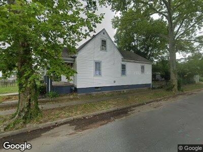
100 E Broad Rock Rd Richmond, VA 23224
Swansboro West NeighborhoodEstimated Value: $266,000 - $278,772
3
Beds
1
Bath
1,545
Sq Ft
$175/Sq Ft
Est. Value
About This Home
This home is located at 100 E Broad Rock Rd, Richmond, VA 23224 and is currently estimated at $270,943, approximately $175 per square foot. 100 E Broad Rock Rd is a home located in Richmond City with nearby schools including Swansboro Elementary School, Richmond High School for the Arts, and Open High School.
Ownership History
Date
Name
Owned For
Owner Type
Purchase Details
Closed on
Nov 18, 2022
Sold by
Balas Adam
Bought by
Logan Multifamily Properties Llc
Current Estimated Value
Home Financials for this Owner
Home Financials are based on the most recent Mortgage that was taken out on this home.
Original Mortgage
$203,500
Outstanding Balance
$198,709
Interest Rate
7.08%
Mortgage Type
New Conventional
Estimated Equity
$76,901
Purchase Details
Closed on
Jun 16, 2022
Sold by
Heirs Of Constance Hill
Bought by
Balas Adam
Create a Home Valuation Report for This Property
The Home Valuation Report is an in-depth analysis detailing your home's value as well as a comparison with similar homes in the area
Home Values in the Area
Average Home Value in this Area
Purchase History
| Date | Buyer | Sale Price | Title Company |
|---|---|---|---|
| Logan Multifamily Properties Llc | $300,000 | -- | |
| Balas Adam | $100,000 | New Title Company Name |
Source: Public Records
Mortgage History
| Date | Status | Borrower | Loan Amount |
|---|---|---|---|
| Open | Logan Multifamily Properties Llc | $203,500 |
Source: Public Records
Tax History Compared to Growth
Tax History
| Year | Tax Paid | Tax Assessment Tax Assessment Total Assessment is a certain percentage of the fair market value that is determined by local assessors to be the total taxable value of land and additions on the property. | Land | Improvement |
|---|---|---|---|---|
| 2025 | $3,528 | $294,000 | $45,000 | $249,000 |
| 2024 | $3,516 | $293,000 | $45,000 | $248,000 |
| 2023 | $2,220 | $185,000 | $45,000 | $140,000 |
| 2022 | $1,860 | $155,000 | $32,000 | $123,000 |
| 2021 | $1,500 | $132,000 | $20,000 | $112,000 |
| 2020 | $2,360 | $125,000 | $15,000 | $110,000 |
| 2019 | $1,356 | $113,000 | $15,000 | $98,000 |
| 2018 | $1,032 | $86,000 | $10,000 | $76,000 |
| 2017 | $984 | $82,000 | $10,000 | $72,000 |
| 2016 | $1,536 | $82,000 | $10,000 | $72,000 |
| 2015 | $1,536 | $82,000 | $10,000 | $72,000 |
| 2014 | $1,536 | $82,000 | $10,000 | $72,000 |
Source: Public Records
Map
Nearby Homes
- 3010 Lawson St
- 205 E 30th St
- 3004 Midlothian Turnpike
- 3055 Midlothian Turnpike
- 3053 Midlothian Turnpike
- 3153 Decatur St
- 2818 Midlothian Turnpike
- 2821 Burfoot St
- 206 E 33rd St
- 3105 1/2 Logandale Ave
- 3107 Logandale Ave
- 3414 Hull St
- 3057 Maury St
- 203 W 30th St
- 3406 Stockton St
- 3610 Stockton St
- 2608 Porter St
- 3713 Moody Ave
- 3303 Decatur St
- 2815 Semmes Ave