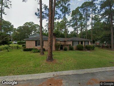
1001 Dean Dr Waycross, GA 31501
Estimated Value: $159,507 - $181,000
4
Beds
3
Baths
2,178
Sq Ft
$78/Sq Ft
Est. Value
About This Home
This home is located at 1001 Dean Dr, Waycross, GA 31501 and is currently estimated at $170,877, approximately $78 per square foot. 1001 Dean Dr is a home located in Ware County with nearby schools including Williams Heights Elementary School, Waycross Middle School, and Ware County High School.
Ownership History
Date
Name
Owned For
Owner Type
Purchase Details
Closed on
May 23, 2024
Sold by
Hiott Deana Faye Walker
Bought by
Cooper Myrick Corp
Current Estimated Value
Purchase Details
Closed on
Mar 13, 2023
Sold by
Townsend Anne D
Bought by
Hiott Deana Faye Walker
Purchase Details
Closed on
Mar 6, 1992
Bought by
Walker Anne
Purchase Details
Closed on
Mar 1, 1989
Bought by
Sanders David M and Sanders Gi
Create a Home Valuation Report for This Property
The Home Valuation Report is an in-depth analysis detailing your home's value as well as a comparison with similar homes in the area
Home Values in the Area
Average Home Value in this Area
Purchase History
| Date | Buyer | Sale Price | Title Company |
|---|---|---|---|
| Cooper Myrick Corp | $160,000 | -- | |
| Hiott Deana Faye Walker | -- | -- | |
| Walker Anne | $78,000 | -- | |
| Sanders David M | $72,500 | -- |
Source: Public Records
Tax History Compared to Growth
Tax History
| Year | Tax Paid | Tax Assessment Tax Assessment Total Assessment is a certain percentage of the fair market value that is determined by local assessors to be the total taxable value of land and additions on the property. | Land | Improvement |
|---|---|---|---|---|
| 2024 | $2,140 | $62,050 | $5,280 | $56,770 |
| 2023 | $2,140 | $57,843 | $2,883 | $54,960 |
| 2022 | $2,305 | $57,843 | $2,883 | $54,960 |
| 2021 | $2,068 | $47,817 | $2,883 | $44,934 |
| 2020 | $1,986 | $45,571 | $2,883 | $42,688 |
| 2019 | $1,866 | $42,201 | $2,883 | $39,318 |
| 2018 | $1,821 | $40,797 | $2,883 | $37,914 |
| 2017 | $1,779 | $40,797 | $2,883 | $37,914 |
| 2016 | $1,779 | $40,797 | $2,883 | $37,914 |
| 2015 | $1,791 | $40,796 | $2,883 | $37,914 |
| 2014 | $1,789 | $40,797 | $2,883 | $37,914 |
| 2013 | -- | $40,796 | $2,883 | $37,913 |
Source: Public Records
Map
Nearby Homes
- 1100 Atlantic Ave
- 807 & 809 Atlantic Ave
- 1203 Baltimore Ave
- 808 Euclid Ave
- 912 Coral Rd
- 705 Atlantic Ave
- 707 Magnolia Dr
- 619 Oakwood Ave
- 1312 Atlantic Ave
- 612 St Mary's Dr
- 612 Saint Marys Dr
- 1105 Cherokee Dr
- 1613 Camellia Dr
- 915 Barkley St
- 1815 Mount Pleasant Rd
- 1004 Hill St
- Lot 3 City Blvd
- 9.6 Acres City Blvd
- 1620 Camellia Dr
- 1715 City Blvd