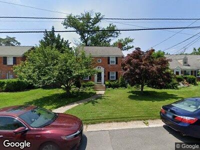
10010 Reddick Dr Silver Spring, MD 20901
South Four Corners NeighborhoodEstimated Value: $708,391 - $810,000
4
Beds
4
Baths
1,806
Sq Ft
$412/Sq Ft
Est. Value
About This Home
This home is located at 10010 Reddick Dr, Silver Spring, MD 20901 and is currently estimated at $744,348, approximately $412 per square foot. 10010 Reddick Dr is a home located in Montgomery County with nearby schools including Flora M. Singer Elementary School, Sligo Middle School, and Albert Einstein High School.
Ownership History
Date
Name
Owned For
Owner Type
Purchase Details
Closed on
Apr 20, 2010
Sold by
Pinsky Greogg and Pinsky C
Bought by
Osterman 3Rd Richard J and Osterman Michelle J K
Current Estimated Value
Home Financials for this Owner
Home Financials are based on the most recent Mortgage that was taken out on this home.
Original Mortgage
$554,700
Interest Rate
5%
Mortgage Type
FHA
Purchase Details
Closed on
Feb 27, 2001
Sold by
Pinsky Gregg
Bought by
Pinsky Gregg and Pinsky C
Purchase Details
Closed on
Jan 13, 1998
Sold by
Y Christopher A and Y Sorensen A
Bought by
Gregg Pinsky
Purchase Details
Closed on
Jun 3, 1996
Sold by
L Robert E and L Kehoe R
Bought by
Y Christopher A and Y Sorensen A
Create a Home Valuation Report for This Property
The Home Valuation Report is an in-depth analysis detailing your home's value as well as a comparison with similar homes in the area
Home Values in the Area
Average Home Value in this Area
Purchase History
| Date | Buyer | Sale Price | Title Company |
|---|---|---|---|
| Osterman 3Rd Richard J | $565,000 | -- | |
| Pinsky Gregg | -- | -- | |
| Gregg Pinsky | $173,000 | -- | |
| Y Christopher A | $172,000 | -- |
Source: Public Records
Mortgage History
| Date | Status | Borrower | Loan Amount |
|---|---|---|---|
| Open | Osterman Richard J | $527,850 | |
| Closed | Osterman Richard J | $554,700 | |
| Previous Owner | Pinsky Gregg | $340,200 | |
| Previous Owner | Pinsky Gregg S | $350,000 |
Source: Public Records
Tax History Compared to Growth
Tax History
| Year | Tax Paid | Tax Assessment Tax Assessment Total Assessment is a certain percentage of the fair market value that is determined by local assessors to be the total taxable value of land and additions on the property. | Land | Improvement |
|---|---|---|---|---|
| 2024 | $7,299 | $576,467 | $0 | $0 |
| 2023 | $6,221 | $544,433 | $0 | $0 |
| 2022 | $4,130 | $512,400 | $210,900 | $301,500 |
| 2021 | $5,284 | $493,533 | $0 | $0 |
| 2020 | $5,156 | $474,667 | $0 | $0 |
| 2019 | $4,762 | $455,800 | $196,200 | $259,600 |
| 2018 | $4,381 | $453,500 | $0 | $0 |
| 2017 | $4,360 | $451,200 | $0 | $0 |
| 2016 | $5,110 | $448,900 | $0 | $0 |
| 2015 | $5,110 | $448,900 | $0 | $0 |
| 2014 | $5,110 | $448,900 | $0 | $0 |
Source: Public Records
Map
Nearby Homes
- 10002 Reddick Dr
- 1012 Stirling Rd
- 1009 Stirling Rd
- 1213 Forest Glen Rd
- 9905 Portland Rd
- 10115 Tenbrook Dr
- 10028 Greenock Rd
- 1106 Dryden St
- 10004 Kinross Ave
- 1615 Dublin Dr
- 10126 Renfrew Rd
- 1612 Sherwood Rd
- 10108 Kinross Ave
- 1002 Laredo Rd
- 9901 Markham St
- 903 Laredo Rd
- 9704 Lorain Ave
- 9906 Rogart Rd
- 1908 Brightleaf Ct
- 10412 Hayes Ave