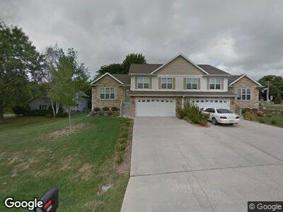
1004 Severson Dr Madison, WI 53718
East Madison NeighborhoodEstimated Value: $581,000 - $799,000
4
Beds
3
Baths
2,636
Sq Ft
$262/Sq Ft
Est. Value
About This Home
This home is located at 1004 Severson Dr, Madison, WI 53718 and is currently estimated at $689,630, approximately $261 per square foot. 1004 Severson Dr is a home located in Dane County with nearby schools including Elvehjem Elementary School, Sennett Middle School, and La Follette High School.
Ownership History
Date
Name
Owned For
Owner Type
Purchase Details
Closed on
Oct 30, 2019
Sold by
Cook Joh R and Constant Ryan D
Bought by
Alydar Llc
Current Estimated Value
Purchase Details
Closed on
May 20, 2016
Sold by
Fieldstone Estates Llc
Bought by
Cook John R and Constant Ryan D
Home Financials for this Owner
Home Financials are based on the most recent Mortgage that was taken out on this home.
Original Mortgage
$304,000
Interest Rate
3.59%
Mortgage Type
New Conventional
Purchase Details
Closed on
Apr 4, 2011
Sold by
Jjl Wickline Revocable Trust
Bought by
Fieldstone Estates Llc
Purchase Details
Closed on
Aug 3, 2010
Sold by
J L L Wickline Revocable Living Trust
Bought by
Wickline Jeff A and Wickline Lisa M
Purchase Details
Closed on
Aug 22, 2005
Sold by
Hd Enterprises Iii Llc
Bought by
Wickline Jeff A
Create a Home Valuation Report for This Property
The Home Valuation Report is an in-depth analysis detailing your home's value as well as a comparison with similar homes in the area
Home Values in the Area
Average Home Value in this Area
Purchase History
| Date | Buyer | Sale Price | Title Company |
|---|---|---|---|
| Alydar Llc | $470,000 | None Available | |
| Cook John R | $380,000 | Attorney | |
| Fieldstone Estates Llc | $290,000 | None Available | |
| Wickline Jeff A | -- | None Available | |
| Wickline Jeff A | -- | None Available |
Source: Public Records
Mortgage History
| Date | Status | Borrower | Loan Amount |
|---|---|---|---|
| Previous Owner | Cook John R | $304,000 | |
| Previous Owner | Wickline Jeff A | $368,000 |
Source: Public Records
Tax History Compared to Growth
Tax History
| Year | Tax Paid | Tax Assessment Tax Assessment Total Assessment is a certain percentage of the fair market value that is determined by local assessors to be the total taxable value of land and additions on the property. | Land | Improvement |
|---|---|---|---|---|
| 2024 | $25,580 | $665,300 | $122,200 | $543,100 |
| 2023 | $11,973 | $604,800 | $114,100 | $490,700 |
| 2021 | $10,704 | $470,000 | $98,900 | $371,100 |
| 2020 | $10,518 | $470,000 | $92,400 | $377,600 |
| 2019 | $8,835 | $395,200 | $92,400 | $302,800 |
| 2018 | $8,583 | $380,000 | $92,400 | $287,600 |
| 2017 | $8,845 | $380,000 | $84,000 | $296,000 |
| 2016 | $5,729 | $242,300 | $84,000 | $158,300 |
| 2015 | $5,789 | $242,300 | $84,000 | $158,300 |
| 2014 | $5,792 | $242,300 | $84,000 | $158,300 |
| 2013 | $5,628 | $235,200 | $84,000 | $151,200 |
Source: Public Records
Map
Nearby Homes
- 6326 Merritt Ridge
- 717 Callisto Dr
- 627 Malvern Hill Dr
- 633 Copernicus Way
- 529 N Star Dr
- 745 N Star Dr Unit 745
- 1508 Lynchburg Trail
- 734 N Star Dr
- 9 Whitefish Ct
- 0 Karmichael Ct
- 7035 Havenswood Dr
- 447 N Star Dr
- 402 Rustic Dr
- 549 Hercules Trail
- 1209 S Thompson Dr
- 546 Apollo Way
- 328 Venus Way
- 1634 Kings Mill Way Unit 107
- 6012 Aries Way
- 422 Orion Trail