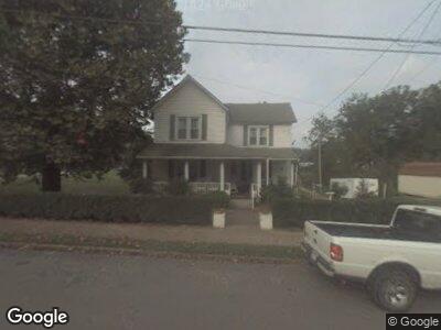
101 N Main St Burnsville, WV 26335
Estimated Value: $78,000 - $99,633
4
Beds
1
Bath
2,048
Sq Ft
$42/Sq Ft
Est. Value
About This Home
This home is located at 101 N Main St, Burnsville, WV 26335 and is currently estimated at $85,544, approximately $41 per square foot. 101 N Main St is a home with nearby schools including Braxton County High School.
Ownership History
Date
Name
Owned For
Owner Type
Purchase Details
Closed on
Nov 27, 2020
Sold by
Henderson Richard E
Bought by
Moss Timothy J
Current Estimated Value
Purchase Details
Closed on
Mar 30, 2012
Sold by
Smith Ronald L and Smith Joann
Bought by
Henderson Richard E and Henderson Sheree
Home Financials for this Owner
Home Financials are based on the most recent Mortgage that was taken out on this home.
Original Mortgage
$45,000
Outstanding Balance
$32,254
Interest Rate
3.89%
Mortgage Type
New Conventional
Estimated Equity
$47,181
Create a Home Valuation Report for This Property
The Home Valuation Report is an in-depth analysis detailing your home's value as well as a comparison with similar homes in the area
Home Values in the Area
Average Home Value in this Area
Purchase History
| Date | Buyer | Sale Price | Title Company |
|---|---|---|---|
| Henderson Richard E | $45,000 | -- |
Source: Public Records
Mortgage History
| Date | Status | Borrower | Loan Amount |
|---|---|---|---|
| Open | Henderson Richard E | $10 | |
| Open | Henderson Richard E | $45,000 |
Source: Public Records
Tax History Compared to Growth
Tax History
| Year | Tax Paid | Tax Assessment Tax Assessment Total Assessment is a certain percentage of the fair market value that is determined by local assessors to be the total taxable value of land and additions on the property. | Land | Improvement |
|---|---|---|---|---|
| 2024 | $370 | $36,300 | $3,060 | $33,240 |
| 2023 | $364 | $35,640 | $3,060 | $32,580 |
| 2022 | $722 | $35,100 | $3,060 | $32,040 |
| 2021 | $664 | $32,280 | $3,060 | $29,220 |
| 2020 | $645 | $31,320 | $3,060 | $28,260 |
| 2019 | $619 | $29,820 | $3,060 | $26,760 |
| 2018 | $599 | $28,800 | $3,060 | $25,740 |
| 2017 | $575 | $27,480 | $3,060 | $24,420 |
| 2016 | $576 | $27,480 | $3,060 | $24,420 |
| 2015 | $594 | $28,320 | $3,060 | $25,260 |
| 2014 | $559 | $25,500 | $3,060 | $22,440 |
Source: Public Records
Map
Nearby Homes
- 234 S Main St
- TBD Dumpling Run Rd
- 496 Happy Hollow
- 3219 Copen Rd
- 3254 3 Lick Rd
- 1329 3 Lick Rd
- 4895 Gem Rd
- 862 Three Lick Rd
- 0 Route 2
- TBD Walker Fork Rd
- 1186 Walker Fork Rd
- 0 Millstone Run Rd
- 823 Curry Ridge Rd
- 000 Hawk's View Ln
- TBD Exchange Rd
- 6559 Exchange Rd
- TBD Wilt Hollow Rd
- 167 Upper Level Run
- 451 Harley Brown Dr
- 2356 Cove Lick Rd