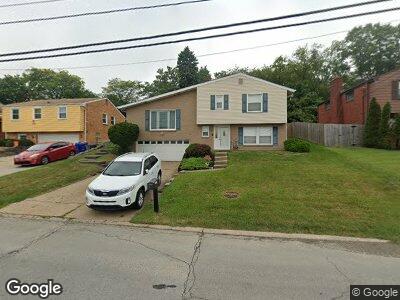
1017 Huston Dr West Mifflin, PA 15122
Estimated Value: $272,658 - $297,000
3
Beds
3
Baths
1,779
Sq Ft
$162/Sq Ft
Est. Value
About This Home
This home is located at 1017 Huston Dr, West Mifflin, PA 15122 and is currently estimated at $287,665, approximately $161 per square foot. 1017 Huston Dr is a home located in Allegheny County with nearby schools including West Mifflin Area High School, Walnut Grove Christian School, and Cornerstone Leadership Academy.
Ownership History
Date
Name
Owned For
Owner Type
Purchase Details
Closed on
Apr 8, 2016
Sold by
Skillpa Ronald P and Skillpa Jennifer L
Bought by
Skillpa Ronald P
Current Estimated Value
Purchase Details
Closed on
Nov 7, 2008
Sold by
Hricisak David P
Bought by
Skillpa Ronald P
Home Financials for this Owner
Home Financials are based on the most recent Mortgage that was taken out on this home.
Original Mortgage
$162,050
Interest Rate
6.13%
Mortgage Type
FHA
Create a Home Valuation Report for This Property
The Home Valuation Report is an in-depth analysis detailing your home's value as well as a comparison with similar homes in the area
Home Values in the Area
Average Home Value in this Area
Purchase History
| Date | Buyer | Sale Price | Title Company |
|---|---|---|---|
| Skillpa Ronald P | -- | None Available | |
| Skillpa Ronald P | $165,000 | -- |
Source: Public Records
Mortgage History
| Date | Status | Borrower | Loan Amount |
|---|---|---|---|
| Open | Skillpa Ronald P | $117,500 | |
| Closed | Skillpa Ronald P | $142,300 | |
| Closed | Robertson Gail E | $14,213 | |
| Closed | Skillpa Ronald P | $162,050 |
Source: Public Records
Tax History Compared to Growth
Tax History
| Year | Tax Paid | Tax Assessment Tax Assessment Total Assessment is a certain percentage of the fair market value that is determined by local assessors to be the total taxable value of land and additions on the property. | Land | Improvement |
|---|---|---|---|---|
| 2024 | $6,311 | $134,900 | $18,300 | $116,600 |
| 2023 | $6,226 | $134,900 | $18,300 | $116,600 |
| 2022 | $6,044 | $134,900 | $18,300 | $116,600 |
| 2021 | $638 | $134,900 | $18,300 | $116,600 |
| 2020 | $5,818 | $134,900 | $18,300 | $116,600 |
| 2019 | $5,741 | $134,900 | $18,300 | $116,600 |
| 2018 | $638 | $134,900 | $18,300 | $116,600 |
| 2017 | $5,674 | $152,900 | $18,300 | $134,600 |
| 2016 | $638 | $134,900 | $18,300 | $116,600 |
| 2015 | $638 | $134,900 | $18,300 | $116,600 |
| 2014 | $4,962 | $134,900 | $18,300 | $116,600 |
Source: Public Records
Map
Nearby Homes
- 3326 New England Rd
- 518 Lisa Dr
- 417 Lisa Dr
- 507 Lisa Dr
- 376 Livingston Rd
- 373 Livingston Rd
- 233 Bluemont Dr
- 333 Meadowlark Ln
- 1746 Clairton Rd
- 310 Bost Dr
- 2620 Old Elizabeth Rd
- 470 Spring Valley Rd
- 214 Skyport Rd
- 203 Skyport Rd
- 667 Debaldo Dr
- 613 Shadyside Dr
- 819 Shadyside Dr
- 904 Sunnyside Dr
- 439 Dennison Dr
- 263 Lynn Dr