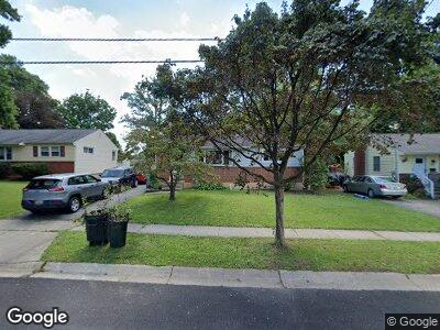
1017 Scott Ave Rockville, MD 20851
East Rockville NeighborhoodEstimated Value: $499,000 - $649,000
--
Bed
3
Baths
1,482
Sq Ft
$389/Sq Ft
Est. Value
About This Home
This home is located at 1017 Scott Ave, Rockville, MD 20851 and is currently estimated at $576,570, approximately $389 per square foot. 1017 Scott Ave is a home located in Montgomery County with nearby schools including Meadow Hall Elementary School, Earle B. Wood Middle School, and Rockville High School.
Ownership History
Date
Name
Owned For
Owner Type
Purchase Details
Closed on
Jan 30, 2025
Sold by
Bierman Howard N
Bought by
Us Bank Trust and Jp Morgan Mortgage Acquisition Corp
Current Estimated Value
Purchase Details
Closed on
Mar 28, 2000
Sold by
Zeek Mary Jane
Bought by
Capotosto William and Capotosto A L
Create a Home Valuation Report for This Property
The Home Valuation Report is an in-depth analysis detailing your home's value as well as a comparison with similar homes in the area
Home Values in the Area
Average Home Value in this Area
Purchase History
| Date | Buyer | Sale Price | Title Company |
|---|---|---|---|
| Us Bank Trust | $430,000 | None Listed On Document | |
| Us Bank Trust | $430,000 | None Listed On Document | |
| Capotosto William | $145,050 | -- |
Source: Public Records
Mortgage History
| Date | Status | Borrower | Loan Amount |
|---|---|---|---|
| Previous Owner | Capotosto William P | $407,000 | |
| Previous Owner | Capotosto William P | $50,000 | |
| Previous Owner | Capotosto Laurene A | $75,000 |
Source: Public Records
Tax History Compared to Growth
Tax History
| Year | Tax Paid | Tax Assessment Tax Assessment Total Assessment is a certain percentage of the fair market value that is determined by local assessors to be the total taxable value of land and additions on the property. | Land | Improvement |
|---|---|---|---|---|
| 2024 | $6,523 | $435,933 | $0 | $0 |
| 2023 | $6,670 | $400,300 | $188,700 | $211,600 |
| 2022 | $4,857 | $379,300 | $0 | $0 |
| 2021 | $4,273 | $358,300 | $0 | $0 |
| 2020 | $4,273 | $337,300 | $179,600 | $157,700 |
| 2019 | $4,192 | $330,833 | $0 | $0 |
| 2018 | $4,136 | $324,367 | $0 | $0 |
| 2017 | $4,108 | $317,900 | $0 | $0 |
| 2016 | -- | $302,033 | $0 | $0 |
| 2015 | $2,948 | $286,167 | $0 | $0 |
| 2014 | $2,948 | $270,300 | $0 | $0 |
Source: Public Records
Map
Nearby Homes
- 1021 Maple Ave
- 502 Woodburn Rd
- 1 Grandin Cir
- 1205 Gladstone Dr
- 805 Baltimore Rd
- 1000 Veirs Mill Rd
- 803 Burdette Rd
- 814 Burdette Rd
- 1013 Crawford Dr
- 1306 Clagett Dr
- 512 Calvin Ln
- 801 Gail Ave
- 900 Gail Ave
- 524 Calvin Ln
- 310 Baltimore Rd
- 712 Crabb Ave
- 302 Highland Ave
- 520 Crabb Ave
- 511 Crabb Ave
- 515 Woodston Rd