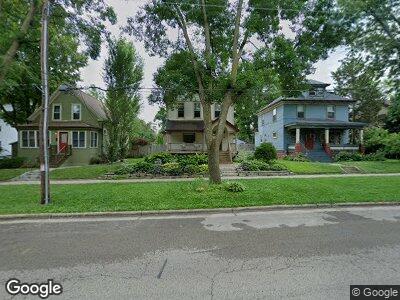
1019 Vilas Ave Unit 1 Madison, WI 53715
Greenbush NeighborhoodEstimated Value: $652,000 - $858,000
4
Beds
3
Baths
2,318
Sq Ft
$329/Sq Ft
Est. Value
About This Home
This home is located at 1019 Vilas Ave Unit 1, Madison, WI 53715 and is currently estimated at $762,241, approximately $328 per square foot. 1019 Vilas Ave Unit 1 is a home located in Dane County with nearby schools including Franklin Elementary School, Hamilton Middle School, and West High School.
Ownership History
Date
Name
Owned For
Owner Type
Purchase Details
Closed on
May 15, 2008
Sold by
Culligan James P and Culligan Mary Ann
Bought by
Olsen Julie
Current Estimated Value
Home Financials for this Owner
Home Financials are based on the most recent Mortgage that was taken out on this home.
Original Mortgage
$340,800
Interest Rate
4.62%
Mortgage Type
Commercial
Create a Home Valuation Report for This Property
The Home Valuation Report is an in-depth analysis detailing your home's value as well as a comparison with similar homes in the area
Home Values in the Area
Average Home Value in this Area
Purchase History
| Date | Buyer | Sale Price | Title Company |
|---|---|---|---|
| Olsen Julie | $426,000 | None Available |
Source: Public Records
Mortgage History
| Date | Status | Borrower | Loan Amount |
|---|---|---|---|
| Open | Olsen Julie | $255,000 | |
| Closed | Olsen Julie | $340,800 | |
| Previous Owner | Culligan James | $55,125 | |
| Previous Owner | Culligan Mary A | $263,000 |
Source: Public Records
Tax History Compared to Growth
Tax History
| Year | Tax Paid | Tax Assessment Tax Assessment Total Assessment is a certain percentage of the fair market value that is determined by local assessors to be the total taxable value of land and additions on the property. | Land | Improvement |
|---|---|---|---|---|
| 2024 | $25,637 | $744,000 | $180,700 | $563,300 |
| 2023 | $12,293 | $695,300 | $139,000 | $556,300 |
| 2021 | $11,646 | $559,800 | $119,300 | $440,500 |
| 2020 | $12,305 | $559,800 | $119,300 | $440,500 |
| 2019 | $11,845 | $538,300 | $114,700 | $423,600 |
| 2018 | $11,280 | $512,700 | $106,200 | $406,500 |
| 2017 | $10,657 | $466,100 | $106,200 | $359,900 |
| 2016 | $10,411 | $443,900 | $98,300 | $345,600 |
| 2015 | $10,033 | $402,700 | $90,000 | $312,700 |
| 2014 | $9,547 | $402,700 | $90,000 | $312,700 |
| 2013 | $8,831 | $391,000 | $84,100 | $306,900 |
Source: Public Records
Map
Nearby Homes
- 512 S Mills St Unit 12
- 926 Erin St
- 842 S Brooks St Unit 1
- 1505 Adams St
- 216 Campbell St
- 1520 Chandler St
- 1922 Adams St
- 615 W Main St Unit 109
- 535 S Shore Dr
- 1731 Regent St
- 533 W Main St Unit 305
- 530 W Doty St Unit 107
- 113 N Spooner St
- 642 Cedar St
- 314 N Breese Terrace
- 2150 Keyes Ave
- 15 S Broom St Unit 402
- 350 W Wilson St Unit 104
- 333 W Mifflin St Unit 4100
- 333 W Mifflin St Unit 2070