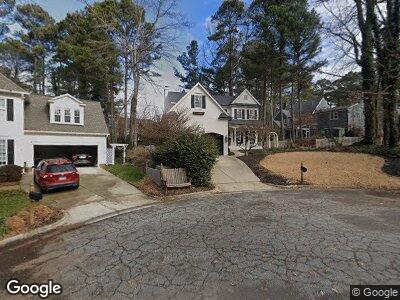
102 Parkgrove Ct Cary, NC 27519
West Cary NeighborhoodEstimated Value: $684,336 - $746,000
--
Bed
1
Bath
2,401
Sq Ft
$299/Sq Ft
Est. Value
About This Home
This home is located at 102 Parkgrove Ct, Cary, NC 27519 and is currently estimated at $718,834, approximately $299 per square foot. 102 Parkgrove Ct is a home located in Wake County with nearby schools including Davis Drive Elementary, Davis Drive Middle, and Green Hope High.
Ownership History
Date
Name
Owned For
Owner Type
Purchase Details
Closed on
Sep 21, 2007
Sold by
Durrett D Mark
Bought by
Durrett D Mark and Durrett Jeannette D
Current Estimated Value
Home Financials for this Owner
Home Financials are based on the most recent Mortgage that was taken out on this home.
Original Mortgage
$273,600
Interest Rate
6.57%
Mortgage Type
Stand Alone Refi Refinance Of Original Loan
Purchase Details
Closed on
Sep 2, 1997
Bought by
Durrett Durrett D and Durrett Jeannette D
Create a Home Valuation Report for This Property
The Home Valuation Report is an in-depth analysis detailing your home's value as well as a comparison with similar homes in the area
Home Values in the Area
Average Home Value in this Area
Purchase History
| Date | Buyer | Sale Price | Title Company |
|---|---|---|---|
| Durrett D Mark | -- | None Available | |
| Durrett Durrett D | $229,000 | -- |
Source: Public Records
Mortgage History
| Date | Status | Borrower | Loan Amount |
|---|---|---|---|
| Open | Durrett D Mark | $78,500 | |
| Open | Durrett D Mark | $264,000 | |
| Closed | Durrett D Mark | $273,600 | |
| Closed | Durrett D Mark | $165,487 | |
| Closed | Durrett D Mark | $176,000 | |
| Closed | Durrett D Mark | $60,000 |
Source: Public Records
Tax History Compared to Growth
Tax History
| Year | Tax Paid | Tax Assessment Tax Assessment Total Assessment is a certain percentage of the fair market value that is determined by local assessors to be the total taxable value of land and additions on the property. | Land | Improvement |
|---|---|---|---|---|
| 2024 | $5,830 | $692,853 | $240,000 | $452,853 |
| 2023 | $3,528 | $350,093 | $80,000 | $270,093 |
| 2022 | $3,397 | $350,093 | $80,000 | $270,093 |
| 2021 | $3,328 | $350,093 | $80,000 | $270,093 |
| 2020 | $3,346 | $350,093 | $80,000 | $270,093 |
| 2019 | $3,700 | $343,683 | $98,000 | $245,683 |
| 2018 | $3,472 | $343,683 | $98,000 | $245,683 |
| 2017 | $3,337 | $343,683 | $98,000 | $245,683 |
| 2016 | -- | $336,965 | $98,000 | $238,965 |
| 2015 | $3,234 | $326,439 | $90,000 | $236,439 |
| 2014 | -- | $326,439 | $90,000 | $236,439 |
Source: Public Records
Map
Nearby Homes
- 307 Parkmeadow Dr
- 112 Parkmeadow Dr
- 102 Parkbranch Ln
- 205 Caniff Ln
- 104 Barnes Spring Ct
- 101 Barriedale Cir
- 102 Battenburg Ct
- 437 Creekhurst Place
- 312 Alliance Cir
- 104 Glenmore Rd
- 207 Lewey Brook Dr
- 105 Bergeron Way
- 2324 High House Rd
- 1207 Corkery Ridge Ct
- 1215 Corkery Ridge Ct
- 100 W Acres Crescent
- 6824 Branton Dr
- 1046 Upchurch Farm Ln
- 1027 Upchurch Farm Ln
- 103 Ticonderoga Rd