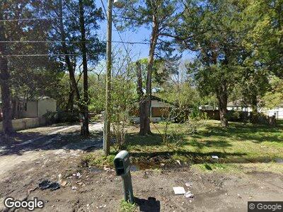
1020 Woodstock Ave Jacksonville, FL 32254
West Jacksonville NeighborhoodEstimated Value: $117,522 - $176,000
2
Beds
1
Bath
1,242
Sq Ft
$114/Sq Ft
Est. Value
About This Home
This home is located at 1020 Woodstock Ave, Jacksonville, FL 32254 and is currently estimated at $141,381, approximately $113 per square foot. 1020 Woodstock Ave is a home located in Duval County with nearby schools including Reynolds Lane Elementary School, Lake Shore Middle School, and William M. Raines High School.
Ownership History
Date
Name
Owned For
Owner Type
Purchase Details
Closed on
Feb 19, 2025
Sold by
Carmony Dale
Bought by
Shack Ciera M
Current Estimated Value
Purchase Details
Closed on
Nov 8, 2023
Sold by
Nipper Michael
Bought by
Carmony Dale
Purchase Details
Closed on
Aug 22, 2023
Sold by
Rigdon Debra and Nipper Steven
Bought by
Convergent Rei Llc and Alford
Purchase Details
Closed on
Jan 22, 2013
Sold by
Abrams Michael
Bought by
Abrams Dorothy
Purchase Details
Closed on
Dec 28, 1999
Sold by
Reeves Clara B
Bought by
Abrams Michael R and Abrams Dorothy S
Home Financials for this Owner
Home Financials are based on the most recent Mortgage that was taken out on this home.
Original Mortgage
$30,000
Interest Rate
7%
Mortgage Type
Seller Take Back
Purchase Details
Closed on
Jun 15, 1998
Sold by
Westberry Evelyn Grace
Bought by
Westberry Donald Lee and Westberry Evelyn Grace
Create a Home Valuation Report for This Property
The Home Valuation Report is an in-depth analysis detailing your home's value as well as a comparison with similar homes in the area
Home Values in the Area
Average Home Value in this Area
Purchase History
| Date | Buyer | Sale Price | Title Company |
|---|---|---|---|
| Shack Ciera M | $100 | None Listed On Document | |
| Shack Ciera M | $100 | None Listed On Document | |
| Carmony Dale | $7,000 | None Listed On Document | |
| Convergent Rei Llc | -- | None Listed On Document | |
| Abrams Dorothy | -- | None Available | |
| Abrams Michael R | $30,000 | -- | |
| Westberry Donald Lee | $100 | -- |
Source: Public Records
Mortgage History
| Date | Status | Borrower | Loan Amount |
|---|---|---|---|
| Previous Owner | Abrams Michael R | $30,000 |
Source: Public Records
Tax History Compared to Growth
Tax History
| Year | Tax Paid | Tax Assessment Tax Assessment Total Assessment is a certain percentage of the fair market value that is determined by local assessors to be the total taxable value of land and additions on the property. | Land | Improvement |
|---|---|---|---|---|
| 2024 | $1,598 | $77,580 | $30,962 | $46,618 |
| 2023 | $486 | $40,291 | $0 | $0 |
| 2022 | $452 | $39,118 | $0 | $0 |
| 2021 | $439 | $37,979 | $0 | $0 |
| 2020 | $431 | $37,455 | $0 | $0 |
| 2019 | $419 | $36,613 | $0 | $0 |
| 2018 | $409 | $35,931 | $0 | $0 |
| 2017 | $398 | $35,192 | $5,529 | $29,663 |
| 2016 | $390 | $34,602 | $0 | $0 |
| 2015 | $525 | $41,558 | $0 | $0 |
| 2014 | $522 | $41,229 | $0 | $0 |
Source: Public Records
Map
Nearby Homes
- 1018 Hood Ave
- 3348 Commonwealth Ave
- 3335 Columbus Ave
- 1004 Hood Ave
- 1008 Hood Ave
- 1088 Hood Ave
- 1056 Hood Ave
- 1041 Seminole Ave
- 3430 Commonwealth Ave
- 1079 Hood Ave
- 3345 Lowell Ave
- 1047 Melson Ave
- 1094 Woodstock Ave
- 3138 Columbus Ave
- 3418 Lowell Ave
- 1068 Prospect St
- 3510 Andrews St
- 3469 Lowell Ave
- 3518 Andrews St
- 3057 Columbus Ave
