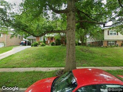
10207 Chautauqua Ave Lanham, MD 20706
Seabrook NeighborhoodEstimated Value: $399,000 - $440,000
3
Beds
2
Baths
1,080
Sq Ft
$381/Sq Ft
Est. Value
About This Home
This home is located at 10207 Chautauqua Ave, Lanham, MD 20706 and is currently estimated at $411,588, approximately $381 per square foot. 10207 Chautauqua Ave is a home located in Prince George's County with nearby schools including Seabrook Elementary School, Thomas Johnson Middle School, and Duval High School.
Ownership History
Date
Name
Owned For
Owner Type
Purchase Details
Closed on
Nov 12, 2004
Sold by
Engel Martha M
Bought by
Ekwe Benneth I
Current Estimated Value
Purchase Details
Closed on
Mar 10, 1999
Sold by
Manson Joseph L
Bought by
Engel Martha M and Engel Anthony J
Purchase Details
Closed on
Oct 14, 1976
Sold by
Linder Robert J
Bought by
Manson Joseph L and Manson Evelyn M
Create a Home Valuation Report for This Property
The Home Valuation Report is an in-depth analysis detailing your home's value as well as a comparison with similar homes in the area
Home Values in the Area
Average Home Value in this Area
Purchase History
| Date | Buyer | Sale Price | Title Company |
|---|---|---|---|
| Ekwe Benneth I | $235,000 | -- | |
| Engel Martha M | -- | -- | |
| Manson Joseph L | $51,500 | -- |
Source: Public Records
Mortgage History
| Date | Status | Borrower | Loan Amount |
|---|---|---|---|
| Open | Ekwe Benneth I | $34,650 | |
| Open | Ekwe Benneth I | $292,573 | |
| Closed | Ekwe Benneth I | $289,987 | |
| Closed | Ekwe Benneth I | $186,000 | |
| Closed | Ekwe Benneth I | $57,000 |
Source: Public Records
Tax History Compared to Growth
Tax History
| Year | Tax Paid | Tax Assessment Tax Assessment Total Assessment is a certain percentage of the fair market value that is determined by local assessors to be the total taxable value of land and additions on the property. | Land | Improvement |
|---|---|---|---|---|
| 2024 | $4,361 | $282,600 | $71,700 | $210,900 |
| 2023 | $4,416 | $309,600 | $71,700 | $237,900 |
| 2022 | $4,182 | $286,167 | $0 | $0 |
| 2021 | $3,954 | $262,733 | $0 | $0 |
| 2020 | $3,818 | $239,300 | $70,800 | $168,500 |
| 2019 | $3,714 | $227,067 | $0 | $0 |
| 2018 | $3,590 | $214,833 | $0 | $0 |
| 2017 | $3,408 | $202,600 | $0 | $0 |
| 2016 | -- | $184,867 | $0 | $0 |
| 2015 | $2,852 | $167,133 | $0 | $0 |
| 2014 | $2,852 | $149,400 | $0 | $0 |
Source: Public Records
Map
Nearby Homes
- 10307 Buena Vista Ave
- 10107 Linford Terrace
- 0 Franklin St
- 1010 & 1012 Railroad Ave
- 5504 Linwood Ct
- 5714 Lincoln Ave
- 10308 Vista Hollow Way
- 4803 Vista Green Ln
- 9719 Vang Dr Unit 810
- 5608 Glen St
- 10200 Maryland St
- 10801 Electric Ave
- 5203 Ashleigh Glen Ct
- 5604 Glen Ave
- 9911 Ridge St
- 9524 Dubarry Ave
- 10005 Redstone Ave
- 10001 Redstone Ave
- 6310 Rory Ct
- 9404 Wyatt Dr
