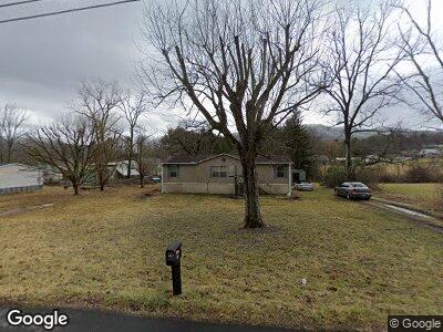
1021 Hampton St Mountain City, TN 37683
Estimated Value: $109,800 - $259,000
3
Beds
2
Baths
1,152
Sq Ft
$157/Sq Ft
Est. Value
About This Home
This home is located at 1021 Hampton St, Mountain City, TN 37683 and is currently estimated at $180,450, approximately $156 per square foot. 1021 Hampton St is a home located in Johnson County with nearby schools including Johnson County Middle School, Johnson County High School, and Mountain City SDA.
Ownership History
Date
Name
Owned For
Owner Type
Purchase Details
Closed on
Feb 18, 2005
Sold by
Saltsman Norma J
Bought by
Calhoun Donnie S and Calhoun David Mcclean
Current Estimated Value
Home Financials for this Owner
Home Financials are based on the most recent Mortgage that was taken out on this home.
Original Mortgage
$40,000
Interest Rate
5.61%
Mortgage Type
Cash
Purchase Details
Closed on
Oct 30, 2000
Bought by
Saltsman Norma J
Purchase Details
Closed on
Aug 1, 1996
Bought by
Gentry William J and Gentry Margaret P
Purchase Details
Closed on
Jan 29, 1996
Bought by
Greene Gregory W
Purchase Details
Closed on
Sep 18, 1995
Bought by
Stines Coy
Purchase Details
Closed on
Oct 11, 1971
Bought by
Thomas Donald and Thomas Thelma R
Create a Home Valuation Report for This Property
The Home Valuation Report is an in-depth analysis detailing your home's value as well as a comparison with similar homes in the area
Home Values in the Area
Average Home Value in this Area
Purchase History
| Date | Buyer | Sale Price | Title Company |
|---|---|---|---|
| Calhoun Donnie S | $50,000 | -- | |
| Saltsman Norma J | $58,000 | -- | |
| Gentry William J | $10,100 | -- | |
| Greene Gregory W | $12,000 | -- | |
| Stines Coy | -- | -- | |
| Thomas Donald | -- | -- |
Source: Public Records
Mortgage History
| Date | Status | Borrower | Loan Amount |
|---|---|---|---|
| Closed | Calhoun Donnie S | $40,000 |
Source: Public Records
Tax History Compared to Growth
Tax History
| Year | Tax Paid | Tax Assessment Tax Assessment Total Assessment is a certain percentage of the fair market value that is determined by local assessors to be the total taxable value of land and additions on the property. | Land | Improvement |
|---|---|---|---|---|
| 2024 | -- | $19,725 | $5,625 | $14,100 |
| 2023 | $436 | $19,725 | $5,625 | $14,100 |
| 2022 | $357 | $19,725 | $5,625 | $14,100 |
| 2021 | $556 | $19,725 | $5,625 | $14,100 |
| 2020 | $372 | $19,725 | $5,625 | $14,100 |
| 2019 | $369 | $11,750 | $3,650 | $8,100 |
| 2018 | $369 | $11,750 | $3,650 | $8,100 |
| 2017 | $369 | $11,750 | $3,650 | $8,100 |
| 2016 | $369 | $11,750 | $3,650 | $8,100 |
| 2015 | $336 | $11,750 | $3,650 | $8,100 |
| 2014 | $385 | $13,475 | $3,650 | $9,825 |
Source: Public Records
Map
Nearby Homes
- 229 Hillside Rd
- 109 Apple St
- 263 Oak St
- 394 Cedar St
- 103 Shoun St
- 433 Shoun St
- 227 N Murphy St
- 164 Brown Place
- 275 Settlers Secret
- 0 Highway 421 N
- 401 N Church St
- 611 S Church St
- 141 Fairground Ln
- 128 Georgia St
- 1250 J Shoun Rd
- 138 J Phillipi Rd
- 418 Johnson Hollow Rd
- TBD Fairview St
- 140 Dw of Swift Rd
- 00 E Hillcrest St