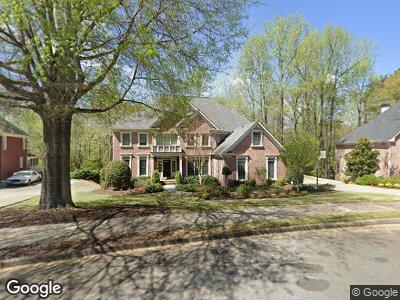
1025 Gunter Ct Alpharetta, GA 30022
Estimated Value: $1,163,173 - $1,399,000
5
Beds
4
Baths
4,414
Sq Ft
$280/Sq Ft
Est. Value
About This Home
This home is located at 1025 Gunter Ct, Alpharetta, GA 30022 and is currently estimated at $1,234,043, approximately $279 per square foot. 1025 Gunter Ct is a home located in Fulton County with nearby schools including New Prospect Elementary School, Webb Bridge Middle School, and Alpharetta High School.
Ownership History
Date
Name
Owned For
Owner Type
Purchase Details
Closed on
Jul 1, 1998
Sold by
Mcguire Estate Developers
Bought by
Strawinski James S and Strawinski Tyler
Current Estimated Value
Home Financials for this Owner
Home Financials are based on the most recent Mortgage that was taken out on this home.
Original Mortgage
$307,200
Interest Rate
6.75%
Mortgage Type
New Conventional
Create a Home Valuation Report for This Property
The Home Valuation Report is an in-depth analysis detailing your home's value as well as a comparison with similar homes in the area
Home Values in the Area
Average Home Value in this Area
Purchase History
| Date | Buyer | Sale Price | Title Company |
|---|---|---|---|
| Strawinski James S | $384,200 | -- |
Source: Public Records
Mortgage History
| Date | Status | Borrower | Loan Amount |
|---|---|---|---|
| Open | Strawinski James | $278,900 | |
| Closed | Strawinski Tyler R | $144,230 | |
| Closed | Strawinski James S | $286,000 | |
| Closed | Strawinski James S | $112,000 | |
| Closed | Strawinski James S | $112,000 | |
| Closed | Strawinski James S | $112,000 | |
| Closed | Strawinski James S | $307,200 |
Source: Public Records
Tax History Compared to Growth
Tax History
| Year | Tax Paid | Tax Assessment Tax Assessment Total Assessment is a certain percentage of the fair market value that is determined by local assessors to be the total taxable value of land and additions on the property. | Land | Improvement |
|---|---|---|---|---|
| 2023 | $11,415 | $404,400 | $96,680 | $307,720 |
| 2022 | $9,395 | $332,840 | $82,240 | $250,600 |
| 2021 | $1,413 | $284,400 | $68,760 | $215,640 |
| 2020 | $8,611 | $284,560 | $75,040 | $209,520 |
| 2019 | $0 | $268,680 | $70,720 | $197,960 |
| 2018 | $6,897 | $267,800 | $67,080 | $200,720 |
| 2017 | $7,088 | $267,800 | $67,080 | $200,720 |
| 2016 | $6,375 | $281,200 | $67,080 | $214,120 |
| 2015 | $8,279 | $267,800 | $67,080 | $200,720 |
| 2014 | $6,218 | $218,120 | $57,920 | $160,200 |
Source: Public Records
Map
Nearby Homes
- 605 Tatum Ct
- 230 Society St
- 225 Cotton Field Ct
- 2732 Wander Ln
- 1270 Seale Dr
- 10625 Haynes Forest Dr
- 315 Stanyan Place
- 11212 Snowy Owl Ln Unit 46
- 3277 Bluejay Ln Unit 41
- 790 Thornberry Dr
- 230 Summerfield Dr
- 1275 N Point Dr
- 1275 N Point Dr
- 1275 N Point Dr
- 1275 N Point Dr
- 348 Olmstead Way Unit 30
- 344 Olmstead Way Unit 32
- 332 Olmstead Way Unit 38
- 362 Olmstead Way Unit 23
- 352 Olmstead Way Unit 28