L
Seller's Agent in 2017
Louise Stoever Baumann
Century 21 Running S Realty


Estimated Value: $351,077
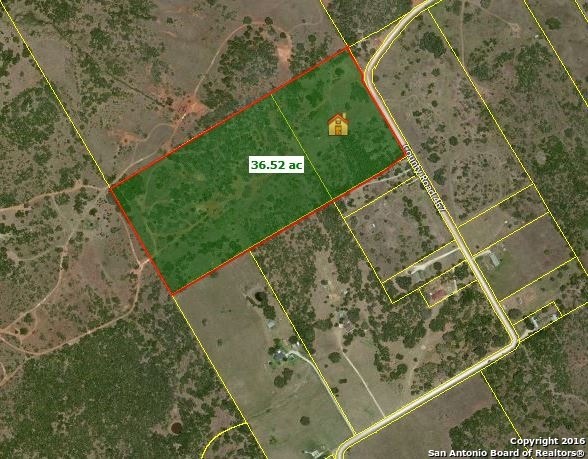
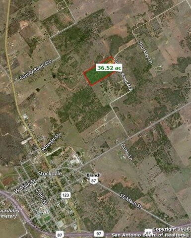
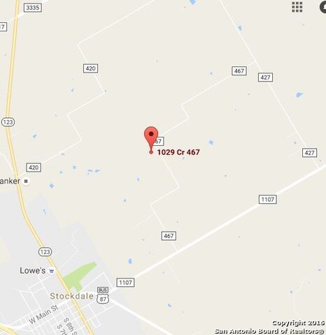
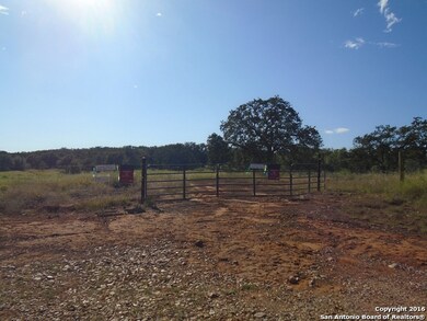
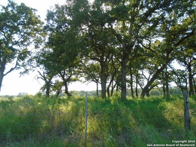
Seller owns none of the minerals. Lots of oak trees. Seller cleared a nice building spot. 2 pump jacks on property, entire tract is fenced. All 4 corners marked with pink tape. Great hilltop views of Stockdale! Sunko water in place w meter by the road, and GVEC electric meter by old non-liveable mobile. Not currently under Ag exemption!
Last Listed By
Louise Stoever Baumann
Century 21 Running S Realty Listed on: 10/01/2016
Property Type
Est. Annual Taxes
Lot Details
Schools
Listing and Financial Details
| Date | Buyer | Sale Price | Title Company |
|---|---|---|---|
| Marquez Gabriel | -- | None Listed On Document | |
| Smith Richard Nathaniel | -- | None Listed On Document | |
| 2008 Colquitt Llc | $28,544 | -- |
| Date | Status | Borrower | Loan Amount |
|---|---|---|---|
| Previous Owner | Smith Richard Nathaniel | $110,300 |
| Date | Event | Price | Change | Sq Ft Price |
|---|---|---|---|---|
| 04/23/2017 04/23/17 | Off Market | -- | -- | -- |
| 01/19/2017 01/19/17 | Sold | -- | -- | -- |
| 12/20/2016 12/20/16 | Pending | -- | -- | -- |
| 09/30/2016 09/30/16 | For Sale | $188,495 | -- | -- |
| Year | Tax Paid | Tax Assessment Tax Assessment Total Assessment is a certain percentage of the fair market value that is determined by local assessors to be the total taxable value of land and additions on the property. | Land | Improvement |
|---|---|---|---|---|
| 2024 | $806 | $85,722 | -- | -- |
| 2023 | $1,184 | $78,552 | $0 | $0 |
| 2022 | $1,210 | $67,364 | $0 | $0 |
| 2021 | $1,264 | $338,620 | $288,990 | $49,630 |
| 2020 | $877 | $200,390 | $166,690 | $33,700 |
| 2019 | $59 | $166,760 | $166,690 | $70 |
| 2018 | $59 | $166,750 | $166,690 | $60 |
| 2017 | $59 | $2,850 | $2,790 | $60 |
| 2016 | $3,007 | $145,400 | $145,000 | $400 |
| 2015 | -- | $145,400 | $145,000 | $400 |
| 2014 | -- | $1,430 | $1,070 | $360 |
L
Seller's Agent in 2017
Louise Stoever Baumann
Century 21 Running S Realty
C
Buyer's Agent in 2017
Carolyn Martinez
Crosspoint Realty, Llc
Source: San Antonio Board of REALTORS®
MLS Number: 1204445
APN: 15439
Disclaimer: Certain information contained herein is derived from information provided by parties other than Homes.com. All information provided is deemed reliable, but is not guaranteed to be accurate and should be independently verified.
![]() IDX information is provided exclusively for personal, non-commercial use, and may not be used for any purpose other than to identify prospective properties consumers may be interested in purchasing.
IDX information is provided exclusively for personal, non-commercial use, and may not be used for any purpose other than to identify prospective properties consumers may be interested in purchasing.
Information is deemed reliable but not guaranteed.