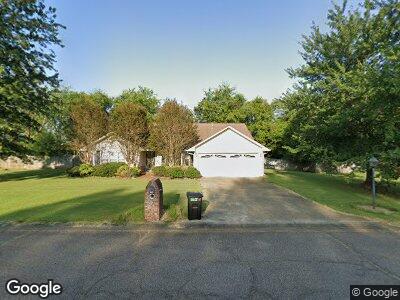
105 Crossgate St Starkville, MS 39759
Estimated Value: $223,166 - $276,000
3
Beds
2
Baths
1,549
Sq Ft
$163/Sq Ft
Est. Value
About This Home
This home is located at 105 Crossgate St, Starkville, MS 39759 and is currently estimated at $252,292, approximately $162 per square foot. 105 Crossgate St is a home located in Oktibbeha County with nearby schools including Sudduth Elementary School, Overstreet Elementary School, and Henderson/Ward-Stewart Elementary School.
Ownership History
Date
Name
Owned For
Owner Type
Purchase Details
Closed on
Mar 24, 2023
Sold by
Patterson Gregory S and Patterson Brandy R
Bought by
Krafft Jennifer E Jared
Current Estimated Value
Home Financials for this Owner
Home Financials are based on the most recent Mortgage that was taken out on this home.
Original Mortgage
$208,000
Outstanding Balance
$203,652
Interest Rate
6.54%
Mortgage Type
Construction
Estimated Equity
$48,640
Purchase Details
Closed on
Dec 17, 2014
Bought by
Scott Patterson Gregory
Create a Home Valuation Report for This Property
The Home Valuation Report is an in-depth analysis detailing your home's value as well as a comparison with similar homes in the area
Home Values in the Area
Average Home Value in this Area
Purchase History
| Date | Buyer | Sale Price | Title Company |
|---|---|---|---|
| Krafft Jennifer E Jared | $260,000 | Attorney Only | |
| Scott Patterson Gregory | $106,500 | -- |
Source: Public Records
Mortgage History
| Date | Status | Borrower | Loan Amount |
|---|---|---|---|
| Open | Krafft Jennifer E Jared | $208,000 |
Source: Public Records
Tax History Compared to Growth
Tax History
| Year | Tax Paid | Tax Assessment Tax Assessment Total Assessment is a certain percentage of the fair market value that is determined by local assessors to be the total taxable value of land and additions on the property. | Land | Improvement |
|---|---|---|---|---|
| 2024 | $1,933 | $14,588 | $0 | $0 |
| 2023 | $3,350 | $21,882 | $0 | $0 |
| 2022 | $3,309 | $21,882 | $0 | $0 |
| 2021 | $3,160 | $20,877 | $0 | $0 |
| 2020 | $3,138 | $20,877 | $0 | $0 |
| 2019 | $3,096 | $20,877 | $0 | $0 |
| 2018 | $3,075 | $20,877 | $0 | $0 |
| 2017 | $2,897 | $19,991 | $0 | $0 |
| 2016 | $2,897 | $19,991 | $0 | $0 |
| 2015 | $2,770 | $19,991 | $0 | $0 |
| 2014 | $1,554 | $13,327 | $0 | $0 |
| 2013 | -- | $12,958 | $0 | $0 |
Source: Public Records
Map
Nearby Homes
- 122 W Bound St
- 2701 Maple Dr
- 2605 Maple Dr
- 2604 Maple Dr
- 0 Mississippi 25
- 111 Rutledge St
- 113 Rutledge St
- 2500 Maple Dr
- 0 Airport Rd
- 2604 Redbud Dr
- 0 Stark Rd
- 2423 Douglas McArthur Dr
- 709 Cypress Rd
- 704 Cypress Rd
- 701 Sassafras Dr
- 305 Clements Ave
- 126 Clements Ave
- 200 Pinebrook Rd
- 105 Tomlinson Dr
- 2105 Douglas McArthur Dr