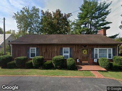
105 Rick Mast Loop Rockbridge Baths, VA 24473
Estimated Value: $190,326 - $243,000
2
Beds
2
Baths
1,368
Sq Ft
$159/Sq Ft
Est. Value
About This Home
This home is located at 105 Rick Mast Loop, Rockbridge Baths, VA 24473 and is currently estimated at $218,082, approximately $159 per square foot. 105 Rick Mast Loop is a home located in Rockbridge County with nearby schools including Rockbridge County High School.
Ownership History
Date
Name
Owned For
Owner Type
Purchase Details
Closed on
Jul 11, 2024
Sold by
Hall Owen Robert
Bought by
Mast Mill Guest House Llc
Current Estimated Value
Purchase Details
Closed on
Sep 27, 2022
Sold by
Dudley Doris S
Bought by
Hall Owen Robert
Home Financials for this Owner
Home Financials are based on the most recent Mortgage that was taken out on this home.
Original Mortgage
$134,000
Interest Rate
5.89%
Mortgage Type
New Conventional
Create a Home Valuation Report for This Property
The Home Valuation Report is an in-depth analysis detailing your home's value as well as a comparison with similar homes in the area
Home Values in the Area
Average Home Value in this Area
Purchase History
| Date | Buyer | Sale Price | Title Company |
|---|---|---|---|
| Mast Mill Guest House Llc | -- | None Listed On Document | |
| Hall Owen Robert | $150,000 | Lexington Title Agency |
Source: Public Records
Mortgage History
| Date | Status | Borrower | Loan Amount |
|---|---|---|---|
| Previous Owner | Hall Owen Robert | $134,000 |
Source: Public Records
Tax History Compared to Growth
Tax History
| Year | Tax Paid | Tax Assessment Tax Assessment Total Assessment is a certain percentage of the fair market value that is determined by local assessors to be the total taxable value of land and additions on the property. | Land | Improvement |
|---|---|---|---|---|
| 2024 | $1,030 | $168,900 | $50,000 | $118,900 |
| 2023 | $1,030 | $168,900 | $50,000 | $118,900 |
| 2022 | $926 | $125,200 | $30,000 | $95,200 |
| 2021 | $926 | $125,200 | $30,000 | $95,200 |
| 2020 | $926 | $125,200 | $30,000 | $95,200 |
| 2019 | $914 | $125,200 | $30,000 | $95,200 |
| 2018 | $876 | $125,200 | $30,000 | $95,200 |
| 2017 | $876 | $125,200 | $30,000 | $95,200 |
| 2016 | $928 | $126,300 | $40,000 | $86,300 |
| 2015 | -- | $0 | $0 | $0 |
| 2014 | -- | $0 | $0 | $0 |
| 2013 | -- | $0 | $0 | $0 |
Source: Public Records
Map
Nearby Homes
- 69 Farmhouse Rd
- 99 Farmhouse Rd
- 15 Acres Farmhouse Rd
- TBD Anderson Farm Rd
- 310 Lingonberry Ln
- 599 Lindsay Ln
- 494 Smokey Row Rd
- 12 Abby Rd
- Lot 10 Ridgeline Way
- 563 Mount Atlas Rd
- 63 Seabiscuit Ct
- 10 Seabiscuit Ct
- 33 Seabiscuit Ct
- 21 Seabiscuit Ct
- 26 Seabiscuit Ct
- 370 Old Chapel Rd
- 567 Hays Creek Rd
- 58 Ac. - Mcclung Rd
- 1 Ac. - Boundary Line Ln
- 3111 N Lee Hwy