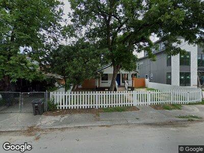
106 Dowdy St San Antonio, TX 78204
Lone Star NeighborhoodEstimated Value: $193,000 - $258,000
2
Beds
1
Bath
720
Sq Ft
$317/Sq Ft
Est. Value
About This Home
This home is located at 106 Dowdy St, San Antonio, TX 78204 and is currently estimated at $228,503, approximately $317 per square foot. 106 Dowdy St is a home located in Bexar County with nearby schools including Brackenridge High School, Andrew Briscoe Elementary, and KIPP Esperanza.
Ownership History
Date
Name
Owned For
Owner Type
Purchase Details
Closed on
Feb 4, 2022
Sold by
Vidaurri and Amelia
Bought by
Mmm Texas Land Company Llc
Current Estimated Value
Purchase Details
Closed on
May 25, 2011
Sold by
Alamo Home Source Llc
Bought by
Vidaurri Gerardo and Vidaurri Amelia E
Purchase Details
Closed on
May 3, 2011
Sold by
Gonzalez Robert G
Bought by
Alamo Home Source Llc
Purchase Details
Closed on
Aug 5, 2010
Sold by
Hoyos Rodolfo and Garcia Mary H
Bought by
Gonzalez Robert G
Create a Home Valuation Report for This Property
The Home Valuation Report is an in-depth analysis detailing your home's value as well as a comparison with similar homes in the area
Home Values in the Area
Average Home Value in this Area
Purchase History
| Date | Buyer | Sale Price | Title Company |
|---|---|---|---|
| Mmm Texas Land Company Llc | -- | Capital Title | |
| Vidaurri Gerardo | -- | None Available | |
| Alamo Home Source Llc | -- | Chicago Title | |
| Gonzalez Robert G | -- | None Available |
Source: Public Records
Mortgage History
| Date | Status | Borrower | Loan Amount |
|---|---|---|---|
| Previous Owner | Hizel Erika | $41,250 |
Source: Public Records
Tax History Compared to Growth
Tax History
| Year | Tax Paid | Tax Assessment Tax Assessment Total Assessment is a certain percentage of the fair market value that is determined by local assessors to be the total taxable value of land and additions on the property. | Land | Improvement |
|---|---|---|---|---|
| 2023 | $3,172 | $115,000 | $87,220 | $27,780 |
| 2022 | $2,845 | $105,000 | $68,960 | $36,040 |
| 2021 | $2,638 | $94,410 | $52,340 | $42,070 |
| 2020 | $2,227 | $78,580 | $42,820 | $35,760 |
| 2019 | $2,027 | $70,710 | $32,180 | $38,530 |
| 2018 | $1,948 | $68,650 | $32,180 | $36,470 |
| 2017 | $1,494 | $52,920 | $20,650 | $32,270 |
| 2016 | $1,150 | $40,750 | $10,750 | $30,000 |
| 2015 | $791 | $32,910 | $10,750 | $22,160 |
| 2014 | $791 | $29,230 | $0 | $0 |
Source: Public Records
Map
Nearby Homes
- 108 Dowdy St
- 111 Dowdy St
- 139 Saint Francis Ave
- 214 E Lachapelle
- 142 E Lachapelle
- 134 E Lachapelle
- 126 E Lachapelle
- 131 E Fest St
- 425 E Fest St
- 242 Simon
- 320 Saint Francis Ave
- 341 Lone Star Blvd
- 125 Forrest Ave
- 310 Clay St Residence 11
- 310 Clay St Residence 14
- 330 Clay
- 330 Clay Unit 26
- 342 Saint Francis Ave
- 335 Helena St
- 212 Clay