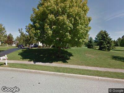
106 Ramsgate Dr Phoenixville, PA 19460
Upper Providence Township NeighborhoodEstimated Value: $784,859 - $943,000
4
Beds
3
Baths
3,396
Sq Ft
$255/Sq Ft
Est. Value
About This Home
This home is located at 106 Ramsgate Dr, Phoenixville, PA 19460 and is currently estimated at $866,215, approximately $255 per square foot. 106 Ramsgate Dr is a home located in Montgomery County with nearby schools including Spring-Ford Intermediate School, Oaks Elementary School, and Spring-Ford Middle School 8th Grade Center.
Ownership History
Date
Name
Owned For
Owner Type
Purchase Details
Closed on
Aug 26, 1998
Sold by
Rosche Terry A and Rosche Deborah L
Bought by
Hennessey Edward M and Hennessey Barbara A
Current Estimated Value
Purchase Details
Closed on
Feb 21, 1996
Sold by
Isenbarger Douglas C and Isenbarger Joan T
Bought by
Rosche Deborah L and Rosche Terry A
Create a Home Valuation Report for This Property
The Home Valuation Report is an in-depth analysis detailing your home's value as well as a comparison with similar homes in the area
Home Values in the Area
Average Home Value in this Area
Purchase History
| Date | Buyer | Sale Price | Title Company |
|---|---|---|---|
| Hennessey Edward M | $302,000 | -- | |
| Rosche Deborah L | $280,000 | -- |
Source: Public Records
Mortgage History
| Date | Status | Borrower | Loan Amount |
|---|---|---|---|
| Closed | Hennessey Edward M | $170,150 |
Source: Public Records
Tax History Compared to Growth
Tax History
| Year | Tax Paid | Tax Assessment Tax Assessment Total Assessment is a certain percentage of the fair market value that is determined by local assessors to be the total taxable value of land and additions on the property. | Land | Improvement |
|---|---|---|---|---|
| 2024 | $11,157 | $289,370 | $97,980 | $191,390 |
| 2023 | $10,648 | $289,370 | $97,980 | $191,390 |
| 2022 | $10,287 | $289,370 | $97,980 | $191,390 |
| 2021 | $9,668 | $289,370 | $97,980 | $191,390 |
| 2020 | $9,412 | $289,370 | $97,980 | $191,390 |
| 2019 | $9,233 | $289,370 | $97,980 | $191,390 |
| 2018 | $7,571 | $289,370 | $97,980 | $191,390 |
| 2017 | $9,055 | $289,370 | $97,980 | $191,390 |
| 2016 | $8,942 | $289,370 | $97,980 | $191,390 |
| 2015 | $8,362 | $289,370 | $97,980 | $191,390 |
| 2014 | $8,362 | $289,370 | $97,980 | $191,390 |
Source: Public Records
Map
Nearby Homes
- 604 Shenandoah Dr
- 275 Hopewell Dr
- 274 Hopewell Dr
- 206 Rock Dove Ln
- 431 Splitleaf Ln
- 140 Fox Run Dr
- 412 Stone House Cir Unit SUTTON
- 29 Eagle Rd
- 100 Bennington Rd
- 20 Windward Ct
- 334 Wheat Sheaf Way
- 112 Bennington Rd
- 106 Mockingbird Cir
- 68 Keokuk Rd
- 130 Providence Forge Rd
- 931 Katie Cir
- 194 Troutman Rd
- 51 Longacre Dr
- 92 Providence Forge Rd
- 63 Elmar Cir
