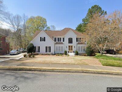
10600 Kingsmark Trail Alpharetta, GA 30022
Estimated Value: $940,164 - $1,056,000
4
Beds
4
Baths
3,497
Sq Ft
$287/Sq Ft
Est. Value
About This Home
This home is located at 10600 Kingsmark Trail, Alpharetta, GA 30022 and is currently estimated at $1,002,291, approximately $286 per square foot. 10600 Kingsmark Trail is a home located in Fulton County with nearby schools including Dolvin Elementary School, Autrey Mill Middle School, and Johns Creek High School.
Ownership History
Date
Name
Owned For
Owner Type
Purchase Details
Closed on
Aug 3, 1994
Sold by
Dunham Albert S
Bought by
Hull David W Pamela W
Current Estimated Value
Home Financials for this Owner
Home Financials are based on the most recent Mortgage that was taken out on this home.
Original Mortgage
$297,000
Interest Rate
5.5%
Create a Home Valuation Report for This Property
The Home Valuation Report is an in-depth analysis detailing your home's value as well as a comparison with similar homes in the area
Home Values in the Area
Average Home Value in this Area
Purchase History
| Date | Buyer | Sale Price | Title Company |
|---|---|---|---|
| Hull David W Pamela W | $330,000 | -- |
Source: Public Records
Mortgage History
| Date | Status | Borrower | Loan Amount |
|---|---|---|---|
| Open | Hull David W | $369,500 | |
| Closed | Hull David W | $368,000 | |
| Closed | Hull David W | $46,000 | |
| Closed | Hull David W | $25,000 | |
| Closed | Hull David W Pamela W | $297,000 |
Source: Public Records
Tax History Compared to Growth
Tax History
| Year | Tax Paid | Tax Assessment Tax Assessment Total Assessment is a certain percentage of the fair market value that is determined by local assessors to be the total taxable value of land and additions on the property. | Land | Improvement |
|---|---|---|---|---|
| 2023 | $7,585 | $268,720 | $72,000 | $196,720 |
| 2022 | $5,621 | $242,880 | $76,400 | $166,480 |
| 2021 | $6,683 | $244,600 | $80,040 | $164,560 |
| 2020 | $6,733 | $249,720 | $95,200 | $154,520 |
| 2019 | $1,071 | $245,280 | $93,520 | $151,760 |
| 2018 | $5,581 | $214,640 | $69,960 | $144,680 |
| 2017 | $5,577 | $206,400 | $67,280 | $139,120 |
| 2016 | $5,557 | $206,600 | $67,280 | $139,320 |
| 2015 | $6,623 | $208,960 | $67,280 | $141,680 |
| 2014 | $5,571 | $196,240 | $73,880 | $122,360 |
Source: Public Records
Map
Nearby Homes
- 10460 Cranchester Way
- 10440 Cranchester Way Unit 2
- 405 N Pine Dr
- 120 Thome Dr
- 850 Highland Bend Cove
- 10540 Willow View Cir Unit 2
- 340 Kincardine Way
- 3605 Grey Abbey Dr
- 115 Parkside Close
- 2590 Runic Way
- 10825 Pinewalk Forest Cir
- 10355 Oxford Mill Cir
- 10210 High Falls Pointe Unit 4B
- 645 Crossbridge Alley
- 10420 Summer Creek Dr
- 4180 Pineset Dr
- 3602 Cape York Trace
- 3585 Legacy Trace
- 3465 Jones Ferry Ln