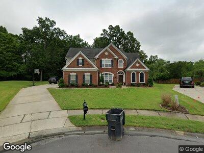
10605 Knight Castle Dr Charlotte, NC 28277
Ballantyne NeighborhoodEstimated Value: $788,000 - $870,000
4
Beds
4
Baths
3,388
Sq Ft
$246/Sq Ft
Est. Value
About This Home
This home is located at 10605 Knight Castle Dr, Charlotte, NC 28277 and is currently estimated at $833,441, approximately $245 per square foot. 10605 Knight Castle Dr is a home located in Mecklenburg County with nearby schools including Polo Ridge Elementary, Jay M Robinson Middle School, and Telra Institute.
Ownership History
Date
Name
Owned For
Owner Type
Purchase Details
Closed on
Apr 30, 2008
Sold by
Boyles Dale W and Boyles Ashley
Bought by
Oakley Brad and Oakley Tiffany
Current Estimated Value
Home Financials for this Owner
Home Financials are based on the most recent Mortgage that was taken out on this home.
Original Mortgage
$316,000
Interest Rate
5.84%
Mortgage Type
Purchase Money Mortgage
Purchase Details
Closed on
Feb 27, 2002
Sold by
Pulte Home Corp
Bought by
Boyles Dale W
Home Financials for this Owner
Home Financials are based on the most recent Mortgage that was taken out on this home.
Original Mortgage
$247,700
Interest Rate
5%
Mortgage Type
Purchase Money Mortgage
Create a Home Valuation Report for This Property
The Home Valuation Report is an in-depth analysis detailing your home's value as well as a comparison with similar homes in the area
Home Values in the Area
Average Home Value in this Area
Purchase History
| Date | Buyer | Sale Price | Title Company |
|---|---|---|---|
| Oakley Brad | $395,000 | Barristers Title Services Of | |
| Boyles Dale W | $296,500 | -- |
Source: Public Records
Mortgage History
| Date | Status | Borrower | Loan Amount |
|---|---|---|---|
| Open | Oakley Brad | $12,200 | |
| Open | Oakley Tiffany | $299,200 | |
| Closed | Oakley Vernon Brad | $313,142 | |
| Closed | Oakley Brad | $316,000 | |
| Previous Owner | Boyles Dale W | $234,100 | |
| Previous Owner | Boyles Dale W | $35,000 | |
| Previous Owner | Boyles Dale W | $247,700 |
Source: Public Records
Tax History Compared to Growth
Tax History
| Year | Tax Paid | Tax Assessment Tax Assessment Total Assessment is a certain percentage of the fair market value that is determined by local assessors to be the total taxable value of land and additions on the property. | Land | Improvement |
|---|---|---|---|---|
| 2023 | $5,073 | $672,600 | $130,000 | $542,600 |
| 2022 | $4,609 | $464,600 | $115,000 | $349,600 |
| 2021 | $4,598 | $464,600 | $115,000 | $349,600 |
| 2020 | $4,591 | $464,600 | $115,000 | $349,600 |
| 2019 | $4,575 | $464,600 | $115,000 | $349,600 |
| 2018 | $4,512 | $338,300 | $75,000 | $263,300 |
| 2017 | $4,442 | $338,300 | $75,000 | $263,300 |
| 2016 | $4,432 | $338,300 | $75,000 | $263,300 |
| 2015 | $4,421 | $338,300 | $75,000 | $263,300 |
| 2014 | $4,407 | $338,300 | $75,000 | $263,300 |
Source: Public Records
Map
Nearby Homes
- 10325 Merlin Meadows Ct
- 7031 Walton Heath Ln
- 6920 Stillmeadow Dr
- 11006 Knight Castle Dr
- 11014 Fox Mill Ln
- 6904 Mordred Ln
- 10240 Rose Meadow Ln Unit D
- 7115 Powder Mill Place
- 5345 King Arthur Dr
- 6741 Stillmeadow Dr
- 10942 Winterbourne Ct Unit 42
- 11402 Bloomfield Dr
- 10943 Winterbourne Ct
- 6411 Boykin Spaniel Rd
- 11430 Sir Francis Drake Dr
- 10512 Roseberry Ct
- 10805 Winterbourne Ct
- 7822 Noland Woods Dr
- 11333 Snapfinger Dr
- 8272 Golf Ridge Dr