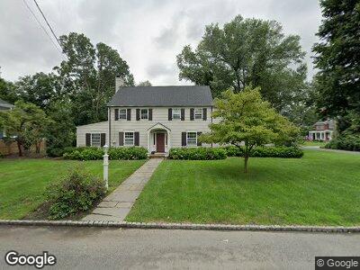
1061 Wychwood Rd Westfield, NJ 07090
Estimated Value: $1,681,000 - $2,042,000
--
Bed
--
Bath
2,565
Sq Ft
$714/Sq Ft
Est. Value
About This Home
This home is located at 1061 Wychwood Rd, Westfield, NJ 07090 and is currently estimated at $1,832,433, approximately $714 per square foot. 1061 Wychwood Rd is a home located in Union County with nearby schools including Wilson Elementary School, Roosevelt Intermediate School, and Westfield Senior High School.
Ownership History
Date
Name
Owned For
Owner Type
Purchase Details
Closed on
Jul 31, 2018
Sold by
Novak Susan and Novak Michael J
Bought by
Novak Michael J
Current Estimated Value
Purchase Details
Closed on
Nov 14, 2011
Sold by
Hays Andrew and Hays Hays,Heather
Bought by
Novak Michael J
Purchase Details
Closed on
Jul 18, 2006
Sold by
Hamilton Dorothy L
Bought by
Hays Andrew and Hayes Heather
Home Financials for this Owner
Home Financials are based on the most recent Mortgage that was taken out on this home.
Original Mortgage
$798,525
Interest Rate
6.71%
Mortgage Type
New Conventional
Create a Home Valuation Report for This Property
The Home Valuation Report is an in-depth analysis detailing your home's value as well as a comparison with similar homes in the area
Home Values in the Area
Average Home Value in this Area
Purchase History
| Date | Buyer | Sale Price | Title Company |
|---|---|---|---|
| Novak Michael J | -- | None Available | |
| Novak Michael J | $650,000 | -- | |
| Hays Andrew | $1,228,500 | -- |
Source: Public Records
Mortgage History
| Date | Status | Borrower | Loan Amount |
|---|---|---|---|
| Open | Novak Michael J | $658,000 | |
| Closed | Novak Michael J | $658,000 | |
| Previous Owner | Hays Andrew | $78,000 | |
| Previous Owner | Hays Andrew | $798,525 | |
| Previous Owner | Hamilton Dorothy L | $250,000 |
Source: Public Records
Tax History Compared to Growth
Tax History
| Year | Tax Paid | Tax Assessment Tax Assessment Total Assessment is a certain percentage of the fair market value that is determined by local assessors to be the total taxable value of land and additions on the property. | Land | Improvement |
|---|---|---|---|---|
| 2024 | $27,324 | $1,238,600 | $807,000 | $431,600 |
| 2023 | $27,324 | $1,238,600 | $807,000 | $431,600 |
| 2022 | $26,754 | $1,238,600 | $807,000 | $431,600 |
| 2021 | $26,791 | $1,238,600 | $807,000 | $431,600 |
| 2020 | $26,729 | $1,238,600 | $807,000 | $431,600 |
| 2019 | $26,630 | $1,238,600 | $807,000 | $431,600 |
| 2018 | $24,460 | $263,100 | $154,900 | $108,200 |
| 2017 | $24,326 | $263,100 | $154,900 | $108,200 |
| 2016 | $22,329 | $247,300 | $154,900 | $92,400 |
| 2015 | $21,884 | $247,300 | $154,900 | $92,400 |
| 2014 | $21,161 | $247,300 | $154,900 | $92,400 |
Source: Public Records
Map
Nearby Homes
- 821 Grant Ave
- 826 Wallberg Ave
- 521 Topping Hill Rd
- 18 Bennett Place
- 460 Topping Hill Rd
- 512 Sherwood Pkwy
- 445 Topping Hill Rd
- 8 Park West Dr Unit 402
- 44 Park West Dr Unit 502
- 46 Park West Dr Unit 501
- 806 Oak Ave
- 752 Belvidere Ave
- 775 Oak Ave
- 40 Canterbury Ln
- 1283 Poplar Ave
- 1238 Beech Ave
- 128 Woodland Ave
- 569 Colonial Ave
- 14 Wychview Dr
- 657 Hillside Ave