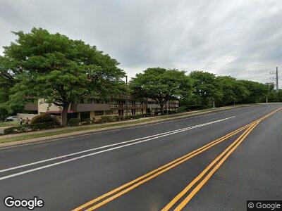
10610 Automotive Dr Manassas, VA 20109
Sudley NeighborhoodEstimated Value: $7,414,378
--
Bed
--
Bath
37,728
Sq Ft
$197/Sq Ft
Est. Value
About This Home
This home is located at 10610 Automotive Dr, Manassas, VA 20109 and is currently estimated at $7,414,378, approximately $196 per square foot. 10610 Automotive Dr is a home located in Prince William County with nearby schools including C.A. Sinclair Elementary School, Unity Braxton Middle School, and Unity Reed High School.
Ownership History
Date
Name
Owned For
Owner Type
Purchase Details
Closed on
May 22, 2019
Sold by
Rri Iii Llc
Bought by
Manassas Lodging Llc
Current Estimated Value
Home Financials for this Owner
Home Financials are based on the most recent Mortgage that was taken out on this home.
Original Mortgage
$4,080,000
Interest Rate
4.1%
Mortgage Type
Commercial
Purchase Details
Closed on
Feb 28, 2011
Sold by
R Roof Iv Llc
Bought by
Rri Iii Llc
Create a Home Valuation Report for This Property
The Home Valuation Report is an in-depth analysis detailing your home's value as well as a comparison with similar homes in the area
Home Values in the Area
Average Home Value in this Area
Purchase History
| Date | Buyer | Sale Price | Title Company |
|---|---|---|---|
| Manassas Lodging Llc | $5,100,000 | Attorney | |
| Rri Iii Llc | $4,416,318 | First American Title Ins Co |
Source: Public Records
Mortgage History
| Date | Status | Borrower | Loan Amount |
|---|---|---|---|
| Open | Manassas Lodging Llc | $4,960,000 | |
| Closed | Manassas Lodging Llc | $4,080,000 |
Source: Public Records
Tax History Compared to Growth
Tax History
| Year | Tax Paid | Tax Assessment Tax Assessment Total Assessment is a certain percentage of the fair market value that is determined by local assessors to be the total taxable value of land and additions on the property. | Land | Improvement |
|---|---|---|---|---|
| 2024 | $54,250 | $5,455,000 | $1,711,300 | $3,743,700 |
| 2023 | $59,585 | $5,726,600 | $1,711,300 | $4,015,300 |
| 2022 | $52,352 | $4,727,000 | $1,711,300 | $3,015,700 |
| 2021 | $53,772 | $4,048,500 | $1,546,700 | $2,501,800 |
| 2020 | $72,945 | $4,706,100 | $1,546,700 | $3,159,400 |
| 2019 | $71,691 | $4,625,200 | $1,415,100 | $3,210,100 |
| 2018 | $57,979 | $4,801,600 | $1,382,200 | $3,419,400 |
| 2017 | $62,426 | $4,734,800 | $1,316,300 | $3,418,500 |
| 2016 | $60,792 | $4,644,400 | $1,354,800 | $3,289,600 |
| 2015 | $57,904 | $4,437,100 | $1,270,200 | $3,166,900 |
| 2014 | $57,904 | $4,317,100 | $1,270,200 | $3,046,900 |
Source: Public Records
Map
Nearby Homes
- 10581 Linden Lake Plaza
- 10745 Coverstone Dr
- 10519 Stonington Ln
- 7560 Emerald Dr
- 7552 Emerald Dr
- 7414 Rokeby Dr Unit 47
- 7372 Rokeby Dr
- 10464 Paradise Ct
- 10491 Paradise Ct Unit 148
- 11008 Hiram Ct
- 7564 Remington Rd
- 7512 Clemson Ct Unit 90
- 7517 Todd Place
- 7390 Colton Ln
- 7530 Quail Run Ln
- 11202 Balls Ford Rd
- 7657 Michelle Ct
- 7621 Monitor Ct
- 7630 Monitor Ct
- 7510 Remington Rd
