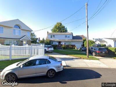
1065 Propp Ave Franklin Square, NY 11010
Franklin Square NeighborhoodEstimated Value: $853,750 - $863,000
4
Beds
2
Baths
1,870
Sq Ft
$459/Sq Ft
Est. Value
About This Home
This home is located at 1065 Propp Ave, Franklin Square, NY 11010 and is currently estimated at $858,375, approximately $459 per square foot. 1065 Propp Ave is a home located in Nassau County with nearby schools including St Anne's School.
Ownership History
Date
Name
Owned For
Owner Type
Purchase Details
Closed on
Apr 8, 2016
Sold by
Franzese Linda and Urso Eleanor
Bought by
Gomes Thomas and Gomes Teresa
Current Estimated Value
Home Financials for this Owner
Home Financials are based on the most recent Mortgage that was taken out on this home.
Original Mortgage
$354,090
Interest Rate
3.75%
Mortgage Type
FHA
Purchase Details
Closed on
Jan 14, 2008
Sold by
Blondo Peter
Create a Home Valuation Report for This Property
The Home Valuation Report is an in-depth analysis detailing your home's value as well as a comparison with similar homes in the area
Home Values in the Area
Average Home Value in this Area
Purchase History
| Date | Buyer | Sale Price | Title Company |
|---|---|---|---|
| Gomes Thomas | $435,000 | None Available | |
| -- | -- | -- |
Source: Public Records
Mortgage History
| Date | Status | Borrower | Loan Amount |
|---|---|---|---|
| Open | Gomes Thomas | $184,133 | |
| Open | Gomes Thomas | $336,000 | |
| Closed | Gomes Teresa | $53,600 | |
| Closed | Gomes Thomas | $357,000 | |
| Closed | Gomes Thomas | $354,090 |
Source: Public Records
Tax History Compared to Growth
Tax History
| Year | Tax Paid | Tax Assessment Tax Assessment Total Assessment is a certain percentage of the fair market value that is determined by local assessors to be the total taxable value of land and additions on the property. | Land | Improvement |
|---|---|---|---|---|
| 2024 | $4,725 | $557 | $279 | $278 |
| 2023 | $11,961 | $588 | $212 | $376 |
| 2022 | $11,961 | $585 | $293 | $292 |
| 2021 | $14,952 | $612 | $307 | $305 |
| 2020 | $12,259 | $723 | $563 | $160 |
| 2019 | $11,204 | $723 | $403 | $320 |
| 2018 | $10,660 | $1,010 | $0 | $0 |
| 2017 | $6,170 | $1,010 | $563 | $447 |
| 2016 | $11,281 | $1,010 | $563 | $447 |
| 2015 | $3,805 | $1,010 | $563 | $447 |
| 2014 | $3,805 | $1,010 | $563 | $447 |
| 2013 | $3,540 | $1,010 | $563 | $447 |
Source: Public Records
Map
Nearby Homes
- 1042 Wool Ave
- 280 Franklin Ave Unit 17
- 1120 Esther St
- 231 Doris Ave
- 978 Fenworth Blvd
- 331 Doris Ave
- 192 Doris Ave
- 249 Hoffman St
- 140 Hoffman St
- 330 Lucille Ave
- 336 Lucille Ave
- 175 Clement Ave
- 1041 Russell St
- 934 Hancock St
- 407 Saint Luke Place
- 311 Litchfield Ave
- 924 Van Buren Ave
- 1000 Russell St
- 1191 Burton Ave
- 293 Hunnewell Ave