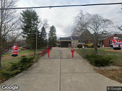
10659 Twightwee Ave Loveland, OH 45140
Remington-Lake Isabella NeighborhoodEstimated Value: $295,000 - $390,000
--
Bed
--
Bath
2,724
Sq Ft
$125/Sq Ft
Est. Value
About This Home
This home is located at 10659 Twightwee Ave, Loveland, OH 45140 and is currently estimated at $340,351, approximately $124 per square foot. 10659 Twightwee Ave is a home with nearby schools including Loveland Intermediate School, Loveland Primary School, and Loveland Elementary School.
Ownership History
Date
Name
Owned For
Owner Type
Purchase Details
Closed on
Dec 18, 2024
Sold by
Needham Janie Lynn and Needham Joshua Jamie
Bought by
Needham Family Trust and Needham
Current Estimated Value
Purchase Details
Closed on
Jul 18, 2023
Sold by
Watson Denton
Bought by
Needham Janie Lynn
Create a Home Valuation Report for This Property
The Home Valuation Report is an in-depth analysis detailing your home's value as well as a comparison with similar homes in the area
Home Values in the Area
Average Home Value in this Area
Purchase History
| Date | Buyer | Sale Price | Title Company |
|---|---|---|---|
| Needham Family Trust | -- | None Listed On Document | |
| Needham Family Trust | -- | None Listed On Document |
Source: Public Records
Mortgage History
| Date | Status | Borrower | Loan Amount |
|---|---|---|---|
| Previous Owner | Needham Janie Lynn | $300,000 |
Source: Public Records
Tax History Compared to Growth
Tax History
| Year | Tax Paid | Tax Assessment Tax Assessment Total Assessment is a certain percentage of the fair market value that is determined by local assessors to be the total taxable value of land and additions on the property. | Land | Improvement |
|---|---|---|---|---|
| 2024 | $5,701 | $104,167 | $37,779 | $66,388 |
| 2023 | $5,741 | $104,167 | $37,779 | $66,388 |
| 2022 | $5,349 | $79,300 | $32,631 | $46,669 |
| 2021 | $5,325 | $79,300 | $32,631 | $46,669 |
| 2020 | $5,264 | $79,300 | $32,631 | $46,669 |
| 2019 | $5,044 | $73,423 | $30,212 | $43,211 |
| 2018 | $5,071 | $73,423 | $30,212 | $43,211 |
| 2017 | $4,839 | $73,423 | $30,212 | $43,211 |
| 2016 | $4,959 | $71,320 | $31,119 | $40,201 |
| 2015 | $4,942 | $71,320 | $31,119 | $40,201 |
| 2014 | $5,011 | $71,320 | $31,119 | $40,201 |
| 2013 | $4,607 | $69,241 | $30,212 | $39,029 |
Source: Public Records
Map
Nearby Homes
- 579 Miami Bluff Ct
- 6551 Hollow Ln
- 818 Mohican Dr
- 571 Miami Bluff Ct
- 10582 Swanson Ct
- 6547 Conner Ln
- 10571 Swanson Ct
- 10579 Swanson Ct
- 9394 Bainwoods Dr
- 338 Wiltsee Ave
- 6786 Little River Ln
- 142 Lakeview Ct
- 185 Lexington Dr
- 1112 Bellwood Dr
- 1108 Bellwood Dr
- 9338 Kemper Grove Ln
- 6562 Branch Hill Guinea Pike
- 9274 Witherbone Ct
- 1412 Tuscarora Dr
- 770 Cedar Dr