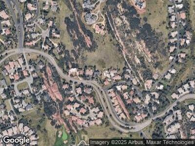
10667 Roxborough Dr Littleton, CO 80125
Roxborough Park NeighborhoodEstimated Value: $837,736 - $1,220,000
2
Beds
2
Baths
1,940
Sq Ft
$504/Sq Ft
Est. Value
About This Home
This home is located at 10667 Roxborough Dr, Littleton, CO 80125 and is currently estimated at $977,184, approximately $503 per square foot. 10667 Roxborough Dr is a home located in Douglas County with nearby schools including Roxborough Elementary School, Roxborough Intermediate School, and Ranch View Middle School.
Ownership History
Date
Name
Owned For
Owner Type
Purchase Details
Closed on
Oct 30, 2002
Sold by
Bergold Alan C and Bergold Janis
Bought by
Rubenstein Kenneth L and Maness Susan E
Current Estimated Value
Home Financials for this Owner
Home Financials are based on the most recent Mortgage that was taken out on this home.
Original Mortgage
$320,000
Interest Rate
5.95%
Purchase Details
Closed on
Nov 15, 1991
Sold by
Irwin David H and Irwin Pamela D
Bought by
Bergold Alan C and Bergold Janis
Purchase Details
Closed on
Nov 18, 1983
Sold by
Venable Ruth
Bought by
Irwin David H and Irwin Pamela D
Create a Home Valuation Report for This Property
The Home Valuation Report is an in-depth analysis detailing your home's value as well as a comparison with similar homes in the area
Home Values in the Area
Average Home Value in this Area
Purchase History
| Date | Buyer | Sale Price | Title Company |
|---|---|---|---|
| Rubenstein Kenneth L | $400,000 | -- | |
| Bergold Alan C | $215,000 | -- | |
| Irwin David H | $34,000 | -- |
Source: Public Records
Mortgage History
| Date | Status | Borrower | Loan Amount |
|---|---|---|---|
| Open | Rubenstein Kenneth L | $279,000 | |
| Closed | Rubenstein Kenneth L | $322,700 | |
| Closed | Rubenstein Kenneth L | $320,000 | |
| Previous Owner | Bergold Alan C | $30,000 |
Source: Public Records
Tax History Compared to Growth
Tax History
| Year | Tax Paid | Tax Assessment Tax Assessment Total Assessment is a certain percentage of the fair market value that is determined by local assessors to be the total taxable value of land and additions on the property. | Land | Improvement |
|---|---|---|---|---|
| 2024 | $4,676 | $60,970 | $10,080 | $50,890 |
| 2023 | $4,710 | $60,970 | $10,080 | $50,890 |
| 2022 | $3,216 | $41,720 | $7,170 | $34,550 |
| 2021 | $3,368 | $41,720 | $7,170 | $34,550 |
| 2020 | $3,233 | $41,310 | $7,590 | $33,720 |
| 2019 | $3,252 | $41,310 | $7,590 | $33,720 |
| 2018 | $2,820 | $35,940 | $6,220 | $29,720 |
| 2017 | $2,652 | $35,940 | $6,220 | $29,720 |
| 2016 | $2,526 | $34,820 | $8,240 | $26,580 |
| 2015 | $2,581 | $34,820 | $8,240 | $26,580 |
| 2014 | $3,137 | $30,120 | $4,580 | $25,540 |
Source: Public Records
Map
Nearby Homes
- 10751 Fairway Vistas Ct
- 10542 Leonardo Place
- 10571 Leonardo Place
- 6753 Big Horn Trail
- 10886 Pheasant Run
- 6960 Buckskin Dr Unit 86
- 6931 Buckskin Dr
- 10895 Pheasant Run
- 10985 Ambush Rock
- 6945 Fargo Trail
- 6980 Fargo Trail
- 7139 Pine Hills Way
- 7190 Pine Hills Way
- 6260 Rain Dance Trail
- 7132 Eagle Rock Dr
- 6435 Spotted Fawn Run
- 6201 Rain Dance Trail
- 7586 Halleys Dr
- 7507 Halleys Dr
- 7488 Hawks Nest Trail
