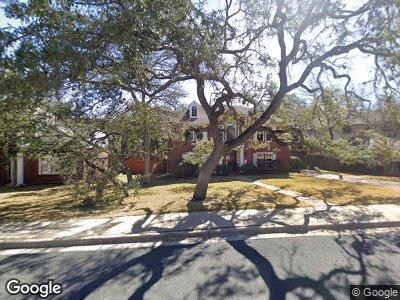
10705 Beckwood Dr Austin, TX 78726
Canyon Creek NeighborhoodEstimated Value: $783,701 - $838,000
--
Bed
4
Baths
3,306
Sq Ft
$245/Sq Ft
Est. Value
About This Home
This home is located at 10705 Beckwood Dr, Austin, TX 78726 and is currently estimated at $810,851, approximately $245 per square foot. 10705 Beckwood Dr is a home located in Travis County with nearby schools including Canyon Creek Elementary School, Noel Grisham Middle, and Westwood High School.
Ownership History
Date
Name
Owned For
Owner Type
Purchase Details
Closed on
Jul 2, 2001
Sold by
Dawson David P and Dawson Amy R
Bought by
Lawson Jack H and Nolte Pamela D
Current Estimated Value
Home Financials for this Owner
Home Financials are based on the most recent Mortgage that was taken out on this home.
Original Mortgage
$194,400
Interest Rate
6.85%
Purchase Details
Closed on
Jun 30, 2000
Sold by
Stmartin David A and Stmartin Joni S
Bought by
Dawson David P and Dawson Amy R
Home Financials for this Owner
Home Financials are based on the most recent Mortgage that was taken out on this home.
Original Mortgage
$216,000
Interest Rate
8.66%
Create a Home Valuation Report for This Property
The Home Valuation Report is an in-depth analysis detailing your home's value as well as a comparison with similar homes in the area
Home Values in the Area
Average Home Value in this Area
Purchase History
| Date | Buyer | Sale Price | Title Company |
|---|---|---|---|
| Lawson Jack H | -- | Alamo Title Company | |
| Dawson David P | -- | Alamo Title Company |
Source: Public Records
Mortgage History
| Date | Status | Borrower | Loan Amount |
|---|---|---|---|
| Open | Lawson Jack H | $100,000 | |
| Closed | Lawson Jack H | $146,000 | |
| Closed | Lawson Jack H | $24,300 | |
| Previous Owner | Lawson Jack H | $194,400 | |
| Previous Owner | Dawson David P | $216,000 |
Source: Public Records
Tax History Compared to Growth
Tax History
| Year | Tax Paid | Tax Assessment Tax Assessment Total Assessment is a certain percentage of the fair market value that is determined by local assessors to be the total taxable value of land and additions on the property. | Land | Improvement |
|---|---|---|---|---|
| 2023 | $8,410 | $549,580 | $0 | $0 |
| 2022 | $10,197 | $499,618 | $0 | $0 |
| 2021 | $10,213 | $454,198 | $110,000 | $368,368 |
| 2020 | $9,322 | $412,907 | $110,000 | $302,907 |
| 2018 | $9,269 | $398,371 | $110,000 | $301,834 |
| 2017 | $8,585 | $362,155 | $50,000 | $362,639 |
| 2016 | $7,805 | $329,232 | $50,000 | $337,068 |
| 2015 | $6,267 | $299,302 | $50,000 | $306,849 |
| 2014 | $6,267 | $272,093 | $0 | $0 |
Source: Public Records
Map
Nearby Homes
- 10615 Beckwood Dr
- 11207 Crossland Dr
- 11105 Crossland Dr
- 11406 Boulder Ln
- 11205 Appletree Ln
- 11600 Sweet Basil Ct
- 11529 Sweet Basil Ct
- 10505 Pariva Trail
- 10912 Chestnut Ridge Rd
- 10225 Matoca Way
- 11105 Calavar Dr
- 10448 Ember Glen Dr
- 10900 Peale Ct
- 11100 Centennial Trail
- 11141 Rio Vista Dr
- 10016 Barbrook Dr
- 11409 Cezanne Ct
- 10903 Cade Cir
- 11100 Comiso Pala Path
- 10404 Canyon Vista Way