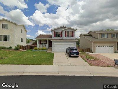
10740 Mount Antero Way Parker, CO 80138
Estimated Value: $523,000 - $560,000
4
Beds
3
Baths
1,769
Sq Ft
$307/Sq Ft
Est. Value
About This Home
This home is located at 10740 Mount Antero Way, Parker, CO 80138 and is currently estimated at $542,587, approximately $306 per square foot. 10740 Mount Antero Way is a home located in Douglas County with nearby schools including Pioneer Elementary School, Cimarron Middle School, and Legend High School.
Ownership History
Date
Name
Owned For
Owner Type
Purchase Details
Closed on
May 10, 1999
Sold by
Garcia June I and Garcia Elmina D
Bought by
Roybal Christopher E and Roybal Diana M
Current Estimated Value
Home Financials for this Owner
Home Financials are based on the most recent Mortgage that was taken out on this home.
Original Mortgage
$159,000
Interest Rate
7.04%
Mortgage Type
VA
Purchase Details
Closed on
Jul 31, 1998
Sold by
Centex International Inc
Bought by
Garcia June I and Garcia Elmina D
Home Financials for this Owner
Home Financials are based on the most recent Mortgage that was taken out on this home.
Original Mortgage
$131,796
Interest Rate
6.94%
Create a Home Valuation Report for This Property
The Home Valuation Report is an in-depth analysis detailing your home's value as well as a comparison with similar homes in the area
Home Values in the Area
Average Home Value in this Area
Purchase History
| Date | Buyer | Sale Price | Title Company |
|---|---|---|---|
| Roybal Christopher E | $159,000 | -- | |
| Garcia June I | $138,733 | -- |
Source: Public Records
Mortgage History
| Date | Status | Borrower | Loan Amount |
|---|---|---|---|
| Open | Roybal Christopher E | $265,000 | |
| Closed | Roybal Christopher E | $191,207 | |
| Closed | Roybal Christopher E | $15,000 | |
| Closed | Roybal Christopher E | $180,000 | |
| Closed | Roybal Christopher E | $159,000 | |
| Previous Owner | Garcia June I | $131,796 |
Source: Public Records
Tax History Compared to Growth
Tax History
| Year | Tax Paid | Tax Assessment Tax Assessment Total Assessment is a certain percentage of the fair market value that is determined by local assessors to be the total taxable value of land and additions on the property. | Land | Improvement |
|---|---|---|---|---|
| 2024 | $2,836 | $36,140 | $8,850 | $27,290 |
| 2023 | $2,869 | $36,140 | $8,850 | $27,290 |
| 2022 | $2,228 | $25,770 | $6,040 | $19,730 |
| 2021 | $2,319 | $25,770 | $6,040 | $19,730 |
| 2020 | $2,117 | $23,910 | $6,660 | $17,250 |
| 2019 | $2,130 | $23,910 | $6,660 | $17,250 |
| 2018 | $1,958 | $21,420 | $5,990 | $15,430 |
| 2017 | $1,816 | $21,420 | $5,990 | $15,430 |
| 2016 | $1,642 | $19,010 | $5,010 | $14,000 |
| 2015 | $1,672 | $19,010 | $5,010 | $14,000 |
| 2014 | $1,527 | $15,480 | $4,380 | $11,100 |
Source: Public Records
Map
Nearby Homes
- 10825 Mount Antero Way
- 10799 Eagle Crest Ct
- 10824 Quail Ridge Dr W
- 10831 Eagle Crest Ln
- 10795 Quail Creek Dr E
- 21743 Farmingdale Ct
- 21580 Longs Peak Ln
- 21718 Silver Meadow Ln
- 21710 Silver Meadow Ln
- 21736 Silver Meadow Ln
- 10885 Longs Peak Ln
- 22388 Quail Run Dr
- 21562 Omaha Ave
- 11207 Day Star Ct
- 21593 Hill Gail Way
- 22134 Wintergreen Way
- 21656 Hill Gail Way
- 8855 E Parker Rd
- 11020 Glacier Park Cir
- 11032 Cannonade Ln