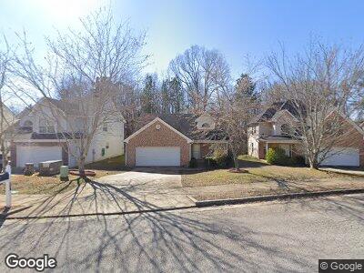
109 Avonwood Cir Locust Grove, GA 30248
Estimated Value: $268,000 - $309,000
4
Beds
2
Baths
2,290
Sq Ft
$124/Sq Ft
Est. Value
About This Home
This home is located at 109 Avonwood Cir, Locust Grove, GA 30248 and is currently estimated at $284,467, approximately $124 per square foot. 109 Avonwood Cir is a home located in Henry County with nearby schools including Locust Grove Elementary School, Locust Grove Middle School, and Locust Grove High School.
Ownership History
Date
Name
Owned For
Owner Type
Purchase Details
Closed on
Dec 22, 2020
Sold by
Barber Boynes Tiara
Bought by
Barber Boynes Tiara and Boynes Raymond A
Current Estimated Value
Home Financials for this Owner
Home Financials are based on the most recent Mortgage that was taken out on this home.
Original Mortgage
$194,413
Outstanding Balance
$176,246
Interest Rate
2.7%
Mortgage Type
FHA
Estimated Equity
$105,949
Purchase Details
Closed on
Mar 5, 2009
Sold by
Colonial Bank
Bought by
Dribnak Diana L
Home Financials for this Owner
Home Financials are based on the most recent Mortgage that was taken out on this home.
Original Mortgage
$108,630
Interest Rate
5.29%
Mortgage Type
New Conventional
Create a Home Valuation Report for This Property
The Home Valuation Report is an in-depth analysis detailing your home's value as well as a comparison with similar homes in the area
Home Values in the Area
Average Home Value in this Area
Purchase History
| Date | Buyer | Sale Price | Title Company |
|---|---|---|---|
| Barber Boynes Tiara | -- | -- | |
| Barber Boynes Tiara | $198,000 | -- | |
| Dribnak Diana L | $106,500 | -- |
Source: Public Records
Mortgage History
| Date | Status | Borrower | Loan Amount |
|---|---|---|---|
| Open | Barber Boynes Tiara | $194,413 | |
| Previous Owner | Dribnak Diana L | $120,000 | |
| Previous Owner | Dribnak Diana L | $108,630 |
Source: Public Records
Tax History Compared to Growth
Tax History
| Year | Tax Paid | Tax Assessment Tax Assessment Total Assessment is a certain percentage of the fair market value that is determined by local assessors to be the total taxable value of land and additions on the property. | Land | Improvement |
|---|---|---|---|---|
| 2024 | $4,055 | $115,640 | $16,000 | $99,640 |
| 2023 | $4,128 | $113,920 | $16,000 | $97,920 |
| 2022 | $3,046 | $83,240 | $16,000 | $67,240 |
| 2021 | $2,503 | $68,080 | $16,000 | $52,080 |
| 2020 | $2,542 | $69,160 | $13,000 | $56,160 |
| 2019 | $2,211 | $59,040 | $12,000 | $47,040 |
| 2018 | $2,103 | $56,480 | $9,200 | $47,280 |
| 2016 | $1,922 | $51,680 | $8,000 | $43,680 |
| 2015 | $1,849 | $47,960 | $8,000 | $39,960 |
| 2014 | $1,553 | $40,040 | $8,000 | $32,040 |
Source: Public Records
Map
Nearby Homes
- 200 Baumgard Way
- 521 Moline Way
- 325 Nutwood Trace
- 489 Kirkland Dr
- 1152 Werre Way
- 188 Sophie Cir
- 509 Vervain Dr Unit 172
- 509 Vervain Dr
- 513 Vervain Dr Unit 171
- 2142 Theberton Trail
- 169 Aster Ave
- 169 Aster Ave Unit 178
- 2039 Theberton Trail
- 165 Aster Ave Unit 179
- 165 Aster Ave
- 532 Vervain Dr
- 532 Vervain Dr Unit 162
- 161 Aster Ave
- 166 Aster Ave
- 166 Aster Ave Unit 103