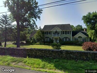
109 Davis Rd Seymour, CT 06483
Seymour NeighborhoodEstimated Value: $656,836 - $829,000
4
Beds
3
Baths
3,176
Sq Ft
$226/Sq Ft
Est. Value
About This Home
This home is located at 109 Davis Rd, Seymour, CT 06483 and is currently estimated at $717,459, approximately $225 per square foot. 109 Davis Rd is a home located in New Haven County with nearby schools including Bungay Elementary School, Seymour Middle School, and Seymour High School.
Ownership History
Date
Name
Owned For
Owner Type
Purchase Details
Closed on
Jan 7, 2004
Sold by
Morlo Llc
Bought by
Szleszynski Jadwiga M and Szleszynski Kazimierz
Current Estimated Value
Home Financials for this Owner
Home Financials are based on the most recent Mortgage that was taken out on this home.
Original Mortgage
$220,000
Interest Rate
5.88%
Mortgage Type
Purchase Money Mortgage
Create a Home Valuation Report for This Property
The Home Valuation Report is an in-depth analysis detailing your home's value as well as a comparison with similar homes in the area
Home Values in the Area
Average Home Value in this Area
Purchase History
| Date | Buyer | Sale Price | Title Company |
|---|---|---|---|
| Szleszynski Jadwiga M | $479,000 | -- | |
| Szleszynski Jadwiga M | $479,000 | -- |
Source: Public Records
Mortgage History
| Date | Status | Borrower | Loan Amount |
|---|---|---|---|
| Open | Szleszynski Jadwiga M | $50,000 | |
| Open | Szleszynski Jadwiga M | $350,000 | |
| Closed | Szleszynski Jadwiga M | $220,000 |
Source: Public Records
Tax History Compared to Growth
Tax History
| Year | Tax Paid | Tax Assessment Tax Assessment Total Assessment is a certain percentage of the fair market value that is determined by local assessors to be the total taxable value of land and additions on the property. | Land | Improvement |
|---|---|---|---|---|
| 2024 | $10,908 | $296,100 | $60,690 | $235,410 |
| 2023 | $10,654 | $296,100 | $60,690 | $235,410 |
| 2022 | $10,538 | $296,100 | $60,690 | $235,410 |
| 2021 | $10,278 | $296,100 | $60,690 | $235,410 |
| 2020 | $11,068 | $307,440 | $71,260 | $236,180 |
| 2019 | $11,068 | $307,440 | $71,260 | $236,180 |
| 2018 | $11,068 | $307,440 | $71,260 | $236,180 |
| 2017 | $11,068 | $307,440 | $71,260 | $236,180 |
| 2016 | $11,068 | $307,440 | $71,260 | $236,180 |
| 2015 | $11,291 | $326,410 | $78,260 | $248,150 |
| 2014 | $11,111 | $326,410 | $78,260 | $248,150 |
Source: Public Records
Map
Nearby Homes
- 29 Brookdale Rd
- 88 Brookfield Rd
- 1 Mac Connie Ct
- 8 Partridge Dr
- 290 Silver Hill Rd
- 269 Silver Hill Rd
- 306 Wakelee Ave
- 157 Hull St
- 154 S Benham Rd
- 124 Bungay Rd
- 258 Wakelee Ave
- 4 Edgehill Rd
- 10 Clarkson St Unit 12
- 30 Morningside Dr
- 45 Roosevelt Dr
- 22 Deer Run Dr
- 270 N Main St
- 37 Deer Run Dr
- 72 Bellevue Terrace
- 17 Gardners Ln